88 Central Asia: Historical Geography II – Wakhan Corridor

One aspect of Political Geography involves borders. Of course, a country’s international borders create the country’s shape. Sometimes shapes are elongated, much longer than wider – for instance, Vietnam. Other shapes may be compact, roughly as long as wide – for instance, Nigeria and Zimbabwe. Occasionally, a country’s shape may be rather odd-looking – Croatia, Denmark, India. A specific odd-looking shape is the prorupted country. The prorupted shape is relatively compact region that has an unusual arm or edge sticking out. In Geography, this proruption is known as a salient; however, in some cases this jutting piece is termed a panhandle – Oklahoma, Florida. Afghanistan has a salient with the extended arm being known as the Wakhan Corridor.
Why do these salients exist? There are different circumstances, including some that have historically unique reasons. In some cases, the extending territory exists to provide access to a trading site or port. For the Wakhan Corridor, the reason for its existence is its placement as a buffer zone that acts as a protective or preventive area between strong empires. Its name as a corridor reflects another historical element of transportation through a rugged mountainous area.
In the late 19th century, officials in the powerful British Empire and the expansive Russian Empire pondered a hypothetical geographic concern. What if the two empires would meet across a land mass? Specifically, what would happen if British rule over South Asia and Russian rule over Central Asia would meet and vie for territorial advantage? In fact, both empires were large and seemingly content not to seek expansion into either realm’s respective territories. However, perhaps things could get dicey if soldiers of both empires found themselves face-to-face in a remote area.
Fortunately, most of the territory between the empires’ Asian lands was established in Afghanistan. In 1879 the Treaty of Gandamak identified Afghanistan as a British protectorate, while the Second Anglo-Afghan War ended in 1880 with British victory at Kandahar. However, Afghanistan did remain a sovereign state, while agreeing to receive British protection against Persia and against the Russian Empire as well as ceding Britain control over Afghan foreign policy. This provided an additional incentive or necessity for Britain to deter conflict in the region.
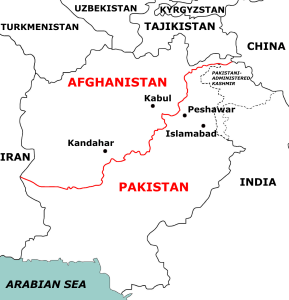
In 1893, the Durand Line was drawn to form the border between British India and Afghanistan. The border remains as the boundary for Pakistan and Afghanistan, though the line is not fully recognized by the Afghans. In 1895, agreement with the Russian Empire established that empire’s borders with Afghanistan, creating the narrow extension that is the Wakhan Corridor, thereby ending the so-called Great Game.
The Great Game was a not a military conflict but rather a political and diplomatic duel between the British and Russian Empires for nearly all of the 19th century. Its focus was the British concern that Russian expansion into Central Asia was not a territorial end, but was a regional passage for a Russian desire to conquer India. The Russian Empire certainly was expansive, reaching the Baltic Sea and Black Sea in the west, the Arctic Ocean in the north, and the Pacific Ocean in the east; however, historians question whether Russia desire to stretch to the Indian Ocean was practical or even existent. Nevertheless, the Great Game developed the geopolitical interest in a buffer between the two empires. Afghanistan itself may have been sufficient, but the possibility of a small gap the eluded the compact shape of Afghanistan brought concern of Russian forces directly reaching the Durand Line and thus British India. Thus, the Wakhan Corridor was created to serve as a narrow buffer zone and part of the larger buffer of the rest of Afghanistan. The Wakhan Corridor is as little as nine miles in width, but extends 217 miles in length.
Given the rugged mountainous terrain and narrow high valleys, this stretch of land appears to be well-designed for an empty space, nicely separating empires. Curiously however, it is not an entirely empty space, but rather has a history as a corridor or passageway. Indeed, the corridor was a portion of a branch of the famous Silk Road, the trade road from China to Turkey. Local history recalls the passage of Alexander the Great and of Marco Polo.
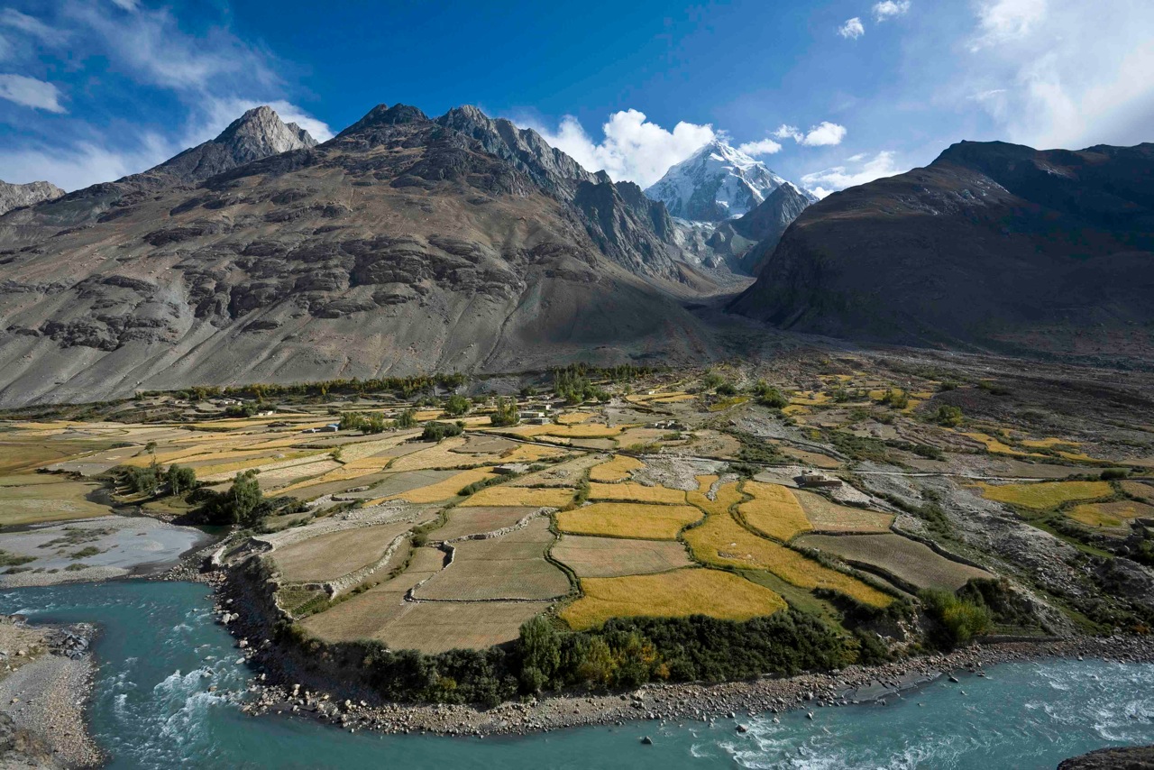
About 12,000 people live in the Wakhan Corridor, most of them ethnically Wakhi (thus, the name of the corridor simply refers to the people). Modest cultivated agriculture exists along streams such as the Wakhan, Pamir, and Panj Rivers, while sheep and goats are herded. Although historically the Zoroastrian and Buddhists faiths had followers here, the contemporary religion in this region is a moderate form of Islam. As the Taliban now controls Afghanistan, there is concern that the Islamic practices of the Wakhi may be deemed insufficient. Additionally, the small number of Kyrgyz who live in the corridor fear that their ethnic minority may be opposed by the Taliban.
The Wakhan Corridor is a historical buffer between the Russian Empire and British India, but now serves as an odd extension of Afghanistan that benignly separates Tajikistan from Pakistan.
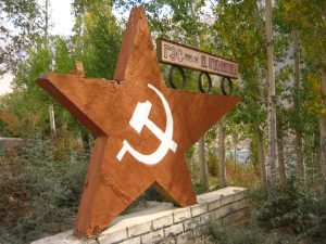
Photo by Aya Okawa on Flickr.
Of course, for several decades Central Asia was part of the Soviet Union, so the Wakhan Corridor was positioned between India and the Soviet Union. Although the Soviets never attacked India, they did invade Afghanistan. The region’s isolated people cite a history on the Silk Road, but hope that they can live unbothered in contemporary Afghanistan.
Did you know?
Legend has it that in this region in 1889, a chance encounter between British Captain Francis Younghusband and Russian Captain Bronislav Grombchevsky led to the creation of the Wakhan Corridor as a buffer zone.
Cited and additional bibliography:
Dunning, Sam. “China Is Protecting Its Thin Corridor to the Afghan Heartland.” Foreign Policy, 14 August 2021. https://foreignpolicy.com/2021/08/14/china-afghanistan-wakhan-corridor-imperial-ambitions/.
Foster, Kendrick. “The New Road to Conflict: Geopolitics of the Wakhan Corridor.” Harvard International Review, 5 Dec. 2019, https://hir.harvard.edu/wakhancorridor/.
Okawa, Aya. Tajik side of Wakhan Corridor. Photo, 2 Oct. 2006. Flickr, https://www.flickr.com/photos/73915179@N00/275122326/. Attribution-NonCommercial-NoDerivs 2.0 Generic (CC BY-NC-ND 2.0).
Weaveravel, Durand Line. Map. CC BY-SA 4.0 <https://creativecommons.org/licenses/by-sa/4.0>, via Wikimedia Commons.
Wong, Edward. “In Icy Tip of Afghanistan, War Seems Remote.” The New York Times, 28 Oct. 2010. NYTimes.com, https://www.nytimes.com/2010/10/28/world/asia/28wakhan.html.
