87 Central Asia: Urban Geography – Entrepôt ~ Samarkand
Entrepôt

For a mini-series of several chapters, we address the concept of the entrepôt, a particular type of trading city.
As seen in trading cities formerly in the British Empire; no, this time much before and never in the British Empire
Central Asia – Samarkand, Uzbekistan
An entrepôt is a point of transshipment. That is, this type of city is located advantageously where export and import take place; however, not only in terms of products arriving and products departing, but importantly as the location where imports are sorted and repackaged for export. It is very likely that an entrepôt is an ocean seaport, though it is possible that a point of transshipment could be an intersection of highways, railroads, airports, and/or rivers. Roads, railroads, and airports are modern transportation hubs, whereas an entrepôt often has a lengthy history of trade, being founded as a settlement long ago. This preceding historical advantage favors the ancient seafaring trade; thus, again we note that seaports have an advantage in becoming entrepôts. In this case the ancient Silk Road allowed Samarkand to become an entrepôt without being a seaport.
Samarkand is an ancient and remarkable city in Uzbekistan. Conquered by Alexander the Great in 329 BC, Samarkand developed as a city about 400 years earlier, although human presence in the location 40,000 years ago. The city originated at an oasis of the Zerafshan River Valley. Access to water was only one siting aspect of the useful geography of this interesting location.
In terms of toponymy, the name Samarkand (sometimes spelled Samarqand), as from Eastern Iranian Sogdian language, derives from samar meaning stone and kand meaning fort.
Previously called Maracanda in the years around Alexander’s conquest of the city, it served as an important trading stop along the famed Silk Road. Typically, convoys along the Silk Road did not venture the whole route as what we might now call a shipping company. The whole journey was quite lengthy, obviously calling for stops along the way. Additionally, generally it was more efficient for individual shippers to transports goods only certain distances to transfer points. At these locations, convoys could offload their products, enabling a different convoy to take the shipment the subsequent leg of the journey. After offloading goods at this type of settlement, a convoy could load up with materials similarly offloaded there by a different shipper from a different location. Trade merchants could facilitate the logistics of these transfers and shipping directions. Samarkand developed as one of these trading hubs.
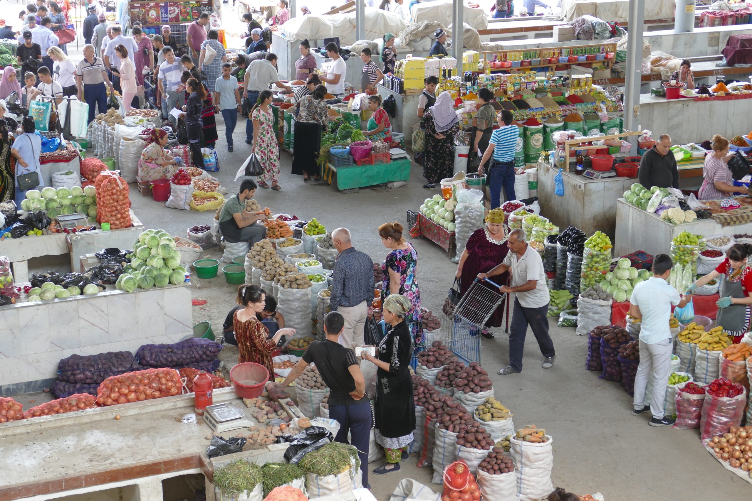
Photo by falco from Pixabay.
Trading hubs are common and valued throughout the world, likewise Samarkand was a valuable piece of urban settlement, sought by different rulers and empires. In modern days, this sort of intermediate trading stop is referenced as part of the transshipment problem. Now transport companies use complex mathematics to seek efficiencies in addressing supply and demand in the midst of timing of shipments and temporary storage of transshipped products. In centuries past, traders in Samarkand no doubt tried to be efficient too, without computer calculations and tracking and perhaps without complex mathematical formulations. Of course, some of the products moving on the Silk Road moved into merchants’ stalls in the markets of Samarkand.
Movement of peoples and products through Samarkand made the city a valuable location, coveted by those wishing to control the region. Genghis Khan had his turn in 1220. In the 14th century, Timur (also known as Tamerlane) conquered an expansive area, but used Samarkand as his center and capital. This was a time a cultural flourishing, still noted in the architecture of classic buildings in the city.
Later, lands including Samarkand were taken by Turkic peoples, who mainly became identified as Uzbeks, using subsequent Soviet categories. These peoples were followed by Russians who took Central Asian lands for the Tsar’s empire. Eventually, the Soviet Union dissolved, prompting Uzbekistan to become a new country, gaining an upgrade from status as a republic in the Soviet Union. In contemporary Samarkand, cultural legacies remain.
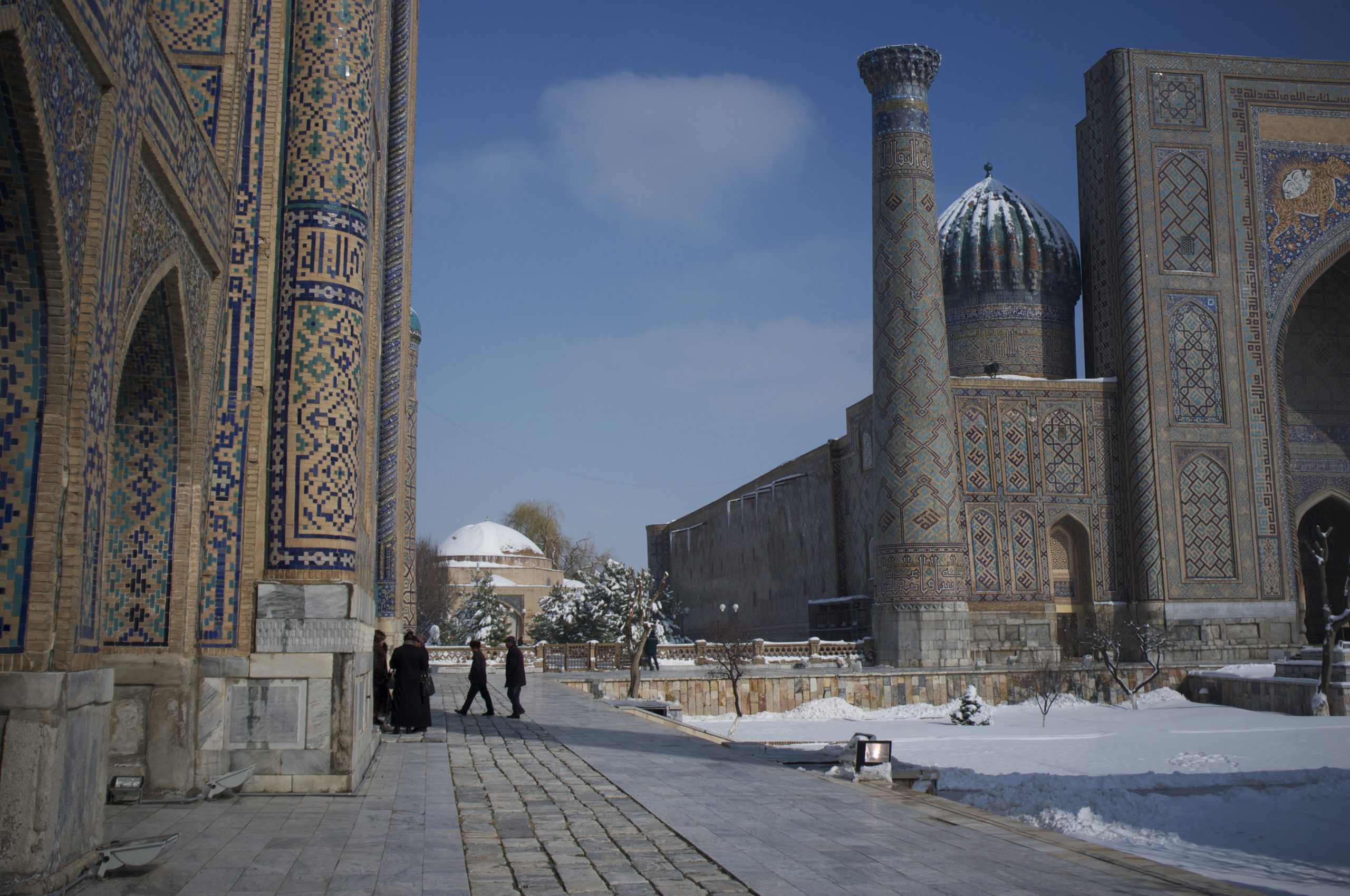
Historical transportation network flows greatly impacted Samarkand. While the Silk Road led to Samarkand’s prosperity, mid-18th century emphasis on sea travel and European colonies that featured seaports greatly diminished Samarkand. It is difficult to imagine, but from the 1720s to the 1770s, Samarkand essentially was uninhabited. Russian development of rail networks connected Samarkand, eventually restored much of the city’s importance. Relatively newer sections of the city date to 1871, whereas often the most striking structures are several centuries older. The the Gūr-e Amīr mausoleum, Tamerlane’s burial site, was constructed in about the year 1405. Rēgistan Square features three madrasahs (Islamic schools). Construction of Ulugh Beg Madrasah began in 1417, while Sher-Dor Madrasah (1619) and Tilya-Kore Madrash (1646) came later.
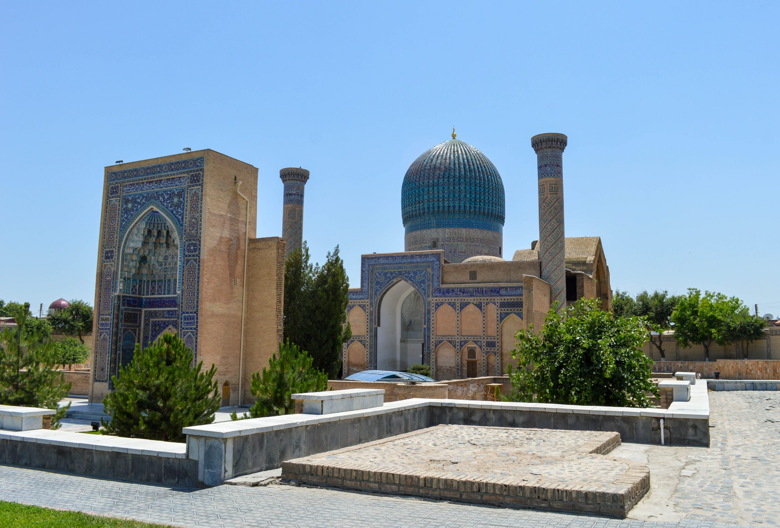
Photo by Francisco Anzola on Flickr.
A cultural center, Samarkand contributes considerable architectural, religious, and transportation elements. Surprisingly, Samarkand also is renowned for a type of round loafs of bread, produced in vast numbers daily. Although bread is a key part of the diet in Uzbekistan, Samarkand bread is famous. In the city, thousands of loaves of this distinctive bread are hand-formed and baked in local ovens.
Samarkand was an entrepôt, though not in the British Empire and not really anymore.
Did You Know?
Also in Uzbekistan, the capital city Tashkent as well draws its name from stone fort, but from Turkic language roots.
Samar is an Arabic name, usually female; however, this is not related to the city Samarkand. Even so, in the TV series “The Blacklist,” actress Mozhan Marnò plays an ensemble character named Samar Navabi.
Rēgistan means sandy place or desert in Persian.
Cited and additional bibliography:
Anzola, Francisco. Gur-e-Amir. 11 June 2015. Flickr, https://www.flickr.com/photos/fran001/18719314311/. Attribution 2.0 Generic (CC BY 2.0).
falco. Public Market in Samarkand, Uzbekistan. Photo, Pixabay, 27 Oct. 2019, https://pixabay.com/photos/uzbekistan-samarkand-central-asia-4579362/.
hangga, jonata. “Sea Logistic Icon – 4805740.” The Noun Project, https://thenounproject.com/icon/sea-logistic-4805740/.
How 15,000 Legendary Samarkand Bread Loaves Are Baked Daily in Uzbekistan | Big Batches. https://www.youtube.com/watch?v=MUB6DyDY39g.
Smithsonian Folklife Festival. “Samarkand Square – Geography & History.” https://festival.si.edu/2002/the-silk-road/samarkand-geography-and-history/smithsonian.
Zykov, Aleksandr. Registan, Samarkand. 9 Mar. 2013. Flickr, https://www.flickr.com/photos/infanticida/8590108912/. Attribution-ShareAlike 2.0 Generic (CC BY-SA 2.0).
