12 North Africa & the Middle East: Regional Example – The Fertile Crescent
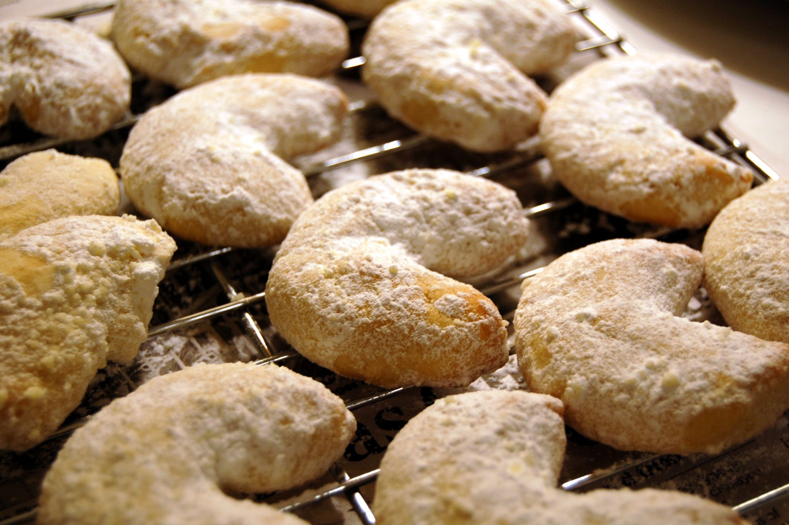
Certainly, the name of this sub-region of NAME is suggestive of food. For some of us, that may bring mental imagery of crescent cookies or crescent rolls. In fact, it is appropriate for the region’s name to make us think of food, for the region was named “Fertile” for its particular triggering role in the progression of agriculture across the world. Of course, “Crescent” did not refer to the literal shape of foods, but to the approximate layout of land where this highlighted agriculture progress took place.
The Fertile Crescent is the geographic location where sedentary agriculture as a regular practice first began. For almost all of the lengthy history of human beings on the planet, people routinely set out to find food. Fruit hung from trees, berries grew on bushes, seeds and nuts were found. Animals like deer or antelope were hunted, as were small game including birds. Hunter-gatherers were the human population.
As explained in fascinating detail in Jared Diamond’s “Guns, Germs, and Steel,” as well as in many historical texts, the Fertile Crescent provided the right circumstances for many people to switch to sedentary agriculture.
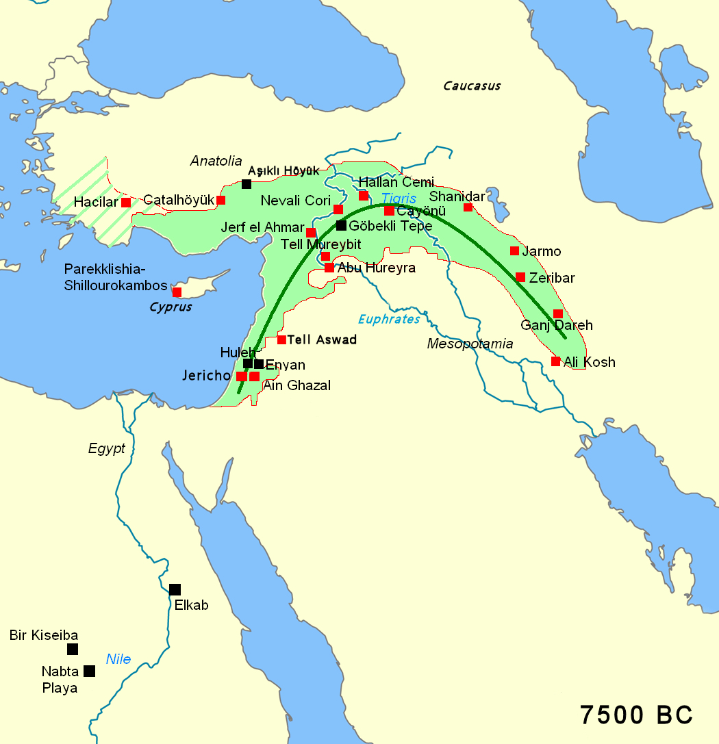
So, where is this Fertile Crescent? This map shows its location at about 7500 BCE. Note the general crescent shape. The location of the Mediterranean Sea along the western edge of the crescent is noteworthy. On the one hand, it appears that the crescent region could have expanded westward in the absence of the sea, thereby altering the crescent shape. On the other hand, it is likely that the sea contributed to the climate of the region, probably necessary for the agricultural fertility there.
The name – the Fertile Crescent – was suggested by archeologist James Henry Breasted in writings in 1914 and 1916. He viewed this territory as being a semi-circle that crossed the lands of different nations, yet lacked a toponym itself. Thus, he suggested that the region be called the Fertile Crescent. Some versions of the crescent extend into Egypt along the Nile River and/or to include the island Cyprus.
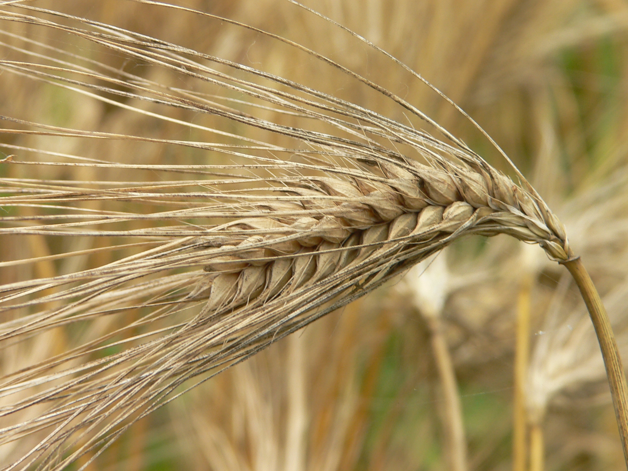
Estimated to begin around 9000 BCE, this agricultural move to sedentary farming is understood to have taken place in a somewhat more favorable climate than the region has today. Irrigation was added to enhance agricultural production. Furthermore, the location of favorable plants and animals was essential to the Fertile Crescent. To facilitate the transition from gathering to planting, it was necessary that certain local plants could be cultivated in a farm-like setting. Fortunately, grains such as barley and emmer wheat were growing wild there. These wild grains became cereal crops, fundamental to local consumption. Other plants such as peas and lentils could do the same. Additionally, certain types of animals would be preferred for domestication instead of hunting. The Fertile Crescent hosted cows, goats, pigs, and sheep. These became farm animals then and of course still today.
The world is a big place that had a plethora of wild plants and animals across its surface. However, the types of plants and animals, as well as their evolutionary circumstances were not uniform from land to land and continent to continent. In his award-winning book, Diamond explains and numbers the non-random geographic distribution of the best cereal grains and animals available for cultivation and domestication. Diamond finds that broadly North Africa – Europe – Asia had the best fits for farming, but that the Fertile Crescent was the ideal focal point. While this sub-region of NAME had several of the best plants and animals, it also proved to be a strategic location.
Another geographic element of the Fertile Crescent is that it served as a crossroads location connecting North Africa, Europe, and Asia. Peoples passing through or connecting for trade provided a great deal of human interaction there. Advances in agriculture as founded in the Fertile Crescent could be diffused to travelers and traders who came to the region.
Additionally, the region’s latitude was favorable. With only modest change in latitude (distances north or south of the equator), extensive land masses were connected to the Fertile Crescent. Slightly to the south and then to the west were the Mediterranean coastlines of North Africa. Similarly westward, but slightly north, were similar coastlines of Southern Europe. These climates and patterns of sunlight would be very similar to each other and to the Fertile Crescent. Therefore, new farm crops cultivated in the crescent also would succeed in similar weather and sunlight along both shores of the Mediterranean Sea. Animals that thrived in one region would thrive in the other regions. To the east stretched the vast Asian landmass. Crops and animals of the Fertile Crescent should be successful in corresponding latitudes of Asia.
Diffusion of crops and animals to lands of latitude adjacent to the Mediterranean Sea would not be automatic, but did proceed over time in Europe. On the southern shores, this latitudinal spread was blocked by the Sahara Desert. Eventually, European powers brought plants and animals to North America, where similar latitudes generally brought agricultural success.
In the Fertile Crescent and later in these surrounding territories, removal of the need for everyone to be hunter-gatherers brought new opportunities to society. Some of the population stayed with food production as farmers, but others pursued other roles as inventors, teachers, soldiers, and much more, thereby accelerating the development of diverse civilization.
Curiously, now the Fertile Crescent is not known for vast food production. To be sure there are regional specialties (figs come to mind), but the current climate of the region is too dry for large-scale agricultural success. While areas that benefitted from the innovation of the Fertile Crescent now are much more populated (India and Europe, for instance), modern countries such as Israel and Lebanon do not have sizeable populations, even considering their small land areas. Low population density is the norm for the contemporary Fertile Crescent and more broadly for North Africa and the Middle East (NAME).
Did you know?

Cited and additional bibliography:
Bjoertvedt. English: Fertile Crescent Neolithic B circa 7500 BC; Black Squares Indicate Pre-Agricultural Sites. April 22, 2019. This file has been extracted from another file: Fertile Crescent 7500 BC NOR.PNG. Attribution-GFDL-ShareAlike 3.0 Unported (CC BY-SA 3.0). https://commons.wikimedia.org/wiki/File:Fertile_crescent_Neolithic_B_circa_7500_BC.jpg.
Nagy, Craig. Barley. June 18, 2005. Photo. https://www.flickr.com/photos/nagy/23219400/.
Patricia. Crescent Rolls. December 10, 2013. Photo. https://www.flickr.com/photos/trishvan99/11358011085/.
su-lin. Vanilla Crescents Cooling. December 22, 2007. Photo. https://www.flickr.com/photos/su-lin/2144201487/.
