78 South Asia: Overview
 Physical Geography

Landforms
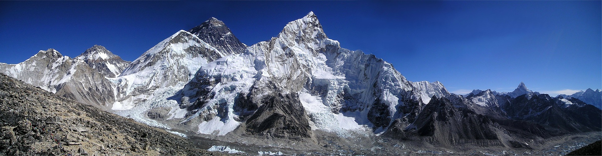
South Asia is separated from the rest of Asia by some of the world’s most spectacular mountains. Much of South Asia’s landmass broke free from Africa 180 million years ago, and began colliding with Asia about 60 million years ago. This caused the uplift of the Himalaya, Hindu Kush, and Pamir mountains, which form a crescent-shaped wall in far northern India, Nepal, Bhutan, and western Pakistan. Because of the ongoing tectonic forces creating these mountains, this area is prone to devastating earthquakes.
High rates of precipitation in these mountains feed three large rivers that rise on the Tibetan Plateau. The Ganges River flows south through the Himalayas, then eastward across northern India to Bangladesh, where it flows into the Bay of Bengal. The Brahmaputra flows eastward across Tibet, turns southwest through northeastern India, and then south into Bangladesh, where it joins the Ganges to form a massive river delta. The Indus River flows westward across Tibet, then southward through Pakistan to the Arabian Sea.
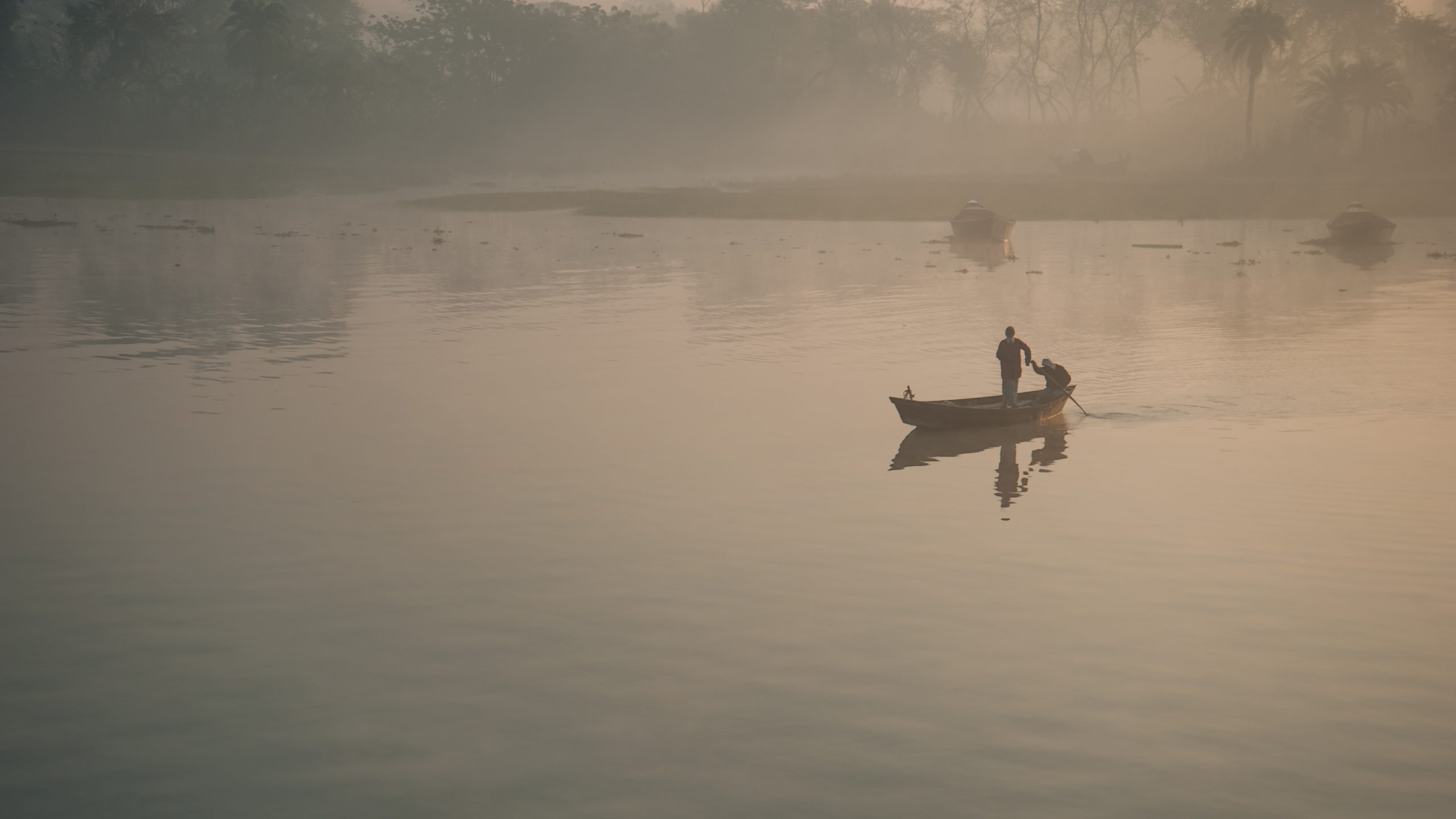
Photo by Armand Rajnoch on Flickr.
These rivers flow swiftly through the mountains, eroding tremendous amounts of earth. When they arrive on the flatlands of India, Pakistan, and Bangladesh, the rivers slow down and begin depositing that eroded material. For millions of years, these rivers have been creating floodplains with extremely deep and fertile soils. These northern river plains have sustained productive agriculture for thousands of years, and are some of the most densely populated rural areas on earth.
Peninsular India consists of ancient, eroded plateaus and hills similar to the landscapes of Africa, including the Central Indian Highlands and the Deccan Plateau. The peninsula is bounded on the east and west by the Ghats – low mountains that descend to the peninsula’s long, narrow coastal plains. Sri Lanka is geologically similar to southern India, and rests on the same tectonic plate as India. It is a hilly island ringed by extensive coastal lowlands.

The Maldives, are an island archipelago southeast of India. These islands were formed long ago by volcanic eruptions as each island passed over a “hotspot” in the Indian Ocean. These islands were soon ringed by coral reefs, and as the volcanoes eroded, the eroded material flowed onto the coral reefs to form alluvial plains. Eventually, the volcanoes eroded entirely away, leaving only the flat, ringlike atolls that make up the Maldives today.
Climate
South Asia’s tropical areas are generally hot year-round. The northern part of the region, in the subtropics, can be relatively cool in the wintertime, but it is extraordinarily rare for any of South Asia’s lowland areas to experience truly cold conditions. As is the case elsewhere in the world, temperature drops as altitude is gained. As a result, South Asia’s highest elevations can be quite cold.
Much of South Asia is relatively wet, with the highest rates of precipitation falling in Bangladesh and southern India. Much of northern India is slightly drier, but still receives a significant amount of rainfall. Northwestern India and much of Pakistan are quite dry, with deserts resulting from the presence of a subtropical high. Much of South Asia is affected by monsoons – seasonal shifts in precipitation that are discussed in Chapter 70.
Historical Geography
South Asia was home to one of the world’s earliest major civilizations. The Indus Valley Civilization arose in the 2500s BCE, and was quite advanced for its time. It developed a complex writing system, a trade network that extended to Mesopotamia and East Africa, and productive irrigation-based agriculture. It is perhaps best known for its advanced cities, which featured some of the world’s earliest forms of urban planning, multi-story homes, and piped water and sewage. The Indus Valley Civilization began to decline in the 1700s BCE, possibly as a result of invasions, environmental change, or both. Its legacy endures in South Asia today, the civilization having laid the foundations for much of the region’s languages, religion, and social organization.
For the next three millennia, South Asia would experience numerous migrations and invasions that would shape its diverse cultural landscape. In the 1500s BCE, the Indo-Aryans began migrating into the region from Central Asia, introducing languages that continue to be spoken in much of the region, and introducing religious elements that would eventually merge with local folk traditions to form Hinduism. Between the 500s and 300s BCE, South Asia would be invaded by the Persians and Greeks, each of them influencing South Asian art, politics, and philosophy, and increasing the region’s cultural and economic contacts with the west. In the 1000s CE, Arab merchants settled along South Asia’s west coast, introducing Islam and increasing the region’s trade with the rest of the eastern hemisphere. In the 1500s, South Asia was invaded by Central Asia’s Mughals, who would establish a kingdom ruling over much of the region. The Mughals further enhanced the status of Islam, and brought significant Turkic influences to South Asia art and architecture.
At about the same time period, European merchants began to arrive, with Portugal, France, Denmark, and Britain established colonial outposts along the coast of South Asia. By the 1700s, Mughal authority was being challenged by numerous internal regions and kingdoms, and the British were quite successful and manipulating these political rivalries and alliances. Over the next century, the British East India Company gained control of most maritime trade with South Asia. The British and their allies defeated the Mughals in 1857, and Britain assumed formal political control over all of South Asia.
British India would be the crown jewel in the enormous British Empire. Britain’s colonial goals mirrored those of other mercantile colonies – to extract raw materials and to create a market for British manufactured goods. Indian merchants initially benefited from this trade – Britain’s vast merchant marine gave them access to markets all over the world. Eventually, however, British colonization would halt India’s economic development. The British slowly banned much of India’s domestic industry, forcing Indians to buy their goods from British manufacturers. The British also changed the economic structure of rural areas by introducing taxation structures that benefited wealthy landowners at the expense of small farmers. Britain’s appetite for raw materials encouraged the wealthy landowners to redirect much of the region’s best farmland from food production to the cash crop production of exports like sugar, tea, cotton, and jute.
There were some positive aspects of British rule. They introduced English as lingua franca, left behind a blueprint for parliamentary democracy, and built a vast rail network, much of which is still in use today. That said, the legacy of colonization was generally negative. Poverty rates increased as result of the displacement of small farmers, and political tensions among cultural and religious groups increased. Perhaps one of the greatest lasting impacts of colonization was the Indian Diaspora – the emigration of hundreds of thousands of people from South Asia to other parts of the British Empire in Africa, Asia, the Americas, and the Pacific.
From the 1920s through the 1940s, Indian resistance to British rule increased. The most famous leader of Indian’s independence movement was Mohandas Gandhi, whose nonviolent means of protest would inspire civil rights activists throughout the world. World War II dramatically reduced both the ability and will of the British to keep their empire intact, and independence was granted to India in 1947. That year, the semiautonomous protectorate of Bhutan became a separate independent country (Its Himalayan counterpart, Nepal, had gained independence in 1923). Sri Lanka would gain independence a year later, and the Maldives would become independent in 1965.
The rest of British India was divided into two separate independent countries. Parts of northwestern and northeastern British India became Pakistan, and the remainder of the colony became India. Although both countries were to feature secular governments with no official religious affiliation, the mutual understanding was that Pakistan would have a Muslim majority, and India a Hindu majority. Eventually, a civil war would fragment Pakistan into two separate states, Pakistan and Bangladesh. That conflict is discussed in Chapter 69.
Cultural Geography
South Asia’s ethnic patterns are shaped by a mixture of various religious and linguistic identities. South Asia’s complex religious geography is discussed separately in Chapter 74, but its linguistic geography is no less complicated.
Photo by Lokesh Dhakar on Flickr.
India is home to 122 different languages, most of them falling into two prominent language families – Indo-European and Dravidian. Indo-European languages are dominant in the north, and are spoken by about 72% of the country’s population. The most common Indo-European language is Hindi, which is spoken by 41% of India’s population. Other prominent Indo-European languages are Bengali, Marathi, Urdu, and Gujarati. Dravidian languages are dominant in southern India, and are spoken by 25% of the country’s population, with Telugu and Tamil being the most prominent.
Indo-European languages are dominant in Pakistan, where 58% of the population speaks Punjabi. Other common languages in Pakistan are Sindhi, Pashtu, and Urdu. Closely related to Hindi, Urdu is the official language of Pakistan, and a common lingua franca throughout the country. Bhutan is home to a dozen major languages, most of them members of the Tibeto-Burman language family. The most prominent is Dzongkha, which is the official language, and which is spoken by about a quarter of the population.
South Asia’s remaining countries demonstrate more linguistic uniformity. 98% of Bangladesh’s population speaks Bengali, and 79% of Nepal’s population speaks Nepali, both Indo-European languages. About 79% of Sri Lanka’s population speaks Sinhala, another Indo-European language, while about 18% speak Tamil, a Dravidian language. The vast majority of the Maldives population speaks Dhivehi, which is closely related to Sinhala.
English remains an important lingua franca in politics, journalism, and academics throughout South Asia. It is common second language, particularly among the educated middle and upper classes, and is spoken by about a third of the region’s population.
Population Geography
South Asia is one of the most densely populated regions on earth. India is the world’s second most populous country, with 1.376 billion people. Pakistan is the world’s fifth most populous country, with 225 million people. Bangladesh is the world’s eighth most populous country, with 173 million people.
Even for this crowded region, the population density of Bangladesh is truly remarkable. Bangladesh’s population density is 3,277 people per square mile, by far the highest of any major country on earth. By comparison, the United States is home to just 94 people per square. DuPage County, a densely settled area in the Chicago suburbs, is home to just 2,800 people per square mile. South Korea, the second most densely populated country on earth, is home to 1,366 people square mile. Perhaps the most remarkable comparison is Russia – it is 115 times larger than that Bangladesh, but Bangladesh is home to more people.
South Asia has been a crowded region for centuries, but its population explosion occurred in the 20th century as the region made its way through the demographic transition. In the 21st century, it appears that most of South Asia is moving into the final stage of the demographic transition. India and Sri Lanka, each with TFRs of 2.2, are now growing slower than the global average. Four of the region’s countries have now dropped below the replacement rate of 2.1, including Bangladesh (2.0), Bhutan (2.0), Nepal (1.9), and the Maldives (1.8).
Birth rates in Pakistan, however, remain stubbornly high. The country’s TFR has been falling, but remains well above the world average, at 3.5. Pakistan has some of the usual hallmarks of countries with high birth rates – it is poor and mostly rural, but the likely reason why Pakistan has higher birth rates than the rest of the region is that many of its citizens adhere to a very conservative interpretation of Islam, which discourages both birth control and educational opportunities for women.
In addition to being one of the most crowded regions on earth, South Asia is also one of the most rural, with the vast majority if its population living in agricultural villages. The Maldives has the region’s highest urbanization rate (41%), and Sri Lanka has the lowest (19%). South Asia’s total population is about 35% urban, but it is urbanizing rapidly, and is already home to some of the world’s largest metropolitan areas. Delhi (29 million), Mumbai (20 million), and Dhaka (20 million) are each larger than New York City (19 million).
This rapid urbanization is being caused by declining economic opportunities in the region’s rural areas. The mechanization of agriculture, the increased cost of modern farming, the expansion of large-scale corporate agriculture, and environmental deterioration are common push factors in rural South Asia, while a hope of employment and upward mobility are the most common pull factors toward urban South Asia. Unfortunately, regular employment is scarce in many of the region’s cities, and those cities have been overwhelmed by rural migrants, featuring high rates of homelessness, poverty, congestion, water and electricity shortages, and air and water pollution.
Three of the region’s countries have positive net migration rates – Nepal, Bhutan, and the Maldives. All of South Asia’s other countries are experiencing a net migration loss. Emigration rates are especially acute among the region’s well-educated populations. Doctors, engineers, entrepreneurs, scientists, and scholars have long drifted from the region seeking higher wages and more stable economic conditions. Favorite destinations include Britain, Canada, and the United States. (India is on pace to soon replace Mexico as the largest source of immigrants to the U.S.). While this “brain gain” certainly benefits the countries to which these migrants move, it creates a severe “brain drain” in South Asia, as the region’s most skilled individuals take their talents elsewhere.
Political Geography
India has been a democracy since independence, and although it suffers from significant corruption, elections are free, political dissent is tolerated, and basic civil rights are respected. In 1947, few predicted that Indian democracy would survive, given the country’s sheer size, its monumental economic challenges, and its remarkable cultural diversity, but India has defied expectations. Each time the country holds a national election, it sets a new world record for the largest election ever held. Unfortunately, since current Prime Minister Narendra Modi came to power, politics in India have taken a troubling turn. Journalists and government critics have experienced increased harassment, and members of Modi’s BJP party have pursued policies considered discriminatory toward the country’s large Muslim minority. Sri Lanka has also been a democracy since independence, and has also recently experienced increased government harassment of journalists and political opponents.
South Asia’s remaining countries could be considered partial democracies – countries with elections and democratic institutions, but with persistent undemocratic traits. Since independence, Pakistan has alternated between periods of democracy and military rule, with the last period of military rule lasting from 1999 to 2008. Despite several years of civilian rule, the military continues to wield significant power. The military frequently acts independently of civilian control, regularly harasses journalists, and operates its own judicial system, in which it can easily charge and imprison any of its critics. Bangladesh has also experienced periods of democracy, but its politics have long been marred by election violence, weak and corrupt governments, and periodic military rule. In 2006, Nepal established a constitutional monarchy after a decade-long civil war. The country has held regular elections, and is becoming somewhat more tolerant of the free press, but the suppression of government critics is still common. Similarly, Bhutan has recently embraced constitutional democracy and, similarly, the harassment of government critics remains common. An opposition presidential candidate was elected in the Maldives in 2018, an encouraging sign, although the country still has many authoritarian restrictions of civil freedoms.
Economic Geography
South Asia is relatively poor region. Sri Lanka and the Maldives are the region’s wealthiest countries, where standards of living are close to the world average. Standards of living in every other country in South Asia fall well below the world average.
The Maldives economy revolves almost entirely around tourism. The major industry in Nepal and Bhutan has long been agriculture, but tourism is likely to be the source of most future economic growth in these countries, as their spectacular scenery and unique cultures continue to lure travelers, and as stabilizing political situations make travel there more attractive. Still, being landlocked, mountainous, and isolated, these countries will face economic challenges for years to come.
Pakistan’s economy has long revolved around the production and export of cotton, and textile manufacturing has expanded rapidly in recent decades, but the country faces numerous economic liabilities. It is politically unstable, which deters foreign investment, and which forces the government to spend lavishly on the military, rather than on economic development programs. It also has relatively poor education system, leaving much of its population without the skills necessary to compete in the technology and information age. Perhaps most troublingly, Pakistan’s high population growth rates will likely outstrip any economic gains for year to come.
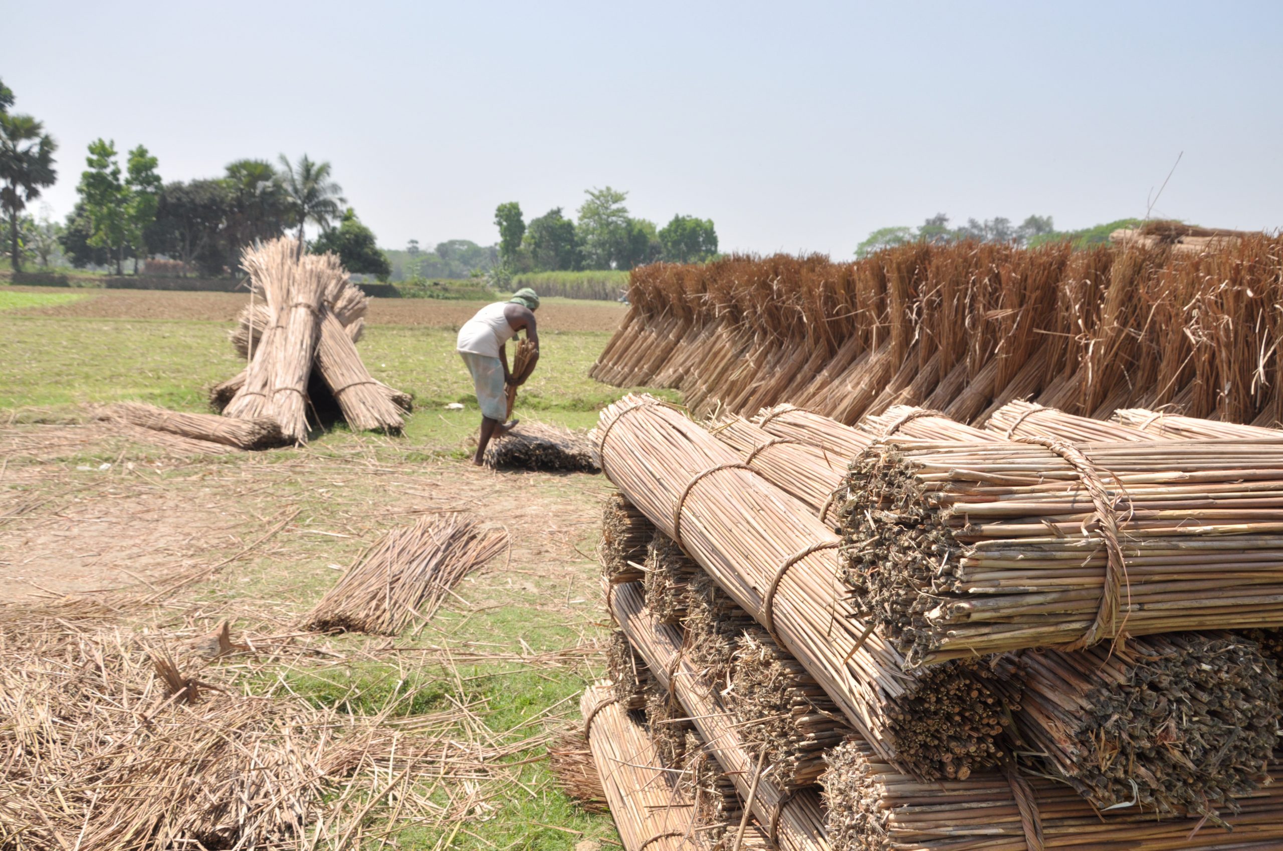
Much of Bangladesh’s population is desperately poor. The country’s export economy was long dominated by the export of jute, a fiber used in ropes and burlap bags, but when jute began to be replaced by synthetic materials, Bangladesh’s economy suffered, and it has yet to find a new economic foundation. It does have a rapidly expanding textile manufacturing industry, but largely because of the country’s extremely low wages. If there is one bright spot for Bangladesh, it’s that the country’s economy is now growing at a faster rate than its population.
Sri Lanka’s economy has long revolved around the export of raw materials such as rubber, graphite, and tea. Sri Lanka is also home to a modest but expanding manufacturing base, and its relatively good education system gives the country significant growth possibilities in the information and high-tech industries. Sri Lanka is also justifiably famous for its natural beauty, and has enormous potential for a robust tourist industry. The country’s greatest liability is the possible renewal of its civil war (see Chapter 90).
India experienced rapid economic growth over the last few decades, with some expansion of traditional manufacturing, such as textiles and steel, and even greater expansion of high-tech manufacturing, such as computers and pharmaceuticals. But the most spectacular growth has occurred in technology sectors such as software, biotechnology, and financial services. The country has tremendous economic potential given its abundant resources, large market, and vast pool of highly skilled yet affordable labor.
India still faces enormous economic challenges. Nearly a third of the population lives in poverty, and about a fifth of the population is seriously undernourished. The country still imports more manufactured goods than it exports. It suffers from poor infrastructure, inefficient government, and is heavily dependent on imported energy. And, as mentioned above, one of India’s greatest challenges is the continued emigration brain drain.
Did you know?
Cited and additional bibliography:
De, Prithu. JUTE. photo, 23 Mar. 2010. Flickr, https://www.flickr.com/photos/scorpioprithu/4821025383/. Attribution-NonCommercial 2.0 Generic (CC BY-NC 2.0).
Dhakar, Lokesh. Heritage Walk Plaque in Hindi. photo, 14 June 2010. Flickr, https://www.flickr.com/photos/lokesh/4706068635/. Attribution 2.0 Generic (CC BY 2.0).
Rajnoch, Armand. Bangladesh. photo, 25 Jan. 2015. Flickr, https://www.flickr.com/photos/armand_rajnoch/16229391869/. Attribution-NonCommercial-NoDerivs 2.0 Generic (CC BY-NC-ND 2.0).
Travelbusy.com. Mount-Everest-Nepal. photo, 1 July 2017. Flickr, https://www.flickr.com/photos/travelbusy/35257755060/. Attribution 2.0 Generic (CC BY 2.0).
