37 Sub-Saharan Africa: Overview
Physical Geography
Landforms
Sub-Saharan Africa is a relatively flat region, its physical landscapes dominated by plateaus – blocks of earth at different elevations and in various stages of weathering – some are quite flat, while others have eroded to form hills. The continent’s most significant mountains and lakes are found along the Great Rift Valley. Africa’s plateaus are surrounded by a relatively narrow and uniform coastal plain.
Climate
Nearly all of Sub-Saharan Africa falls within the tropics, and average daily temperatures tend to be quite warm. The only relatively cool areas in the region are found in the highlands and along the coast of South Africa. Because if its low-latitude location, temperatures vary little from season to season. Some locations in Africa have practically no discernable seasonal variation – some are wet year-round and others are dry year-round, while some have distinct rainy and dry seasons caused the north-south oscillation of subtropical highs and the intertropical convergence zone (ITCZ).
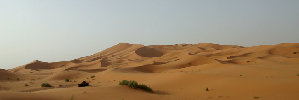
The Sahara, the world’s largest desert, lies between the Mediterranean coast and about 15°N latitude. It is the result of a subtropical high, and is dry year-round. South of the Sahara lies the Sahel. Located between 5°N and 15°N latitude, this area has a distinct wet/dry climate. The rainy season occurs from May to October, and is caused by the northward shift of the ITCZ. The dry season occurs from October to May, and is caused by the southward shift of the Sahara’s subtropical high. Much of the Sahel is covered by savanna – a mixture of grasslands and woodlands – with tree cover increasing toward the South. Near the equator, Africa is rainy year-round as a result of the near-constant presence of the ITCZ. Rainforests cover much of the central part of the continent. The highlands of eastern Africa, despite their equatorial location, are drier than the lowlands to the west (although they are by no means arid). This is the result of a rain shadow effect – the Ethiopian Highlands and Rwenzori Mountains restrict the flow of moisture to the area.
South of the equator, Africa’s climates are something of a mirror image of the north. A tropical wet/dry climate is found between 5°S and 10°S latitude. The wet and dry periods on the calendar are the opposite of the Sahel. The rainy season occurs from October to May, and is caused by the southward shift of the ITCZ. The dry season occurs from May to October, and is caused by the northward shift of southern Africa’s subtropical high. Like the Sahel, this area is covered by savanna, with tree cover decreasing toward the South. Southern Africa’s subtropical high creates desert and steppe climates between 10°S and 30°S latitude, including the semi-arid Kalahari, and the extremely dry Namib Desert. Namibia is especially dry because of the chilly Benguela current that runs along the coast. The cold water chills air masses that pass over it, causing them to lose moisture over the sea. The southern coast of South Africa is home to a Mediterranean climate. From October to May, the subtropical sinks over the southern tip of the continent, and the summers are virtually rainless. In the wintertime (May to October in the southern hemisphere), the westerlies shift north, bringing precipitation in from the Atlantic Ocean.
Some of Africa’s climates create challenging conditions for the people who live there. In many areas, the region’s climates reduce the quality of the soils, which in turn reduces agricultural productivity. Soils lose fertility quickly in warm, wet environments. Organic materials decay rapidly in tropical heat, and the heavy rainfall then leaches those nutrients from the soil. Soils in warm dry environments lack organic material to begin with. Areas with fertile soils tend to have extremely high population densities, such as wet/dry climates, the floodplains of major rivers, and the fertile volcanic soils of the Great Rift Valley.
In dry environments, irrigation water is often in short supply, and this a region that is prone to devastating droughts. In 2015, a drought struck Ethiopia, and 15 million farmers in the country went without a harvest. The warm, wet environments of Africa create an additional challenge. Organisms that carry viruses breed prolifically in such climates, contributing to Africa’s unfortunate distinction of leading the world in rates of infectious disease (see Chapter 33).
Historical Geography
Early Empires
Between the 700s and the 1600s, several powerful empires evolved in or near the Sahel. The most powerful included Ghana (700 – 1070), Mali (1230 – 1430), and Songhai (1460 – 1590). These states prospered by controlling trade across the Sahara, shipping tropical products like timber, gold, and ivory to the north, and by shipping subtropical products like grain and salt to the south. This lucrative trade would begin to collapse in the 1600s, when European ships undercut the economic viability of the Saharan trade routes.
Colonization
By the mid-1400s, Portuguese ships were exploring the west coast of Africa. Portugal’s government, wanting to undercut the Ottoman Empire’s chokehold on trade between Europe and Asia, was attempting to establish sea routes around Africa to India and China. In the process, they built outposts along Africa’s west coast, and established trade with Africans. Some of the coastal areas along the Gulf Guinea still bear the name given to them by Portuguese merchants, based on what they were buying and selling there – the Gold Coast, the Ivory Coast, the Pepper Coast, the Grain Coast, and the Slave Coast.
The slave trade did exist in Africa prior to the involvement in of Europeans – a fact cited for centuries by European and American historians to justify one of the most shameful chapters in their collective histories. And, indeed, African prisoners of war and their descendants were often forced into servitude, and had been for centuries. That said, the European practice of trading enslaved Africans would become far more brutal and widespread than the African slave trade. European traders treated slaves less like servants and more like commodities, often thinking no more of separating husbands and wives, or parents and children, than they would think of separating domesticated animals from their mates and offspring.
The slave trade was deeply intertwined with the colonization of the Americas. Although some slaves were sold in Europe and Asia, the vast majority were destined for plantations in Brazil, the Caribbean, and what was to become the southern United States. It was part of a self-perpetuating economic system known as triangular trade. Slaves would be shipped to the Americas to harvest raw materials, mostly agricultural products such as coffee, tobacco, or cotton. These commodities were then shipped back across the Atlantic to be sold to European merchants. Some of the proceeds from the sale of the raw materials would then be returned to Africa to purchase more slaves. In short, more slaves meant bigger harvests, bigger harvests meant more profits, and more profits meant more slaves. Between the 1500s and the 1800s, some 12 million enslaved humans were sent from Africa to the Americas. More than 25% of them died in transit, and the survivors were often subject to unspeakable brutality on American plantations.
The slave trade also set in motion the process of colonization. By the 1600s, the Dutch, British, and French had joined the Portuguese in establishing outposts along the Africa’s Atlantic coast, trading with Africans for slaves, gold, and ivory. The Dutch also established a colony along Africa’s southern coast to supply ships sailing to Indonesia (and would eventually become the settler colony of South Africa).
European colonization would largely be limited to coastal areas for the next two centuries. European explorers of Africa’s interior had difficulty navigating the continent’s wild rivers, vast deserts, and dense forests. Many expeditions simply never returned, killed by hostile armies or by malaria. The push to the interior accelerated in the 1850s after the discovery of quinine as protection against malaria. The French began to move inland along the Senegal River, Britain established control over the Gold Coast (modern Ghana), and Belgium established control over the Congo Basin. By the 1880s, European armies were equipped with the Maxim gun – an early machine gun – and African armies could, for the most part, no longer resist invasion.
By 1884, the European scramble for Africa was on, and the German government hosted a conference of the world’s major powers to settle claims over Africa’s interior. They haggled over conflicting claims and ultimately settled on their colonial boundaries – borders drawn without knowledge or regard for preexisting cultural patterns. These boundaries would ultimately serve as the basis for today’s independent African countries, and are still the cause of much of Africa’s political strife (see Chapter 30). The table below lists the colonial claims established at the Conference of Berlin.
| Empire | Sub-Saharan African Colonies |
| Britain | Bechuanaland (Botswana)
Gambia Gold Coast (Ghana) Kenya Nyasaland (Malawi) Nigeria Sierra Leone British Somaliland (northern Somalia) South Africa Sudan Uganda Rhodesia (Zambia and Zimbabwe)
|
| France | French Equatorial Africa (Central African Rep., Rep. of Congo, and Chad)
French Somaliland (Djibouti) Gabon Madagascar French West Africa (Benin, Burkina Faso, Guinea, Côte d’Ivoire, Mali, Mauritania, Niger, and Senegal)
|
| Germany | German East Africa (Burundi, Rwanda, and Tanzania)
Cameroon German Southwest Africa (Namibia) Togo
|
| Portugal | Angola
Portuguese Guinea (Guinea-Bissau) Mozambique
|
| Belgium | Belgian Congo (Dem. Rep of Congo)
Burundi Rwanda
|
| Italy | Eritrea
Ethiopia Italian Somaliland (southern Somalia) |
Sub-Saharan Africa would be almost completely colonized by 1900. Two countries remained independent. Ethiopia would resist Italian control until 1936. Liberia remained independent, having been established in 1847 as a homeland for freed slaves and free-born African-Americans. Following World War I, Germany’s colonies would be partitioned by Britain, France, and Belgium.
The European colonization of Sub-Saharan Africa was a textbook example of mercantile colonization. The primary purpose of these colonies was to provide raw materials to European markets, and their secondary purpose was to provide a market for European manufactured goods. Colonization had immediate negative effects for Africans. Much of the best farmland in the region would now be used for the production of cash crops to be exported elsewhere, reducing the amount and quality of land used to grow food for the region’s population. Many African families lost control of land they had possessed for generations since their historic claims had no legal status in the newly established colonies. Many Africans were also forced to work for European agricultural, mining, and timber interests. Furthermore, Africans had essentially no political rights. The colonies were ruled directly by colonial governors, often with the support of an African ruling class installed by the colonizers.
Ghana gained its independence in 1957, and nearly every other country in the region would gain independence in the 1960s. Unfortunately, the lingering effects of colonization has made Sub-Saharan one of the world’s most troubled regions. The post-colonial experiences of these countries will be examined in the political and economic sections below.
Cultural Geography
Religion
Christianity arrived in Ethiopia very early – an Ethiopian convert to Christianity is mentioned in the Biblical Acts of the Apostles. The Ethiopian Orthodox Church was established in the 4th century, about the same time as the Roman Catholic Church. Today, Christians make about two-thirds of Ethiopia’s population. Christianity was introduced to much of the rest of Sub-Saharan Africa by missionaries who accompanied European explorers and colonizers beginning in the 1500s. It would become the dominant faith in southern Africa, central Africa, the East African lake district, and in West Africa near the Gulf of Guinea.
Islam was introduced to the region by Arab merchants who arrived from the Sahara and the Indian Ocean from the 700s to the 1000s. Today, Islam is the dominant faith of the Sahara and Sahel, northern West Africa, Somalia, and the coastal areas of Kenya and Tanzania.
Of course, Africans practiced their own indigenous faiths prior to the arrival of Christianity and Islam. These African folk religions are incredibly diverse, consisting of hundreds of distinct belief systems, but there are a few common traits found in many of them. They are usually polytheistic, involving the worship of numerous gods. Most of them are also examples of animism, in which the spiritual world is manifested in environmental features such as rivers, trees, the soil, the sun, and the weather. Many African folk religions also feature ancestor veneration, in which deceased relatives are asked to intercede with the gods on behalf of their descendants. Many of these faiths also feature shamanism, the belief that certain holy people had special wisdom and powers, such as the ability to heal the sick, communicate with the dead, and interpret the will of the gods.
African folk religions are practiced throughout the region, and are especially prominent in rural areas. Many Africans practice syncretism – the fusion of two different religious belief systems. It is not uncommon, for example, to find people in the region who might attend both a Catholic mass and a traditional indigenous ritual on the same day.
Language and Ethnicity
Perhaps the simplest thing that can be said about patterns of language and ethnicity in Sub-Saharan Africa is that they are incredibly complex. It is the most linguistically diverse region in the world, home to sixteen language families, 100 major languages, and more than 2,000 minor languages. Because of this astounding linguistic diversity, the use of a lingua franca becomes a necessity for many of the region’s inhabitants, with Arabic, Swahili, Portuguese, French, and English being the most commonly used.
Sub-Saharan Africa’s linguistic diversity is, of course, a reflection of its ethnic diversity. The table below shows the largest ethnic groups in the region, their approximate populations, and countries where they are present in substantial numbers.
| Ethnic Group | Approximate Population | Countries |
| Hausa | 80 million | Nigeria, Niger, Ghana, Chad, Cameroon, Cote d’Ivoire, Sudan |
| Yoruba | 35 million | Nigeria, Benin |
| Oromo | 35 million | Ethiopia, Kenya |
| Fula | 34 million | Guinea, Nigeria, Cameroon, Senegal, Mali, Sierra Leone, Central African Rep., Burkina Faso, Benin, Niger, Gambia, Guinea Bissau, Ghana, Chad, Sudan, Togo, Cote d’Ivoire |
| Igbo | 31 million | Nigeria, Cameroon |
| Somali | 24 million | Somalia, Djibouti, Ethiopia, Kenya |
| Hutu | 23 million | Rwanda, Burundi, DR Congo |
| Akan | 20 million | Ghana, Cote d’Ivoire |
| Amhara | 20 million | Ethiopia, Sudan, Somalia, Eritrea, Djibouti |
| Kongo | 18 million | DR Congo, Angola, Rep. of Congo |
| Shona | 18 million | Zimbabwe, Mozambique |
| Zulu | 11 million | South Africa |
This table demonstrates two essential characteristics of Sub-Saharan Africa – that most of these groups are divided into multiple countries, and that most countries contain numerous ethnic groups. Political boundaries in Africa often have very little to do with cultural patterns. The table also barely scratches the surface of Sub-Saharan Africa’s ethnic diversity. These twelve groups, large though they may be, account for less than one-third of the region’s population. There are nearly a hundred more major ethnic groups in Sub-Saharan Africa.
Population Geography
Population Density
Sub-Sharan Africa is home to more than a billion people. Like many regions, it has a very uneven population distribution, containing some of the most densely crowded areas on earth, as well as vast, sparsely populated areas. The region has a huge population, but it also covers a tremendous amount of area, and is actually relatively sparsely population when compared to regions like Europe, South Asia, and East Asia. Its population density is approximately 124 people per square mile, which is somewhat more crowded than the United States (91 people per square mile), but considerably less crowded than the European Union (306 people per square mile).
Sub-Saharan Africa is home to some population giants, with the seven largest countries accounting for 55% of the region’s population, including Nigeria (206 million), Ethiopia (115 million), D.R. Congo (90 million), Tanzania (60 million), South Africa (59 million), Kenya (54 million), and Uganda (46 million). Forty smaller countries account for the remaining 45% of the region’s people. Overall, the most densely settled places are Ethiopia, areas near the Great Rift Valley, and eastern South Africa, and areas in west Africa that are near the Gulf of Guinea.
Urbanization
The majority of Sub-Saharan Africa’s population lives in rural areas, but that may be not be true in a few years. It is a rapidly urbanizing region. In 1960, just 15% of the region’s population lived in cities. By 1980, that number had climbed to 23%. Today, Sub-Saharan Africa is 41% urban.
The region is home to many primate cities – cities that are by far the largest in their respective countries, and that dominate them politically and economically. Kampala, Uganda, for example, is nearly ten times larger than Gulu, the country’s second-largest city. Because much of Sub-Saharan Africa’s rural-to-urban migrants are targeting these primate cities, they have experienced some of the fastest urban population growth rates in world history. Lagos, Nigeria, the region’s largest metropolitan area, was home 1 million people in 1960. By the year 2000, it was home to 11 million people. That is incredibly rapid growth, but even more remarkably, Lagos’s current population is 21 million. That means that Lagos added 10 million people in about two decades. For comparison, the total population of the Chicago metro area is about 10 million people.
The task of absorbing a Chicagoland’s worth of population in just two decades is almost beyond comprehension, but that is precisely what many cities in Sub-Saharan Africa have had to do. As a result, the housing market, job market, schools, civil service, and physical infrastructure of these cities have been more than overwhelmed. An increasingly large share of the region’s urban population is forced to reside in squatter settlements – informal housing without water or electricity, in areas with very few public services, and even fewer economic prospects.
Population Growth
Sub-Saharan Africa is the world’s fastest growing region by a wide margin. Over the last seven decades, the region’s population has increased more than 6000%. Over the last decade, it added about 26 million people every single year – greater than the total population of Australia. At current rates, the region will be home to more than 2 billion people by mid-century, when Nigeria will pass the United States to become the world’s third-largest country.
Of the twenty-five countries on earth with the highest total fertility rates (TFRs), all twenty-five are in Sub-Saharan Africa. Congo is ranked twenty-fifth in the world, with a TFR of 4.4, while Niger ranks highest, with an astounding 6.8 births per female. The region’s TFRs have been drifting lower in recent years, but they are well above the world average of 2.4, and the “zero population growth” number of 2.1. Even if Sub-Saharan Africa’s TFRs were to experience an historic collapse, the region is set to grow for decades to come. The population is extremely young – the median age in Sub-Saharan Africa is just 19 years old (by comparison, the median age in the European Union is 43), so much of the region’s population have yet to enter their reproductive years
The reasons for Sub-Saharan Africa’s rapid population growth are explained by the demographic transition. The region is still in its middle stages. Death rates are high by global standards, but much lower than in centuries past. It is still mostly poor and rural, where cultural and economic conventions drive people to have large families, and there are comparatively few educational and career opportunities for women. Additionally, it is a region of endemic interethnic conflicts, and many ethnic groups do not want to be out-reproduced by their historic foes.
Sub-Saharan Africa’s population trends are troubling, to say the least. The region is on track to double its population in the next three decades. That means that in thirty years the region will have to have twice as much food, and twice as many houses, jobs, doctors, and teachers than it possesses right now – and that’s just to maintain current standards of living, let alone improve upon them.
Political Geography
Sub-Saharan Africa is one of the world’s most politically turbulent places. It is a region of endemic conflict. A significant reason for this political unrest is the region’s political boundaries.
Throughout the Cold War, much of Sub-Saharan Africa was dominated by military governments, many of them supported by the United States or the Soviet Union. Democracy has slowly taken root in the region since the 1990s, but today only seven Sub-Saharan African countries can truly be called democracies – Botswana, Cape Verde, Ghana, Lesotho, Mauritius, Namibia, and South Africa. Although most of these countries suffer from significant corruption and often ineffective governance, they possess fundamental democratic traits – fair elections, an independent judiciary, respect for civil liberties and the rule of law, a free press, and tolerance of political opposition.
Another fourteen of Sub-Saharan Africa’s countries are semi-democratic – Benin, Cote d’Ivoire, Gambia, Kenya, Liberia, Madagascar, Malawi, Mauritania, Nigeria, Senegal, Sierra Leone, Tanzania, Uganda, and Zambia. These countries all possess democratic institutions and hold relatively regular elections, but they possess some decidedly undemocratic traits, such as questionable election practices, frequent constitutional changes to benefit the ruling party, some suppression of the press and opposition politicians, and limits to personal freedoms.
Sub-Saharan Africa’s remaining countries – more than half of them – have authoritarian governments. In these countries, political opposition and the free press are not tolerated, human rights violations are common, and elections, if they take place at all, are almost entirely fraudulent.
Economic Geography
As mentioned above, Sub-Saharan Africa is urbanizing rapidly, but is still a majority-rural region, with agriculture as the dominant form of employment. In the region’s wetter climates, most of the farmers practice a mixture of subsistence and commercial agriculture. Common subsistence crops include beans, cassava, corn, potatoes, and yams, while common cash crops include cacao and coffee. Animal herding is the common agricultural practice in the region’s drier climates.
In Sub-Saharan Africa’s growing cities, only about a third of the workforce enjoys regular employment, mostly in the manufacturing and service sectors. The remaining two-thirds of the region’s urban dwellers do not have regular jobs. Many are day laborers – working on a temporary basis in industries like construction. Many more work in the informal economy, acting as vendors or providing crafts and services out of their homes, on the streets, or in their cities’ market-places.
There is some room for economic optimism in Sub-Saharan Africa. The region’s low wages and abundant natural resources are attractive to foreign investors. Literacy rates are slowly improving, as is the health care, transportation, and communications infrastructure in several countries. That said, Sub-Saharan Africa remains the world’s poorest region by every measure. The per capita GDP is about $1500, the life expectancy is 46 years, the adult literacy rate is 66%, and the infant mortality rate 50/1000. (By comparison, the United States’ per capita GDP is $64,000, the life expectancy is 79 years, the literacy rate is 99%, and the infant mortality rate is 6/1000.)
The United Nations’ Human Development Index ranks 189 of the world’s countries by standard of living. Only three of Sub-Saharan Africa’s countries – Mauritius, Seychelles, and Botswana –rank in the top 100. Gabon and South Africa rank just below that, but most of the rest of the region is close to the bottom of the list. In fact, of the world’s twenty-five poorest countries, all but two of them are located in Sub-Saharan Africa.
The origins of African poverty are examined in Chapter 29.
Did you know?
Do not confuse Africa’s historical Gold Coast with the modern Gold Coast of Australia.
Cited and additional bibliography:
Vreede, Lisa de. Sahara. photo, 13 July 2007. Flickr, https://www.flickr.com/photos/ldevreeede/950849556/.
