27 Sub-Saharan Africa:
Regional Example – The Sahel
“They were the men and the women of the sand, of the wind, of the light, of the night. They appeared as in a dream, at the crest of a dune, as if they were born of the cloudless sky.”
― J.M.G. Le Clézio, French author
As we discussed in the NAME section of this book, there are countries that include portions of the Sahara Desert, but also have significant southern area that is not desert. At times, it is difficult knowing how to categorize these countries by region. NAME or Sub-Saharan Africa? Well, the Sahel is the sub-region that typifies the transition between these two zones, from desert to equatorial climates.
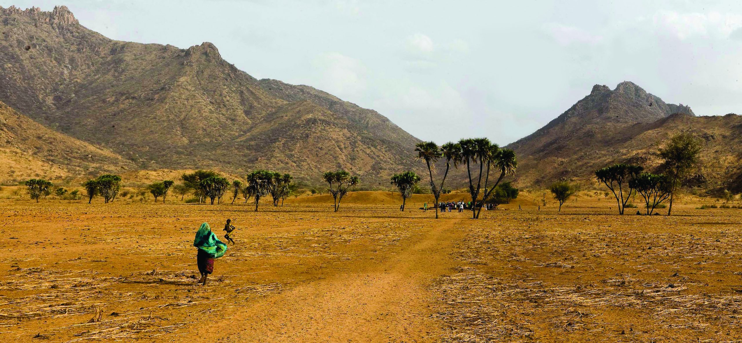
The Sahel reaches from the Red Sea to the Atlantic Ocean, measuring up to 600 miles across from north to south. From east to west, the Sahel includes large areas within several countries – Eritrea, Sudan, Chad, Niger, Mali, and Mauritania. A few other countries have small corners of the Sahelian landscape – South Sudan, Central African Republic, Cameroon, Nigeria, Algeria, Burkina Faso, the Gambia, and Senegal. As a transition zone of land, the Sahel is viewed slightly differently by different scholars, so sometimes this list of countries may vary. After all, the borders of this region are not obvious, being neither coastlines nor the international boundaries between countries.
As appropriate for a transition zone, the Sahel presents some landscape and climate like the adjacent Sahara Desert, but progressively southward displays landscape and climate that are wetter, but not yet like tropical rainforest. Although technically tropical, basically 10°-20° N latitude, the Sahel produces wide variation in climate, including rainfall. In fact, the Sahel shows some of the planet’s greatest climate variability.
 One element of climate that is consistent is sunshine as based on latitude. Any points on the planet that share the same degrees of latitude (or flipped to the other hemisphere – 10° N latitude will match 10° S latitude, though six months later) will have the same number of hours of sunshine and the same angles of sunshine on any particular day and throughout the year. So, year to year the Sahel will receive the same angles of sunshine and durations of daylight. Cloud cover does vary; however, typically in the Sahel sunshine duration is quite high on world standards. The region normally has 55-80% of daylight hours with sunshine, though this is less than neighboring Sahara itself.
With these patterns of sunshine, temperature remains hot year-round. Yearly averages are 77-86°F. Some call the Sahel the hottest place in the world, particularly as the temperature in the hottest months routinely stays at or above 100°F. Climate change likely will increase average temperatures, perhaps even by 5°F by 2050.
So, what has varied greatly in the Sahel? Precipitation. For instance, in the 1950s rainfall exceeded annual averages by more than 20%. In contrast, in the late 1960s and the 1980s, the Sahel suffered from long lasting drought conditions. Rainfall typically is higher the farther south one goes in the Sahel, but these drought conditions spread throughout the Sahel. Obviously, the impact of drought is significant for people living in the region. With two out of every three people of the Sahel living off of agricultural fields and grazing livestock, standards of living are greatly damaged by drought.
Variation in rainfall patterns has contributed to economic instability in the Sahel. Unstable countries are breeding grounds for public unrest, organized crime, political strife, and other woes. Violent conflict is common within these Sahelian countries. Displacement of peoples is routine. By 2018 in Mali, 335,000 people had been forced to flee from their homes, about 60% of them crossing borders to become international refugees. Much bigger Nigeria, the most populated country in Africa with about 190 million people, by 2018 had 2.2 million internally displaced people. Armed aggression in northeastern Nigeria has drawn Niger, Chad, and Cameroon into the conflict.
The terrorist organization Boko Haram and its later splinter group – the Islamic State’s West Africa Province – was formed in 2002 and has brutalized areas of Nigeria, Niger, Chad, and Cameroon.
In 2014, five countries – Burkina Faso, Chad, Mali, Mauritania and Niger – formed the G5 Sahel organization, seeking betterment of life in the region. This group created a Joint Force in 2017 to pool military and security efforts to combat terrorism, organized crime, and human trafficking in the region. Also in 2017, the Sahel Alliance was launched to promote sustainable economic development. This alliance now has twenty-five members and observers – countries such as France and Germany, as well as organizations like European Union, the World Bank, and the International Finance Corporation.
According to the Human Development Index of 2019, as it ranked 189 countries of the world, a number of Sahelian countries are near the bottom of the index, thus among the least developed countries in the world.
| Sahelian Country | HDI Rank |
|---|---|
| Niger | 189 |
| Chad | 187 |
| South Sudan | 185 |
| Mali | 184 |
| Burkina Faso | 182 |
| Eritrea | 180 |
| The Gambia | 172 |
| Senegal | 168 |
| Nigeria | 161 |
| Mauritania | 157 |
| Cameroon | 153 |
In spite of these woes (or is it because of), countries of the Sahel typically remain in stage two of the Demographic Transition, thus producing rapid population increase. In fact, the Sahel’s population is likely to double before 2050. For some years now, Niger has maintained the highest birth rate in the world.
In sum, the Sahel is a troubled region, facing climate and agricultural challenges, where these circumstances often bloom into additional woes of limited development and significant violent instability.
Did you know?
The word Sahel likely is derived from the Arabic word سهل or sahl, meaning plain.
The Great Green Wall is an international attempt to grow trees across the full extent of the Sahel. Read about it in Chapter 31.
In 2019, Reza Pakravan became the first person to trek the Sahel, as he journeyed from Senegal to Somalia by varied means of transportation. https://www.redbull.com/gb-en/worlds-most-dangerous-trek-sahel-reza-pakravan
Cited and additional bibliography:
Alliance Sahel. “The Sahel Alliance.” 2021. https://www.alliance-sahel.org/en/
étrangères, Ministère de l’Europe et des Affaires. “G5 Sahel Joint Force and the Sahel Alliance.” France Diplomacy – Ministry for Europe and Foreign Affairs. May 2020. https://www.diplomatie.gouv.fr/en/french-foreign-policy/security-disarmament-and-non-proliferation/crises-and-conflicts/g5-sahel-joint-force-and-the-sahel-alliance/
Skretteberg, Richard. Africa Renewal. “The world’s most neglected and conflict-ridden region. https://www.nrc.no/shorthand/fr/sahel—the-worlds-most-neglected-and-conflict-ridden-region/index.html
United Nations. “The Sahel: Land of Opportunities | Africa Renewal.” https://www.un.org/africarenewal/sahel
United Nations Chad. Dar Sila. April 24, 2012. Photo. https://www.flickr.com/photos/unchad/15870731043/ .Attribution-ShareAlike 2.0 Generic (CC BY-SA 2.0)
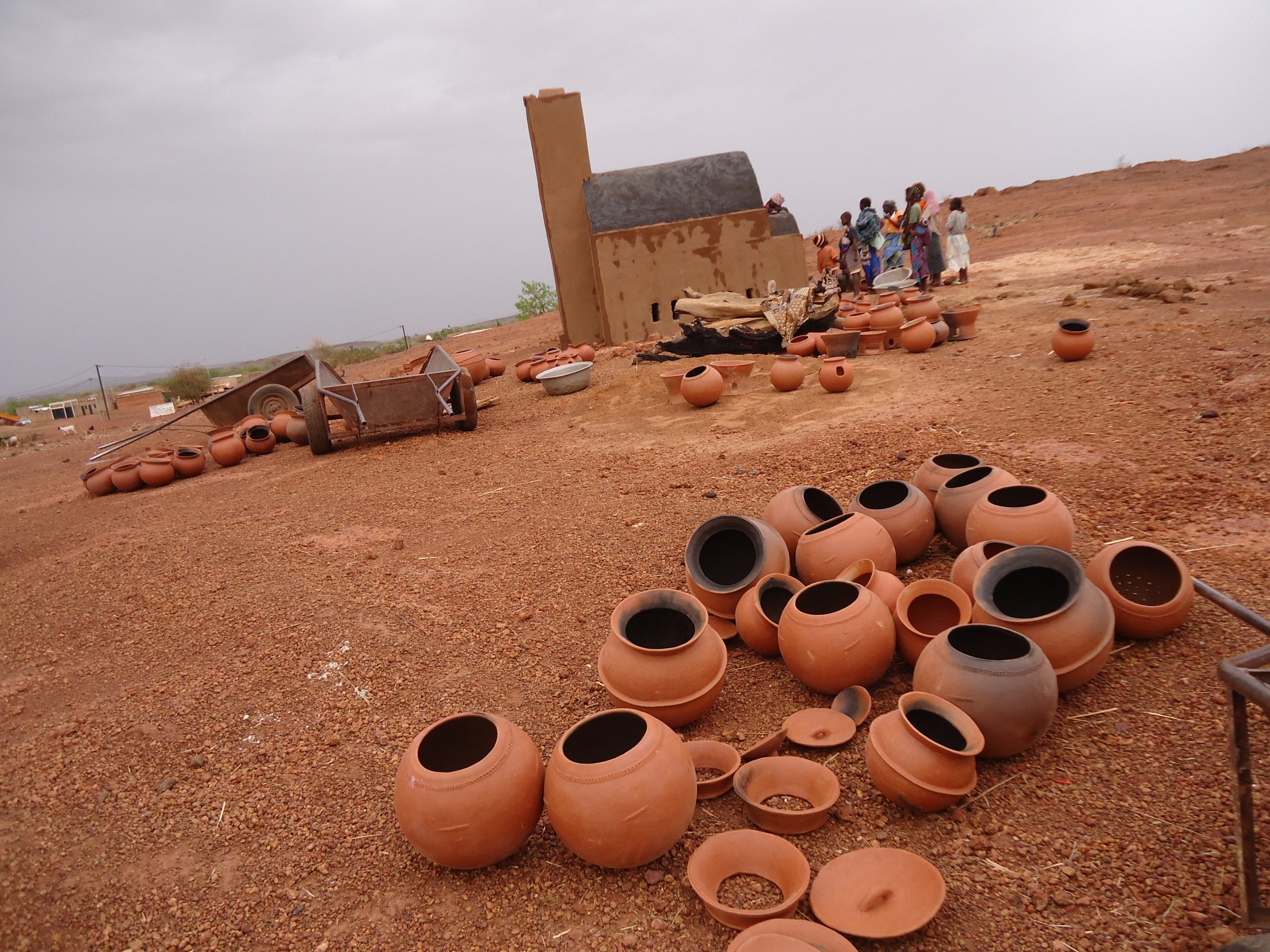
Wagner, Anton. “Burkina Faso.” Photo on Pixaby. May, 19, 2012. https://pixabay.com/photos/africa-afrique-burkina-faso-pottery-170206/
