78 Latin America and the Caribbean (LACAR): Physical Geography II – Precipitation
While the temperature patterns in Latin America are relatively simple, the precipitation patterns are incredibly complex. Part of this is because Latin America covers nearly 90˚ of latitude from north to south—half the planet. As a result, it passes through many of the different global pressure systems that help to determine the world’s precipitation patterns. Complicating matters is the wall of mountains that runs the length of the region from north to south.
As is discussed in Chapter 6, the subtropical highs are located in various places around the world at about 30˚ north and south. The subtropical highs create dry conditions. The subtropical highs also generate the westerlies – winds that move poleward from the subtropical highs, but deflect because of the Coriolis effect and blow from west to east across the midlatitudes. The subtropical highs also generate the trade winds, which head toward the equator, blowing from the northeast in the northern hemisphere, and from the southeast in the southern hemisphere. Finally, the trade winds converge near the equator, creating the very wet intertropical convergence zone (ITCZ). All of these features shift throughout the year, sliding north in June, July, and August, and sliding south in December, January, and February.
Here, we’ll have a look at the four basic kinds of precipitation patterns – those places that are wet year-round, those places with wet summers and dry winters, those places with dry summers and wet winters, and those places that are dry year-round. We’ll conclude with a brief look at another complicating precipitation factor: El Niño.
- Places that are wet year-round:
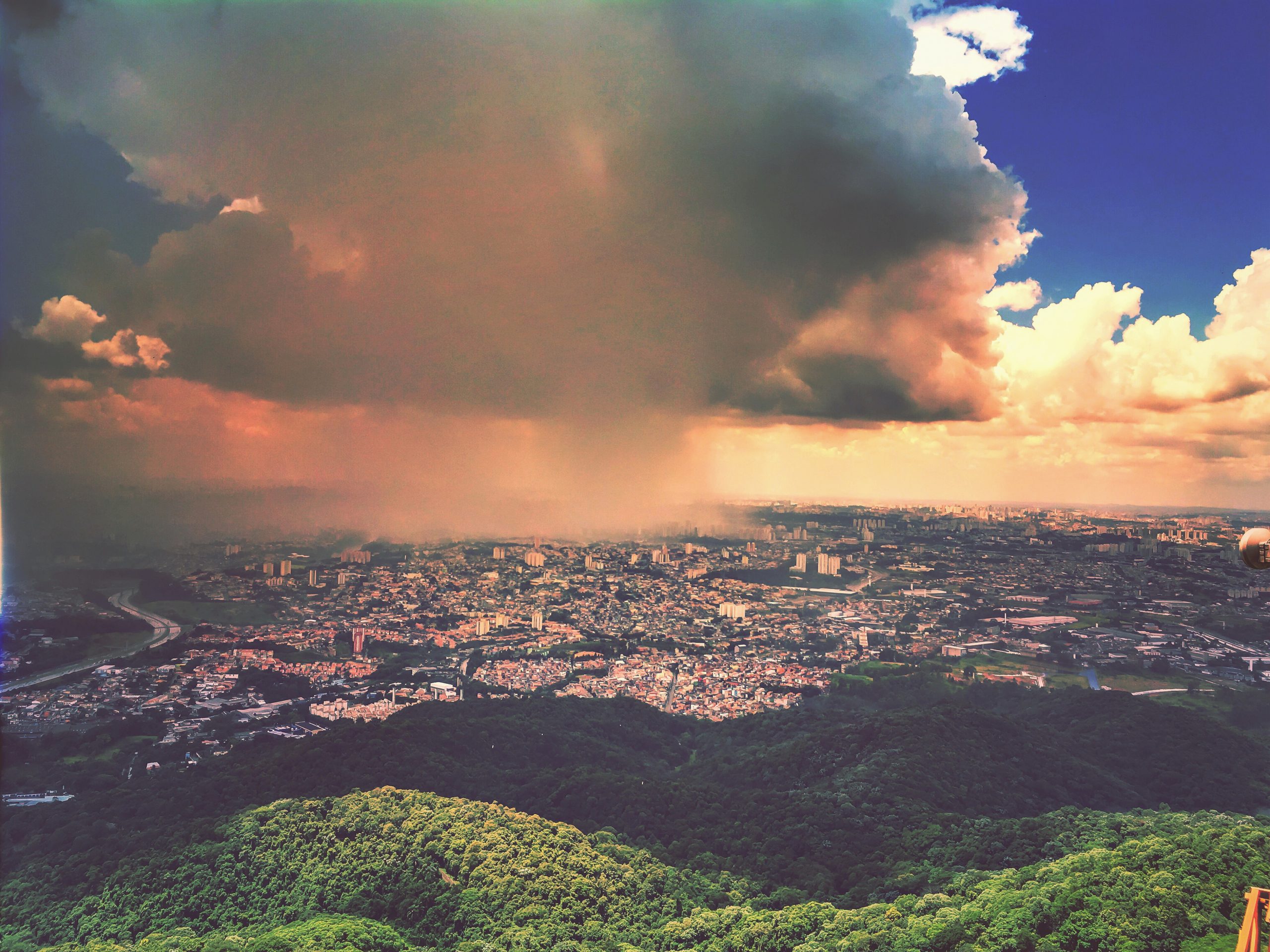
- The Amazon Basin. Most of the Amazon Basin is wet year-round, largely because it is right along the equator, the home of the ITCZ. Rainfall is heavy in all months. This is why the Amazon River is world’s biggest river (It’s not the world’s longest river – that distinction belongs to the Nile – but it does carry more water than any other river on earth, and by a very wide margin).
- The Caribbean Side of Central America. The northeast trade winds that arrive in this area blow across the Caribbean Sea, and those warm air mass pick up enormous amounts of water vapor year-round.
- Southeastern Brazil, Paraguay, northeastern Argentina, and Uruguay. The southeast trade winds bring plenty of moisture off the Atlantic and drop it in the midlatitudes of South America.
- Southern Chile. Here, the westerlies consistently bring moisture in off the Pacific Ocean.
- Places that have wet summers and dry winters:
- Southern Venezuela and Southwestern Brazil. As mentioned above, the ITCZ shifts north from the equator in June, July, and August, and shifts south of the equator in December, January, and February. This means it arrives in southern Venezuela during its summer, bringing lots of rainfall. The ITCZ then arrives in southwestern Brazil during its summer (keep in mind, summer in the southern hemisphere happens six months after it does in the northern hemisphere).
- Southern Mexico and the Pacific Side of Central America: The main source of moisture at this latitude are the trade winds, which are blocked in a rain shadow effect by the mountains of southern Mexico and Central America. Still, the heating of the earth in the summertime causes air to rise off the land, causing low pressure at the surface. This draws moist air masses in off the Pacific Ocean, generating summertime precipitation. It’s a sort of miniature version of the monsoons that bring rain to India in the summer.
- Places that have dry summers and wet winters:
- Central Chile. This area has a Mediterranean climate, just like California and southern Europe. In the summer, the subtropical high over northern Chile shifts south over central Chile, causing dry conditions. In the winter, the subtropical high shifts north, as do the westerlies, which bring moisture in off the Pacific, causing wet conditions.
- Places that are dry year-round:
- Northern Mexico. Just like the southwestern U.S., the near constant presence of high pressure keeps this region dry most of the year.
- Northern Central Venezuela. The Andes Mountains generally run north-south, but they curve east-west in northern Venezuela. As the trade winds blow in off the Caribbean, they dump moisture on the northern side of those mountains, but there is a small rain shadow effect on the southern side.
- The Patagonia: Southern Argentina lies in the westerlies, but it is also east of the Andes, so the Patagonia falls in a rain shadow of those mountains.
-
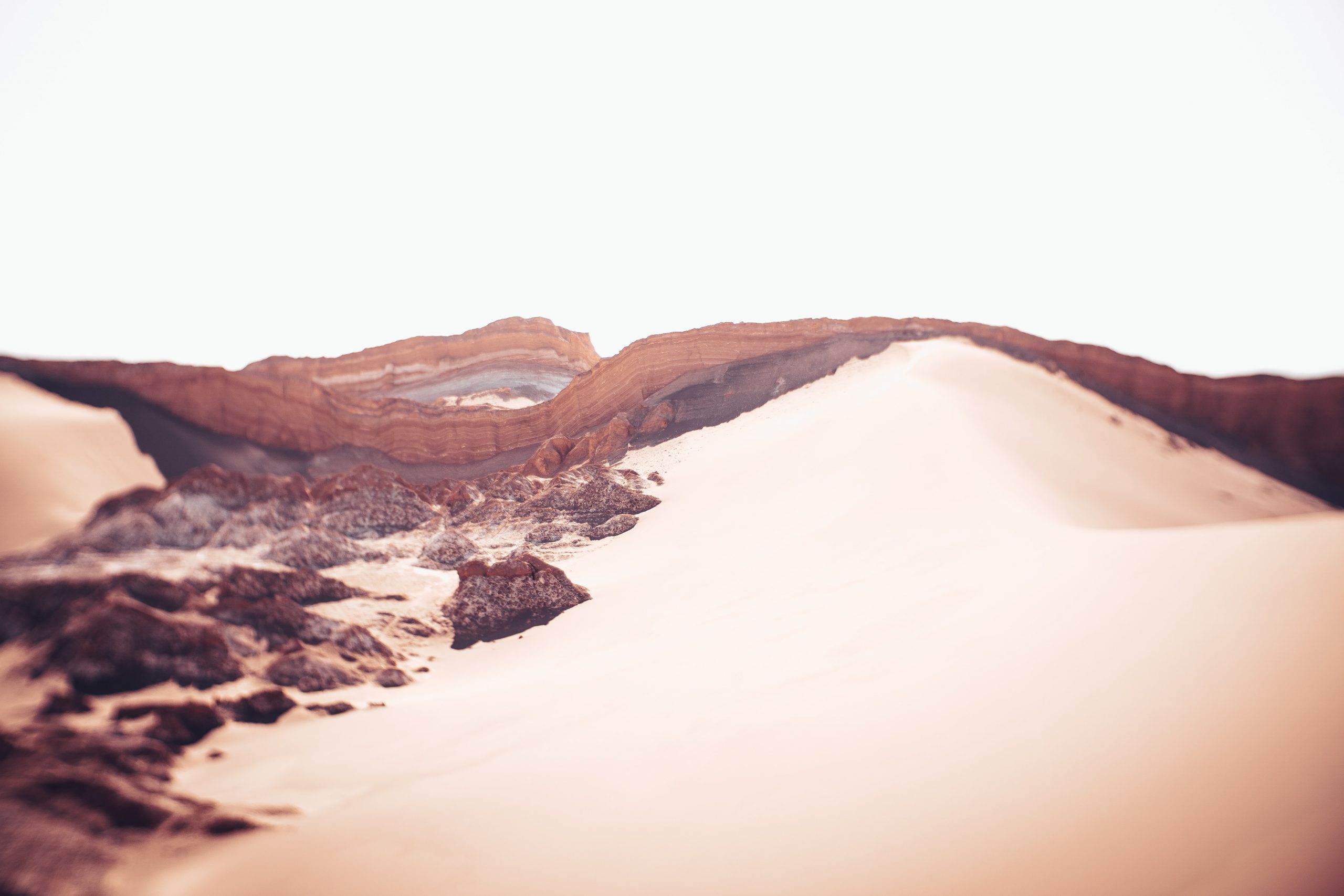
The Atacama Desert: The Atacama Desert of northern Chile is the world’s driest place. Weather stations in the Atacama have sometimes gone multiple years without recording a single drop of precipitation. Some parts of this desert are so dry that bacteria don’t even live there. There are three major causes of deserts around the world – subtropical highs, rain shadows, and cold coasts – and the Atacama Desert, remarkably, is caused by all three. It is under a subtropical high year-round, which would make it dry anyway. One potential source for moisture is from the trade winds coming in from the Atlantic, but the Atacama is in a rain shadow of the Andes Mountains. The only other potential source of moisture is the Pacific, but the waters off the coast of Chile are extremely cold, the result of the Peru Current, which runs from Antarctica and up the coast of South America. That cold water chills the breezes that flow off the ocean, and that cold air cannot contain much water vapor.
Complicating matters is an unusual weather phenomenon known as El Niño. As mentioned above, the waters off the Pacific Coast of Latin America are usually quite cold, causing the coastal areas to be relatively dry. Every two to seven years, however, a temperature inversion occurs in the eastern Pacific, causing the waters off the coast of Latin America to become unusually warm. This warm water heats up the air that passes over it, allowing those air masses to absorb large volumes of water vapor. The result is several months of unusually wet weather. Under particularly severe El Niño conditions, much of Pacific Latin America suffers flooding and mudslides. Usually, El Niño events begin in the late months of a year, and then last through the following year’s spring and summer. The last major El Niño event occurred in 2015-2016.
Did You Know?
Cited and additional bibliography:
Croffi, Rafael Vianna. 2016. Chuva Em São Paulo. https://tinyurl.com/rainySaoP. Attribution 2.0 Generic (CC BY 2.0).
