71 Latin America and the Caribbean (LACAR): Physical Geography I – Altitudinal Zonation
In Latin America’s lowlands, temperature patterns are relatively simple. Most of the region falls in the tropics and subtropics. The Tropic of Cancer (23.5˚N) cuts across the heart of Mexico, and the Tropic of Capricorn (23.5˚S) runs just south of Rio de Janeiro, in southern Brazil. That means that southern Mexico, Central America, and the northern three-quarters of South America all fall within the tropics. Temperature varies little from month to month in the tropics, so these locations experience warm temperatures year-round (at least at low elevations).
The lowland areas of Latin America outside the tropics are pretty warm, too. All of Mexico is farther south than Dallas, Texas, meaning that even the midlatitudes of lowland northern Mexico rarely get cold. Montevideo, Uruguay – the southernmost major metropolis in Latin America – is at 34˚S latitude, about the same distance from the equator as Atlanta, Georgia, which isn’t exactly a cold place.
The only low elevations in Latin America that truly get cold are the southern sections of Chile and Argentina, where few people live. Cape Horn, the southern tip of South America, is located at 56˚S latitude, approximately the same distance from the South Pole as Moscow is from the North Pole.
It’s in Latin America’s highlands where temperature patterns become more complex, and this is a region with plenty of highland areas.
Imagine you’re standing in a mountain valley, at 3,500 feet above sea level. You look up at the top of a mountain that is 14,000 feet above sea level. If it’s 67˚F where you are, at the top of the mountain, it will be about 29˚F. That’s why some very tall mountains maintain their snowcaps in the summer – those high elevations rarely get above freezing. This is because of something called the environmental lapse rate– temperatures tend to drop about 3.6˚F for every 1,000 feet gained in elevation.
The lapse rate is not a daily concern for most Americans. The elevations of many large U.S. cities, like New York (33 feet), Los Angeles (285 feet), Chicago (597 feet), Philadelphia (39 feet), and Dallas (430 feet), are unlikely to give anyone altitude sickness. There are, of course, a few major American cities at high elevations. The highest mid-sized American city is Santa Fe, New Mexico, which is located at 7,199 feet above sea level. The highest major American city is Denver – the famously “mile high” city is located at 5,280 feet.
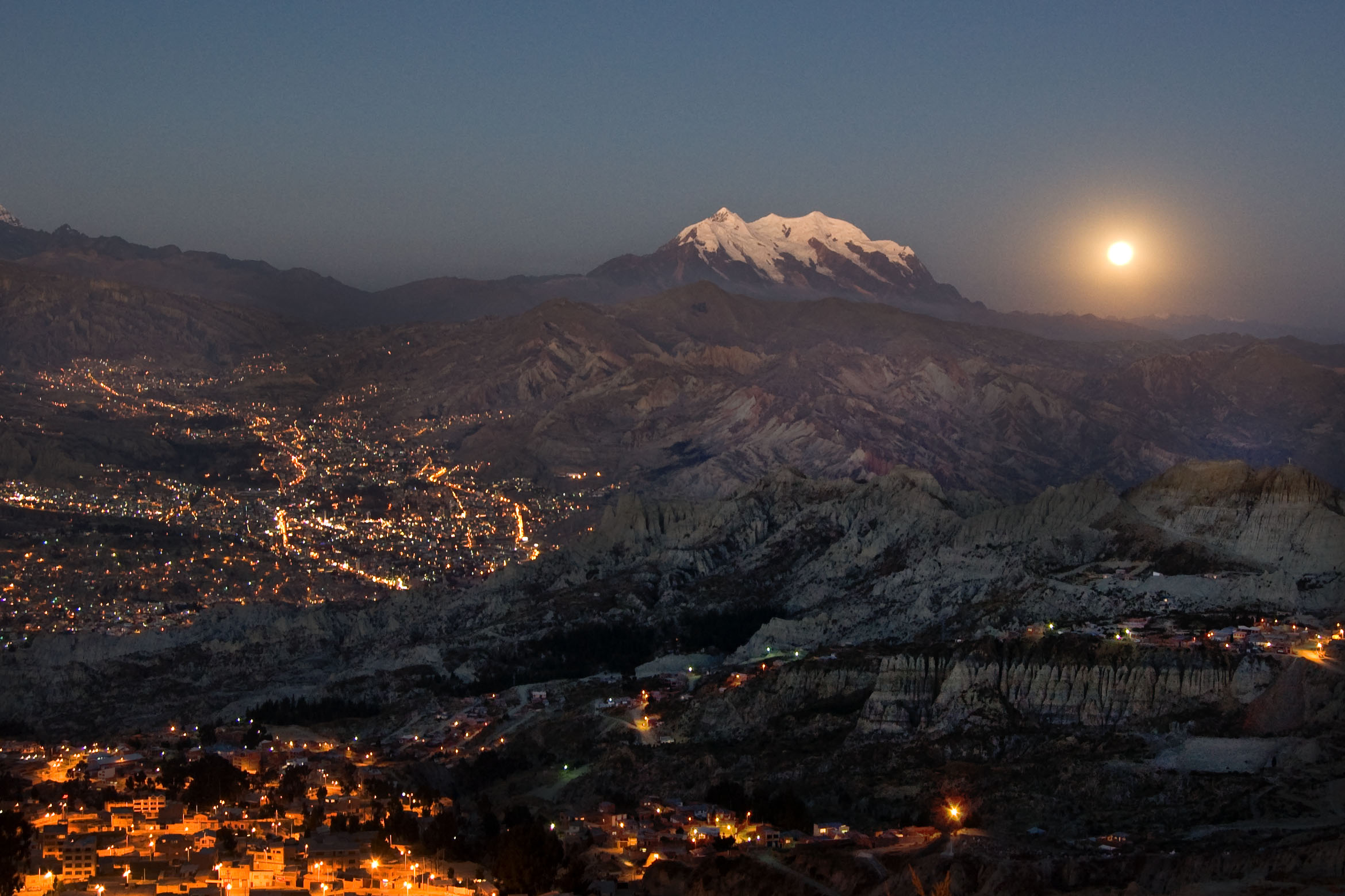
Denver’s elevation is modest by the standards of many Latin American cities. La Paz, the capital city of Bolivia, checks in at a stunning 11,975 feet. Many other major Latin American cities are located at very high altitudes as well, including Quito, Peru (9,350 feet), Bogota, Colombia (8,660 feet), and Mexico City (7,382 feet).
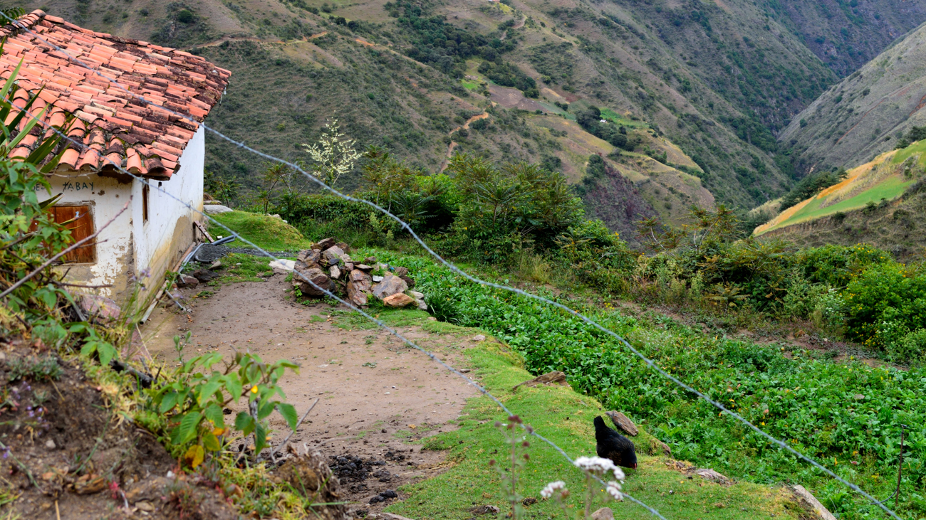
Photo by Smallest Forest on Flickr.
So, for many Latin Americans, altitude has just as much influence on local temperature as latitude. Altitudinal zonation is the examination of how geographic traits change from lower elevations to higher elevations. As temperature drops, other things change as well, such as economic patterns, population patterns, and even ethnic patterns. Traditionally, geographers have divided tropical Latin America up into four temperature-altitude zones: the tierra caliente, the tierra templada, the tierra fria, and the tierra helada.
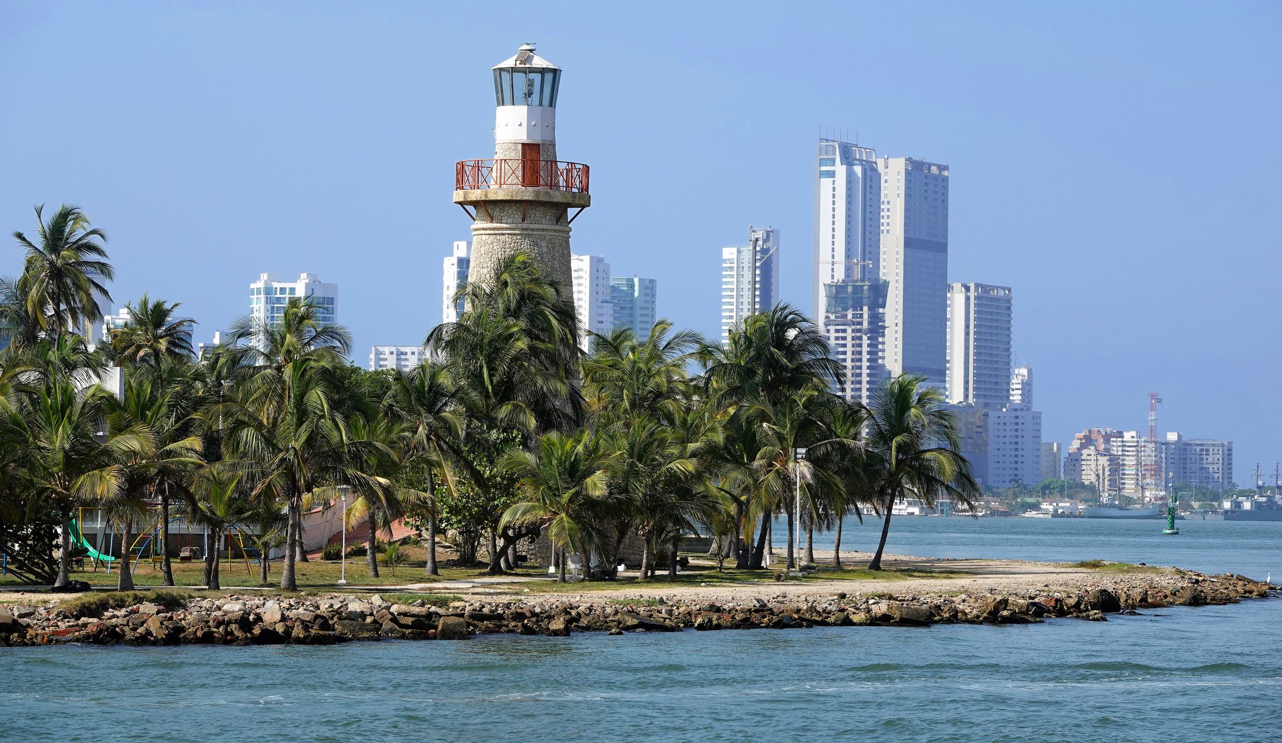
The tierra caliente, or “hot lands,” are located from sea level up to 3,000 feet. Temperatures in this zone tend to be quite hot. Population densities are high near major seaports like Cartagena (seen to the left) and Guayaquil, or near inland ports like Manaus on the Amazon River. Population densities also tend to be high in zones of plantation agriculture, which are typically located along the floodplains of major rivers. Hot-weather crops, like bananas and sugar cane, thrive at these elevations in the tropics.
Elsewhere, population densities of the tierra caliente tend to be relatively low. The economy often focuses on industries like logging and mining, which don’t lend themselves to large, permanent populations. Another factor limiting population density is Latin America’s tropical lowlands is disease. Disease vectors, like mosquitoes, tend to breed prolifically in flat, hot, wet environments.
The primary reason for the low population density in Latin America’s tropical lowlands, however, is poor soil. Much of the tierra caliente is either very wet or very dry, and all of it is hot. Hot, dry environments contain relatively little vegetation, and thus the soils tend to lack organic material, making them infertile. Hot, wet environments also tend to have poor soils.
Looking at a tropical rainforest, an ecosystem that features a superabundance of organisms, one might assume that such an environment would lend itself to robust agriculture. That’s not the case. In hot, wet environments, organic material decays very rapidly. Littering the floor of rainforests is layer of humus – rapidly decaying organic material supplied by the forest. The trees – the foundation of the rainforest ecosystem – rapidly “recycle” the organic material through their root systems. To farm the land, these trees must be removed so that sunlight can reach the crops. Once the trees are cut and burned, the ash and humus provide extremely fertile farmland for a few years. But the forest that provided the source of that fertility – the ash and humus – has been removed. The near-constant rainfall then leaches the nutrients out of the soil, and the land rapidly becomes unproductive. So, agriculture is possible in areas that have been cleared of rainforests, but that agriculture will not be permanent, leading to low population densities.
There is also a distinct ethnic pattern in the tierra caliente. The area features relatively few people of Native American ancestry. When the first Europeans arrived, the densest concentration of Native Americans was in Latin America’s highlands, so populations were already relatively low in the tierra caliente. Those Native Americans who did live at low elevations were quickly subjugated and displaced by the European colonizers, and many died in the process. There are quite a few people of European ancestry in Latin America’s tropical lowlands, particularly in the major cities, but the most distinctive ethnic trait of tierra caliente is the dense concentration of people of African ancestry. This is the legacy of slave labor on tierra caliente plantations. In Brazil, which accounts for much of South America’s tierra caliente, about half the population is of at least partial African ancestry. In mountainous Bolivia, which accounts for very little of South America’s tierra caliente, only about 1% of the population is of African ancestry.
The tierra templada, or “temperate lands,” are located between 3,000 and 6,500 feet. Temperatures in the tierra templada average about 14˚F cooler than those at sea level. If it’s 90˚F on the coast, a city in the tierra templada would be a far more comfortable 76˚F. Because temperatures vary little from month to month in the tropics, this zone enjoys mild temperatures year-round – the climate has been described as “eternal spring.” The pre-Columbian natives, and the Europeans who followed, both found this to be a far more salubrious environment than the sweltering tierra caliente, so population densities in this zone have always been quite high.
The tierra templada is an agriculturally productive region, partly because of fertile volcanic soils. At this elevation, the hot-weather crops associated with tierra caliente don’t grow well, so much of the agriculture is dedicated to domestic food crops like corn. There are some plantations in the tierra templada, and most of them are dedicated to the production of coffee, a crop that grows well in the cooler air of this zone. That said, plantations are less common in the tierra templada, and thus so was slavery. There are fewer people of African ancestry here than in the tierra caliente. Most people of this region are descended from the two groups who heavily settled this zone over the centuries – they are largely of European ancestry, Native American ancestry, or a mixture of the two.
The tierra fria, or “cool lands,” are located between 6,500 and 12,000 feet. Temperatures in the tierra fria will average about 33˚F cooler than those at sea level. If it’s 90˚F on the coast, a city in the tierra templada would be a much cooler 57˚F. In the tierra fria, agriculture mainly revolves around animal grazing and crops that tolerate cool weather, like wheat. Population density is generally lower in this zone than in the tierra templada, although, as mentioned above, there are some very large cities here, including Mexico City, Quito, La Paz, and Bogota.
The ethnic pattern is still largely a mix of European and Native American ancestry, but in the highest elevations of this zone, the ethnic mix tilts largely toward Native Americans. As elevations increase in the tierra fria, temperatures drop and the air gets thin, so the land becomes less desirable. As discussed previously, Europeans were the beneficiaries of colonization, and Native Americans were the victims. So, Native Americans was often displaced to the least desirable locations during the conquest, including those places at high elevations.
The tierra helada, or “frozen lands,” are located between 12,000 and 22,000 feet. Temperatures in the tierra fria will average about 61˚F cooler than those at sea level. If it’s 90˚F on the coast, a location in the tierra templada would be a frigid 29˚F. That is why, remarkably, glaciers exist right at the equator in the Andes. The economy in this zone is largely limited to mining and occasional grazing or grain cultivation at its lowest elevations, but population densities tend to be very low. The few scattered communities of the tierra helada tend to be almost exclusively Native American.
Did You Know?
Cited and additional bibliography:
Donaho, Jerry and Pat. 2019. Cartegena, Colombia. https://tinyurl.com/CartagenaC. Attribution-NonCommercial-NoDerivs 2.0 Generic (CC BY-NC-ND 2.0).
Durán, Guillermo A. 2006. La Paz, Bolivia. https://tinyurl.com/lapazbo. Attribution-NonCommercial-NoDerivs 2.0 Generic (CC BY-NC-ND 2.0).
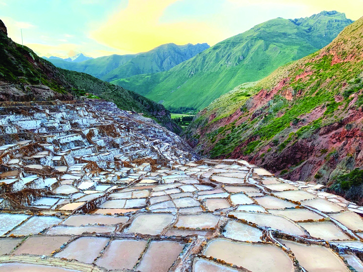
Lao, Amy. 2020. Salineras de Maras, Maras, Peru. St. Olaf College, Class of 2020.
Smallest Forest. 2015. The Andes. https://tinyurl.com/andesv. Attribution-NonCommercial 2.0 Generic (CC BY-NC 2.0).
