12 Pacific Realm: Regional Example – Melanesia
Regional geography studies the people and places of a cohesive region. A “region” is defined to be an area with multiple shared characteristics over a range of categories, including both physical and human geographic characteristics. The secret of creating a region, which is a human construct not a naturally begotten unit, is to cluster together as many similarities as possible, while excluding geographic differences.
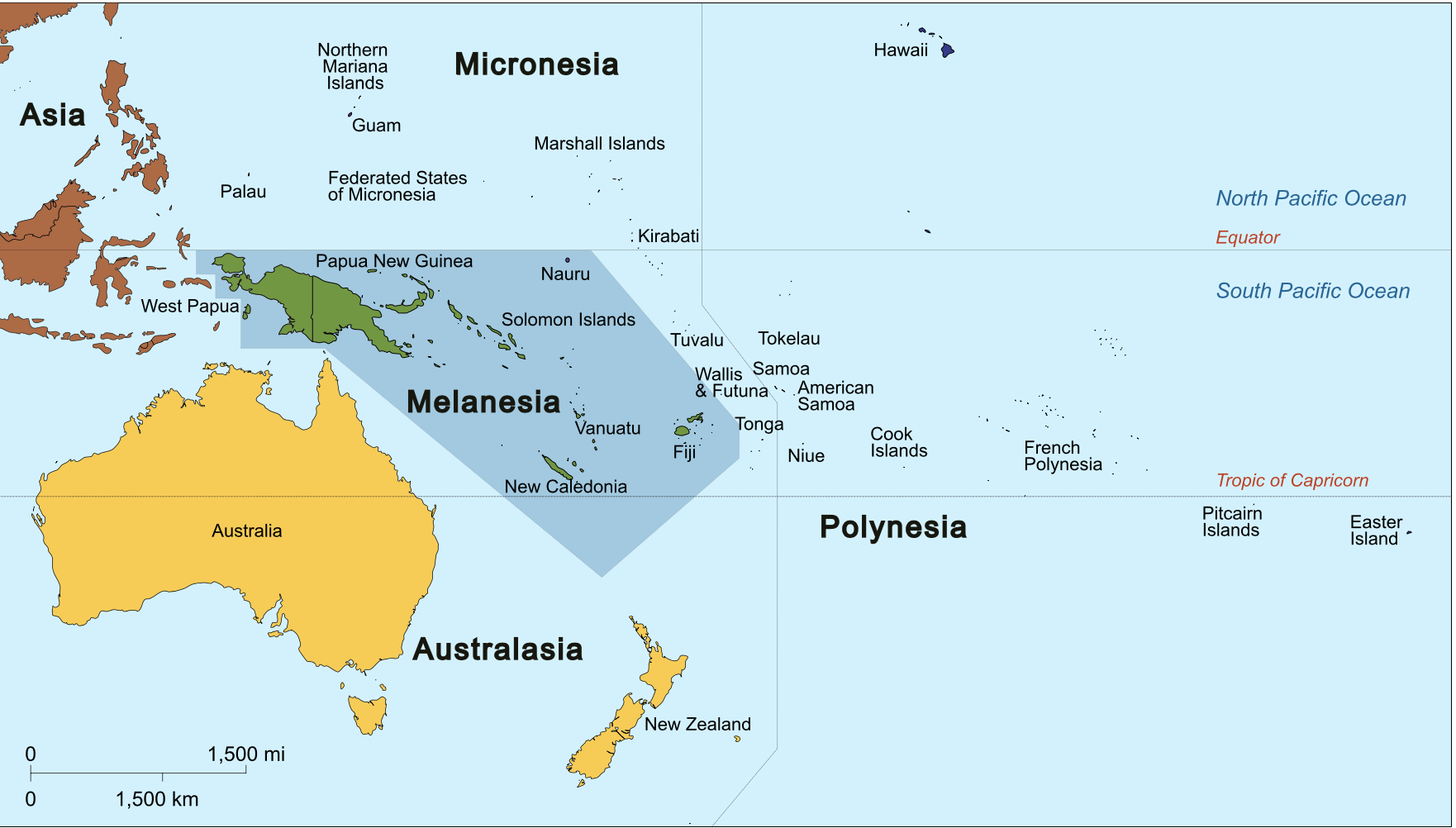
So, what is Melanesia? The Pacific Realm includes Australia, New Zealand, and many other islands. Most of those other islands are quite small, with a noteworthy exception of New Guinea. However, only the eastern half (a bit more than 50% of the land) of the island New Guinea is in the Pacific Realm. The western portion is the Indonesian region of Irian Jaya. Melanesia has some of the largest lands among the Pacific Islands, not counting Australia (continent) and New Zealand (separate). The country Papua New Guinea, the eastern side of the island New Guinea, is larger than all of New Zealand and bigger than any other Pacific island. Melanesia as a whole totals one million square kilometers of land area. Of the remaining islands of the Pacific Realm, Melanesia does have most of the largest islands. New Caledonia, the Solomon Islands, Fiji, and Vanuatu are substantial; each is larger than the big island of Hawaii (Polynesia). Tonga is similarly sized, a bit smaller, more like Oahu in Hawaii, but usually is considered as part of Polynesia, though some maps place it in Melanesia.
Nevertheless, the main reason for naming Melanesia as a sub-region of the Pacific Realm is not land size. An examination of the landscapes of Melanesian islands shows mountainous regions with thick tropical forests.
- Fiji – Mt. Tomanivi – 4341 feet in elevation
- New Caledonia – Mont Panie – 5344 feet
- Papua New Guinea – Mount Wilhelm – 14793 feet
- New Ireland (separate island of Papua New Guinea) – Mt. Taron – 7805
- Solomon Islands – Mount Popomanaseu – 7651 feet
- Vanuatu – Mount Tabwemasana – 6165 feet.
Papua New Guinea features long stretches of mountains, along with extensive valleys between them. The prominent islands of Melanesia are not the low coral islands that are common elsewhere in the Pacific Ocean. As geographers understand that the physical landscape affects, but does not determine, human behavior, certainly the landscapes of Melanesian islands influenced the cultures of Melanesia. Perhaps the naming of Melanesia was a bit prompted by the darkness of forested mountains.
In Greek language, “melan” or “mela” means dark or black, while “nesia” refers to islands. So, Melanesia refers to the dark or black islands. Again, this might have some reference to the physical landscape; however, predominantly the natives of these islands possess very dark skin and hair. Thus, the understood connection of the place name is with the physical appearance of the native peoples. Of course, skin tone does not suggest a single culture. Instead, the cultures of Melanesia are diverse and numerous. One of the most striking features of Melanesia is the vast number of different languages spoken there. Papua New Guinea alone holds over 800 different languages, causing it to be Earth’s most linguistically diverse location. Perhaps an ideal setting for use of a lingua franca, Papua New Guinea has Tok Pisin, an English-based Creole language, as its most common tongue. Certainly, the diversity of language there is related to the mountainous physical barriers that separated valley or coastal peoples from other valley or coastal peoples. Historically and without modern transportation and communication, that separation over centuries caused languages to develop and evolve independently of one another. The relative isolation of the Pacific Realm, in particular in regard to European exploration and settlement, led to belated understanding and discovery of the peoples of Papua New Guinea. Basically, it was an unknown land until 1840.
In sum, Melanesia is composed of relatively large islands north of Australia. Commonly, these islands are mountainous. The separation of these mainly dark-skinned natives historically created a plethora of languages and cultures.
Did You Know?
Given that “nesia” refers to islands, for the other macro-level island groups of the Pacific, “Micronesia” means the “small islands,” while “Polynesia” means “many islands.”
One of the key locations for observation and analysis in the bestselling “Guns, Germs, and Steel” by Jared Diamond is Papua New Guinea.
Where would Germany rank among colonial powers? Certainly (not in ranked order) behind Britain, France, Spain, Portugal, and the Netherlands. Nevertheless, by 1884 Germany did share New Guinea as colonial territory with Britain. Germany lost that territory due World War I, but some of the effects of those years of control still remain today. Germany’s Lutheran missionary work was successful, so that today the Evangelical Lutheran Church of Papua New Guinea holds nearly a million baptized members, cited as 18% of the citizen population of the country, second only to Catholicism.
Cited and additional bibliography:
Cruickshanks. 2014. “Melanesia.” Wikipedia. https://commons.wikimedia.org/wiki/File:Oceania_UN_Geoscheme_-_Map_of_Melanesia.svg. Creative Commons Attribution-Share Alike 3.0 Unported.
