67 Latin America and the Caribbean: Regional Example –
Netherland Antilles
Regional geography studies the people and places of a cohesive region. A “region” is defined to be an area with multiple shared characteristics over a range of categories, including both physical and human geographic characteristics. The secret of creating a region, which is a human construct not a naturally begotten unit, is to cluster together as many similarities as possible, while excluding geographic differences.
In Latin America and the Caribbean (LACAR), the Netherlands Antilles has been one of the sub-regions. Its definition also follows the methodology of regional geography. It turns out that this is a complicated question. In addition to the question of region, consideration of the Netherlands Antilles is made more complex by its colonial history and politics.
First of all, Caribbean islands are divided into two regions – the Great Antilles and the Lesser Antilles, as based on area (though population is correlated to area). Then within the many islands of the Lesser Antilles, there are several that have a colonial history and a current affiliation with the Netherlands. This sub-region was the Netherlands Antilles.
Additionally, Americans forget that the Dutch, who are the people of the Netherlands, were significant explorers, traders, and colonizers. Americans surely recognize the exploration, trade, and colonization done by the British, the French, and the Spanish. Perhaps noting that Brazilians speak Portuguese, Americans may observe that the Portuguese were big in these fields as well (in Africa and elsewhere too). Many Americans do not know or forget that before New York was part of the British colonies of America, New York was a Dutch colony named New Amsterdam. In fact, the Dutch sailed to many corners of the world – naming New Zealand, developing the city Batavia (that is now the capital city Jakarta in Indonesia), taking islands in the Caribbean, and more. Thus, it is that many people are unaware of the Dutch presence in the Caribbean.
The Dutch came to the Caribbean Sea and to the nearby mainland of South America where they also secured the territories cited as the Dutch Guianas. Eventually, the Netherlands lost some of these lands to the British, retaining only Suriname that much later became an independent country in 1975.
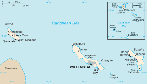
The set of islands of the Netherlands Antilles progressively changed political status in relationship with the Netherlands. OK, this set of islands consisted of Aruba, Bonaire, and Curaçao (the so-called ABC islands), as well as Sint Maarten, Saba, and Sint Eustatius. (Sintis the Dutch word for Saint.) The island St. Maarten is shared with the French and also known as St. Martin. Let’s call these the 3S islands. The Dutch briefly held a few other islands, like Tobago, but lost control, mainly to the British.

These two groups of three islands are clustered together but not adjacent to the other. This presents one of the problems of maintaining the Netherlands Antilles. The two groups are over 600 miles apart. (Though in a much smaller way, this separation is reminiscent of the spatial gap between West Pakistan and East Pakistan before they became Pakistan and Bangladesh respectively.)
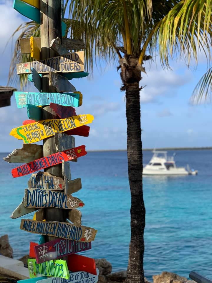
The ABC islands sit off the coast of South America. In fact, Aruba is only nine miles from the Venezuelan Paraguana Peninsula. These islands naturally pick up some of the elements of South American culture. Bonaire is a mecca for scuba divers, as its waters have 85 dive sites and 350 fish species. Diving 24/7/365.
The 3S islands are located on the northern end of the Lesser Antilles, near islands bearing English and French colonial histories.
While the ABC islands are only of modest size, the 3S islands are tiny.
Small Caribbean Islands
| Island | Square Miles | Population |
|---|---|---|
| in thousands | ||
| ABC | ||
| Aruba | 69 | 105 |
| Bonaire | 113 | 19 |
| Curaao | 171 | 161 |
| 3 S | ||
| Saba | 5 | 2 |
| St. Eustatius | 8 | 3 |
| St. Maarten* | 13 | 41 |
| * Dutch half only |
For at least these two reasons, it is a bit awkward to place these six islands together as a sub-region. The next challenge is that Aruba and Curaçao have large enough populations to consider independence. As many colonies around the world and from various colonial empires sought independence, especially in the 1960s, it is reasonable that Aruba and Curaçao would examine this choice too.
Aruba was the first to go. Although the issue of independence was broached in the 1930s, a local referendum on the issue did not take place until 1977. After several years of consideration, Aruba reached a deal with the Netherlands that in 1986 Aruba would achieve the status of a country within the Kingdom of the Netherlands. This is a curious designation with some similarities to the British Commonwealth. The original agreement held the condition that Aruba would become a fully independent country in 1996, but this provision later was eliminated.
Noting that Curaçao is bigger than Aruba both in area and in population, it is understandable that Curaçao also would consider its options. However, in 1993 an island referendum resulted in declining both options that Aruba had taken. In 2005, in a new referendum, islanders voted to have Curaçao gain the status of country within the Kingdom.
As the third most populated of these Dutch islands, St. Maarten too sought the designation of country within the Kingdom. Negotiations amid all six islands and the Dutch kingdom persisted until in 2010 constitutional changes were made official. The current situation remains the same as that final agreement. As made in the official statement of the Dutch Ministry of Foreign Affairs:
“The Kingdom of the Netherlands consists of four autonomous countries: the Netherlands, Aruba, Curaçao and St Maarten. The latter three are located in the Caribbean. The country of the Netherlands consists of a territory in Europe and the islands of Bonaire, Saba and St Eustatius in the Caribbean. The Kingdom of the Netherlands therefore has a European part and a Caribbean part.”1
It is a complex settlement that seems to be working adequately. There are odd circumstances that remain. Bonaire, Saba and St. Eustatius all use the American dollar as their currency, instead of the Euro. Aruba has its own Aruban florin for currency, while Curaçao and St. Maarten use the Netherlands Antillean guilder. Rights within the European Union for all six islands and their residents is still another story.
Overall then, the Netherlands Antilles is no more, though the term often is used popularly to describe the subset of the Lesser Antilles.
Did You Know?
Cited and additional bibliography:
1 Zaken, Ministerie van Algemene. 2013. “Information from the Government of The Netherlands – Government.Nl.” Www.Government.Nl. May 14, 2013. https://www.government.nl.
Neufeld, Dorothy. 2020. “Visualizing the Countries Most Reliant on Tourism.” Visual Capitalist. May 22, 2020. https://www.visualcapitalist.com/countries-reliant-tourism/.
Passov, Sara. 2019. Buddy Dive Resort in Bonaire.
Sparks, Chad. 2015. St. Maarten Island. https://tinyurl.com/stmaa. Attribution 2.0 Generic (CC BY 2.0).
