24 Pacific Realm: Political Geography II – Micronesia

What do doctors call it when someone has a little bit of memory problems? Micronesia!
Ok, that was a pathetic joke. However, micro does mean small, appropriately so for a set of islands in the Pacific Ocean.
Micronesia is a set of quite small islands within our region, the Pacific Realm. There are eight countries/territories in Micronesia, roughly located north of Melanesia (Chapter 13). One of the territories is called the Federated States of Micronesia. Links to the United States are common.
“Good things come in small packages.” “Small is beautiful.” There are some well-known proverbs that suggest that small can be a fine thing. “The bigger they come, the harder they fall.” Yes, there are sayings that suggest that bigger isn’t necessarily better. Nevertheless, being a tiny island country/territory doesn’t have a lot of advantages. Sometimes you get lucky. Read about the rise and fall of tiny Nauru in Chapter 21.
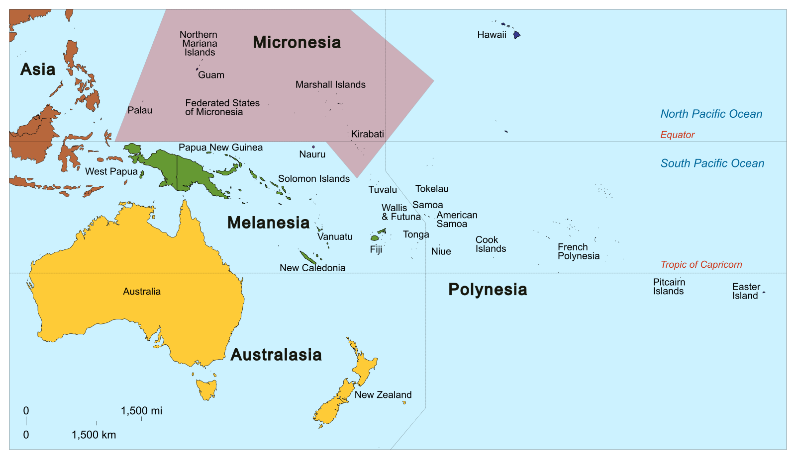
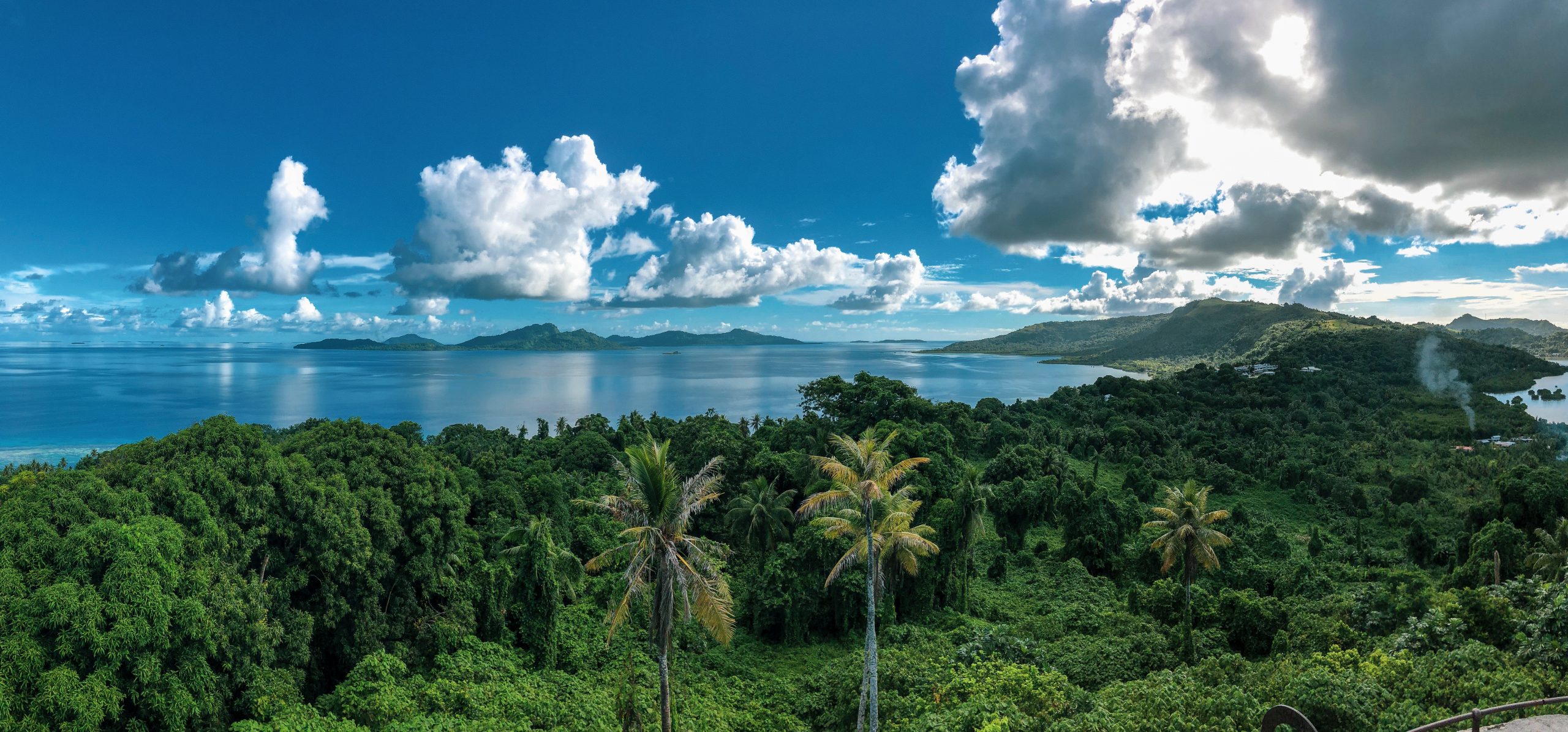
Wouldn’t it make sense for tiny islands to work cooperatively together? That is the approach taken by the Federated States of Micronesia (FSM). These islands are centered in the archipelago of the Caroline Islands. The 607 islands that comprise FSM are grouped into four sets – Yap, Chuuk, Ponhpei, and Kosrae. It is likely that fewer than 1% of people of the world have ever heard of those four island names. Again, tiny. In fact, the whole Federated States of Micronesia includes only 270.8 square miles of land. The area of the city of Chicago is 234 square miles. The average size island, measured by the mathematical mean, is about half a square mile. In contrast, FSM includes over one million square miles of ocean. That ocean surface area is about the same size as the land area of Alaska, Texas, and Wisconsin combined.
As an individual island, any of these dots of land would struggle, so it is logical to work cooperatively together politically and economically. The national government is based on Pohnpei. Historically, Spain, Germany, and Japan held territory among these islands, but after World War II, the United Nations established the Trust Territories of the Pacific Islands (TTPI). That trust included the island sets now in FSM, as well as the Marshall Islands, Palau, and the Northern Mariana Islands. In 1978 referendum, residents voted to create the Federated States of Micronesia, so that this union was formed the following year. Largely due to the American presence, English is the official language, though there are eight major indigenous languages spoken there too.
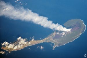
NASA Earth Observatory.
Politically, the Northern Mariana Islands were part of the TTPI, but did not join the FSM. Instead, they formed a commonwealth under the jurisdiction of an American territory. Only 22 islands as compared to the 607 of the Federated States of Micronesia, these islands are somewhat larger, totaling 464 square miles. Ninety percent of the commonwealth’s 50,000 people live on the island of Saipan.
In 1979, the Marshall Islands gained independence, but in 1986 established a free association with the United States, whereby the US provides defense and other services. The Federated States of Micronesia have the same connection with America.
In 1994 out of the TTPI, Palau secured its status as an independent country, but like the Marshall Islands, for its benefit in political and economic terms, it created a free association with the United States.
Guam is the largest island in Micronesia. It was a Spanish territory that was ceded to the United States in 1899.
Kiribati has a somewhat different colonial history, being British subjects until independence in 1979. Maintaining its connection with the United Kingdom, Kiribati is a member of the Commonwealth of Nations. Nauru (Chapter 21) too is in the Commonwealth of Nations.
Eight of the United State Minor Outlying Islands complete the set of islands in Micronesia. These are:
- Baker Island,
- Howland Island,
- Jarvis Island,
- Johnson Atoll,
- Kingman Reef,
- Midway Atoll,
- Palmyra Atoll (the largest at 4.6 square miles),
- Wake Island.
The islands have no permanent residents and are grouped together for statistical convenience. (In the Caribbean Sea, Navassa Island, Bajo Nuevo Bank, and Serranilla Bank complete the list of the United State Minor Outlying Islands.)
Overall, the islands of Micronesia are too small to be successful economically and politically alone. Thus, all of these islands maintain broader connections. The Federated States of Micronesia chose to agglomerate, melding over 600 islands into one federation, while also linking with the United States. Palau and Guam have similar associations with America, while Kiribati and Nauru share other countries’ ties with Britain as members of the Commonwealth of Nations. Trade, tourism, and security are bolstered by these connections.
Did You Know?
Because of the International Date Line, Guam experiences dawn as the first piece of American territory to enter each new day.
One of this textbook’s authors is Professor Joel Quam, no relation to Guam.
Cited and additional bibliography:
“Commonwealth of the Northern Mariana Islands.” 2015. Www.Doi.Gov. June 11, 2015. https://www.doi.gov/oia/islands/cnmi.
Cruickshanks. 2014. “Micronesia.” Wikipedia. https://commons.wikimedia.org/wiki/File:Oceania_UN_Geoscheme_-_Map_of_Micronesia.svg. Creative Commons Attribution-Share Alike 3.0 Unported.
“Federated States of Micronesia -YAP, CHUUK, POHNPEI, KOSRAE-.” 2012. Visit-Micronesia.Fm. 2012. http://www.visit-micronesia.fm/about/index.html.
NASA Earth Observatory. 2012. Steam Plume, Northern Marianas. https://earthobservatory.nasa.gov/images/77503/pagan-island-northern-marianas.
