32 N America: Historical Geography I – Transportation and Urban Location

The history of the United States, and its current geography, have been deeply influenced by transportation, and nothing has shaped the American map more than water transportation. Water was far and away the most important means of domestic transport until the late 1800s, and is still a primary means by which products are shipped into, out of, and around the country. Because of this, water was by far the most important factor determining the location of major American cities, particularly in the eastern half of the country. More often than not, the initial economic activity that created these cities was shipping on an ocean, lake, canal, or river. Water traffic was essential to the founding of major American cities in five different regions:
- The Atlantic Coast (the East Coast): For years, most American imports and exports came into and went out of the country via the Atlantic Ocean. So, it’s not coincidental that some of the country’s most important cities evolved as major ports on the East Coast. Such cities include New York, Boston, Philadelphia, and Baltimore. For years, the American South was far less industrialized than the Northeast, so its Atlantic ports were not nearly as important. Still, many major southern cities began life as an Atlantic port, such as Miami, Norfolk, and Jacksonville.
- The Mississippi Valley (the Central Coast): As the interior of the country was opened to non-native settlement, the Mississippi River and its tributaries were the primary means of moving people and goods around the central U.S. You can think of the Mississippi Valley as being a sort of “Central Coast.” The primary Mississippi River ports were Minneapolis, St. Louis, Memphis, and New Orleans. The cities of Pittsburgh, Cincinnati, and Louisville sprang up as ports along the Ohio River (as did Nashville via the Cumberland River), and the cities of Kansas City and Omaha began as ports on the Missouri River.
- The Great Lakes (the North Coast): The Great Lakes were integral to the development of the Steel Belt, the United States’ most important manufacturing region. Several major industrial cities originated as ports on the “North Coast,” including Chicago, Detroit, Cleveland, Milwaukee, Buffalo, and Duluth.
- The Gulf Coast (the South Coast): As mentioned above, the ports of the American South were less active than those of the rest of the country early on, but over time, particularly as trade with Latin America increased, the ports of the Gulf Coast (or “South Coast”) became some of the most important cities in the region. Such cities included Houston (via Galveston Bay), Mobile, Tampa, and New Orleans (which overlapped with the Mississippi Valley).
- The Pacific Coast (the West Coast): Most of the major cities of California, Washington, and Oregon began as ports on the Pacific Ocean, including Los Angeles, San Francisco, Seattle, San Diego, Sacramento (via the Sacramento River), and Portland (via the Columbia River).
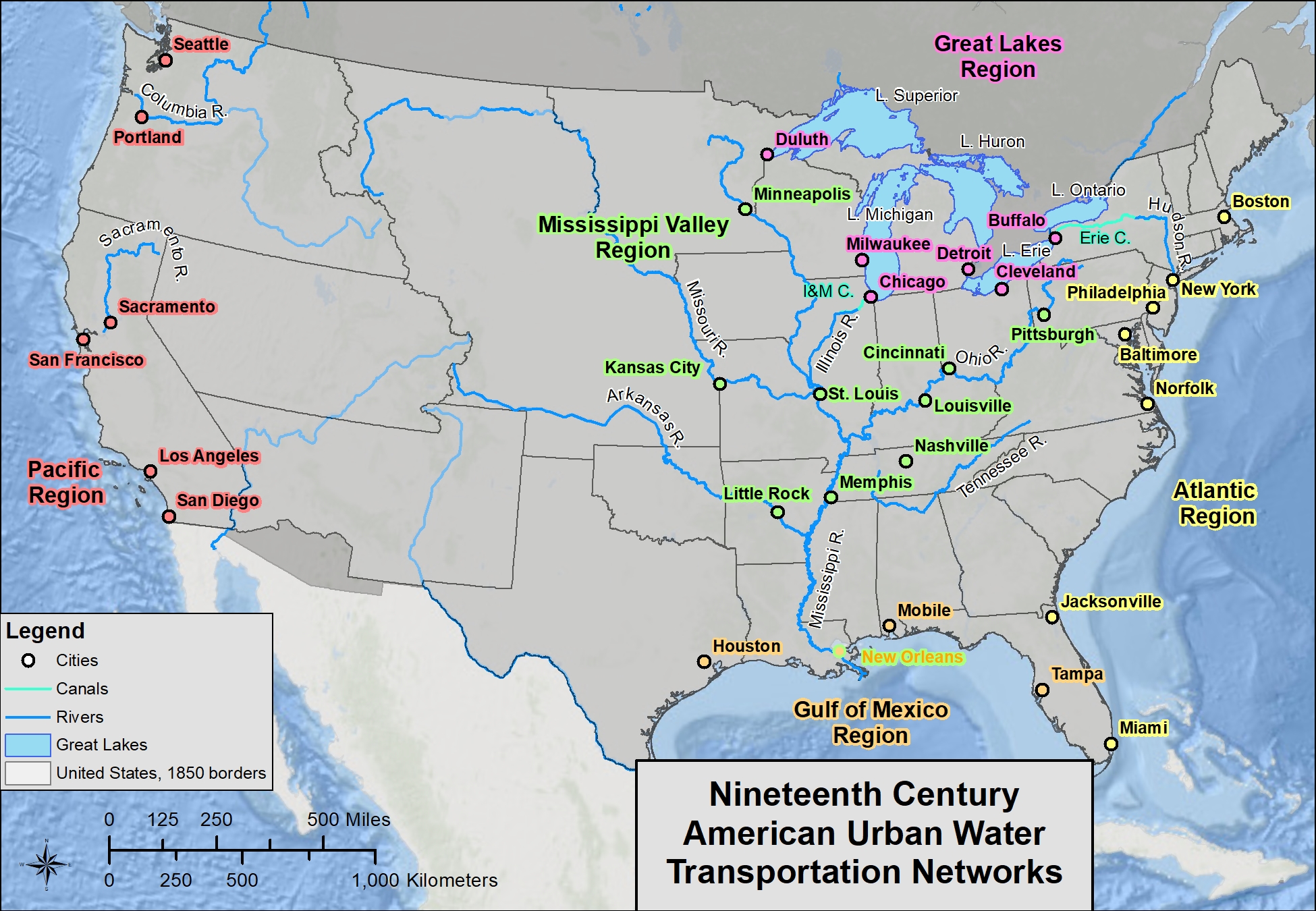
An early ambition of the United States was to link together the four “coasts” (Atlantic Coast, Mississippi Valley, Great Lakes, and Gulf Coast) in the eastern half of the country. Of course, the Atlantic is naturally connected to the Gulf, and the Gulf is naturally connected to the Mississippi River. The real trick was finding a way to link, by water passage, the Great Lakes with the rest of the country.
For Americans, the biggest geographic problem with the Great Lakes is the way they empty into the Atlantic Ocean. Even after Canada completed the Welland Canal, bypassing Niagara Falls, in 1829, it was hardly helpful for the U.S., since Canada was still a colony of Britain, and the U.S. was not yet on particularly good terms with the British. And even if they had been, Lake Ontario connects to the Atlantic via the St. Lawrence River, which enters the ocean hundreds of miles north of the United States’ major East Coast cities.
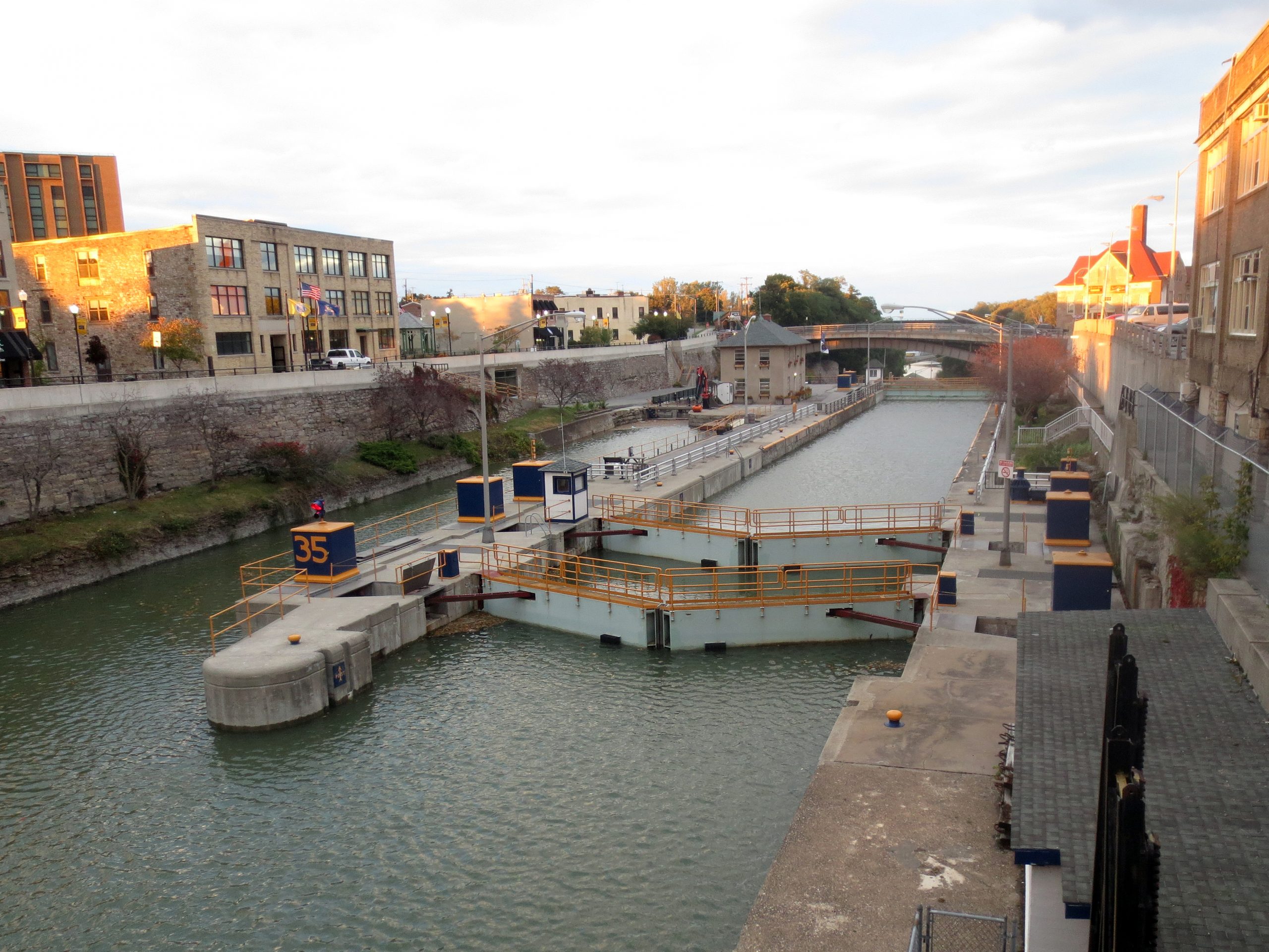
Photo by Mitch Barrie on Flickr.
So, the United States dug its own canal. Completed in 1825, the Erie Canal cuts across Upstate New York, connecting Lake Erie at Buffalo to the Hudson River at Albany. The Hudson River then flows to New York City. This shipping route finally connected the economy of the Atlantic Ocean to the economy of the Great Lakes, and is the primary reason why New York became the most important city on the East Coast.
The United States then sought to create a direct link between the Great Lakes and the Mississippi Valley. It accomplished that in 1848 with the completion of the Illinois & Michigan Canal. The I&M connected Lake Michigan at Chicago with the Illinois River at Morris. The Illinois River then flows south to the Mississippi River near St. Louis. Just as the Erie Canal cemented New York’s position as the most important city on the East Coast, the I&M cemented Chicago’s position as the most important city in the Midwest.

The second-most important form of transportation in shaping the geography of the United States was the railroad. The first practical steam locomotive was invented in the 1830s, and became an important mode of shipping in the United States around the 1860s. Most of the major cities in the eastern half of the United States had already been established by that point, and the railroads of the east largely reinforced the importance of established transportation routes and cities. Chicago, for example, became the most important rail hub in the Midwest, and soon rail traffic would dwarf that of the city’s canal, but the reason that Chicago became the rail hub, rather than, say, Kenosha, Wisconsin, is because the canal had already established Chicago’s importance. Similarly, as railroads decreased the importance of the Erie Canal, most of the rail traffic connecting the Steel Belt to the East Coast still passed through cities that became important because of the canal – cities like Buffalo, Rochester, Syracuse, Utica, Schenectady, Albany, and, of course, New York City.
That said, a few eastern cities owe their importance to the railroad, and one major example is Atlanta. Since it was difficult to build railroads across the Appalachians, many rail lines went around the mountains. Since Atlanta is located at the southern tip of the Appalachians, almost all major rail lines in the South passed through there, making Atlanta the most important southern city, as it remains today.
It was a different story in the American West. West of Kansas City and Omaha, the climate becomes quite dry, which means there are few rivers that carry enough water year-round to be of much use for shipping. So, a lot of Western cities got their start because they were located along a major rail route. Dallas, Albuquerque, Denver, Phoenix, and Salt Lake City are all cities that became prominent once the railroad arrived.
Finally, railroads reinforced the importance of three West Coast cities. The first railroads to reach the Pacific Ocean terminated at San Francisco-Oakland, Los Angeles, and Seattle. It is not a coincidence that the first three Pacific ports to be connected by rail to the eastern U.S. are today the three largest metropolitan areas on the West Coast.

Unlike waterways and railroads, highways had little to do with creating large urban areas. For the most part, they simply reinforced the existing geography of the United States. They did, however, reshape the internal geography of American cities. The reason why highways had such little impact on shaping the national map of the United States is because they came along relatively late, well after the major urban areas were well-established. Prior to the 1920s, outside of cities, highways were rare, poorly maintained, and usually unmarked.

Boyd Shearer on Flickr.
Almost all passenger and freight transport was still done by water and rail. To drive from Chicago to Los Angeles, or even from Chicago to St. Louis, took a very long time, and was usually done only by adventurous spirits. Like highways, airlines had little to do with reorganizing the geography of the country, although they certainly aided in the development of such tourism-rich cities as Las Vegas, Honolulu, and Miami.
DId You Know?
Cited and additional bibliography:
Barrie, Mitch. 2014. Erie Canal Lock. https://tinyurl.com/eriecanallock. Attribution-ShareAlike 2.0 Generic (CC BY-SA 2.0).
McFadden, Kelly. 2020. “Transportation and Urban Location.” College of DuPage GIS class. Instructor Joe Adduci.
Shearer, Boyd. 2017. Transportation at Night. https://www.flickr.com/photos/28640579@N02/36335187654. Attribution-NonCommercial-ShareAlike 2.0 Generic (CC BY-NC-SA 2.0).
