27 Pacific Realm: Overview
“Australia is by far the driest, smallest, flattest, most infertile, climatically most unpredictable, and biologically most impoverished continent.”
– Jared Diamond, author of the award-winning book Guns, Germs, and Steel
In the various essays about the Pacific Realm in this textbook, there are many facts presented and many ways of life understood. After reading the textbook, students or other readers should know and understand many things about the Pacific Realm. Also, as has been stated, it is not the point of this textbook to attempt to convey every possible bit of knowledge about the Pacific Realm. However, there are a number of features of the Pacific Realm that the reader should know, whether picked up in previous chapters or not.
Physical Geography: Australia & New Zealand
The Pacific Realm is dominated in land area by Australia. Papua New Guinea and New Zealand feature large islands, but Australia is a continent. The rest of the Pacific Realm is made up of small and tiny islands. Actually, the most common surface of the Pacific Realm is water – the Pacific Ocean.
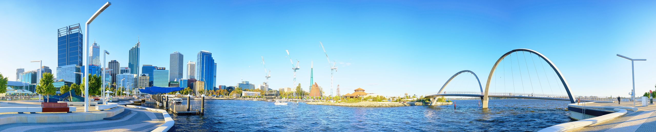
Australia and New Zealand share similar cultures and histories, but their landscapes couldn’t be much different. Australia is the world’s flattest continent, dominated by the vast, flat, dry outback. The only significant mountains, the Great Dividing Range, stretch north-south just inland from the southeastern coast. It is a relatively low mountain range, with peaks rarely exceeding 3,000 feet. New Zealand, on the other hand, is spectacularly mountainous, with some peaks exceeding 12,000 feet.
Australia and New Zealand are in the southern hemisphere, so their seasonal calendar is the opposite of the United States, as is the north-south distribution of temperatures. In Australia and New Zealand, temperatures decrease as you head south. Sydney is located at around 34˚S latitude, a similar latitude as Atlanta, Georgia, and is relatively warm. Melbourne, is at 38˚S latitude, similar to Louisville, Kentucky, and temperatures run a little cooler. Christchurch, New Zealand, is at about the same latitude as Chicago, and will remain quite a lot cooler. If you head north, things get warmer. Darwin, on the north coast of Australia, is in the tropics, at 12˚S latitude, approximately the same distance from the equator as Managua, Nicaragua.
There are five major climate zones in Australia and New Zealand. The marine west coast climate is found in southwestern Australia, where the large cities of Sydney and Melbourne are located, and covers all of New Zealand as well. It features relatively high rates of precipitation and mild temperatures year-round. If you’re wondering why the east coast of Australia has a “west coast” climate, look at a map. Notice that the coastline of southern Australia bows northward – this is called the “Great Australian Bight.” Southeastern Australia is in the westerlies, where winds move from west to east. These winds blow across the waters of the Great Australian Bight before they arrive in Sydney and Melbourne, and keep those locations relatively wet and mild. Up the east coast of Australia, toward Brisbane, is a humid subtropical climate. It is similar to the climate of Sydney – wet year-round, but it runs a little warmer, since it’s closer to the equator.
The vast majority of Australia’s interior is dominated by steppe and desert climates. This region is popularly known as Australia’s “outback” or “bush.” The heart of Australia is a desert, receiving less than ten inches of rainfall per year. It is ringed by the semi-arid steppe. These climates are dry because of high pressure that hangs over much of Australia year-round. The Mediterranean climate is found in found on parts of the Australia’s southern coast, near Adelaide, and its southwestern coast, near Perth. In the summertime, Australia’s high pressure shifts south, creating dry conditions. During the winter, the high pressure shifts north, as do the westerlies, bringing rainy conditions. It’s a maritime climate, so temperatures are relatively mild year-round. A tropical savanna climate is found along Australia’s north coast. In the summertime, the intertropical convergence zone (ITCZ) shifts south, bringing very wet conditions. In wintertime, high pressure shifts north, bringing dry conditions.
Physical Geography: The Pacific Islands
The Pacific Islands have historically been grouped together into three subregions. As discussed in Chapters 12, 15, 17, and 24, these are Melanesia, Micronesia, and Polynesia.
Melanesia consists of large, elongated islands with a central mountain spine. They were created by the same forces of tectonic folding and volcanism that created the islands of Indonesia and the Philippines.
The islands of Micronesia and Polynesia are all relatively small, and of volcanic origin. They consist of three varieties—high islands, low islands, and atolls. These islands are all created by the same process. They’re simply in different stages of their lifespan. High islands are characterized by a central volcanic mountain. Often, coral will attach to the side of the volcano. As the volcano erodes, earth piles on top of the coral reef, creating a narrow, flat coastal ring.
Over the next few thousand years, the dormant volcano slowly erodes away, forming a low island. Eventually, the volcano may erode away entirely, leaving only the narrow coastal ring. These circular or semi-circular islands that surround a central lagoon where the volcano used to be are known as atolls.
Historical and Cultural Geography: Australia and New Zealand
Australia’s indigenous population, the Aborigines, arrived on the continent 50,000 years ago. New Zealand’s indigenous people, the Maori, are comparatively recent arrivals, having moved in from Polynesia less than 1,000 years ago.
The first Europeans began arriving in the 1500s. Famously, some of the first British settlements in Australia were penal colonies – places where debtors and criminals were exiled. Convicts did not account for the majority of British colonizers, for many others came for different reasons, in particular a gold rush. As European settlers did in the Americas, the they slaughtered, displaced, and marginalized the indigenous population. The Aborigines, which most people associate with the Outback, primarily lived along the southeastern coast where Sydney and Melbourne now are. Just as Native Americans were pushed onto undesirable reservations in the Great Plains and Desert Southwest in the U.S., the Aborigines were forced into the Outback. Today, Aborigines account for about 1-2% of Australia’s population. The Maori account for 17% of New Zealand’s population, probably aiding them in gaining a relatively more significant role in their respective lands.
Both Australia and New Zealand are now mainly British in language, religion, politics, and ethnicity, as indicated by the presence of the British Union Jack on the flags of both countries. Because of their isolated location, these countries received much less immigration in the 1800s than did the United States, although some immigrants did trickle in from Ireland, Italy, Germany, Greece, and the Netherlands. Today, Australia is about 95% white, and New Zealand is about 64% white.
For years, both countries had racially biased immigration policies. Until the 1970s, it was difficult for non-white immigrants to move to either country. Since then, there has been more migration from Asia. Australia’s population is about 4% Asian, primarily Chinese and Indian. New Zealand is about 12% Asian, primarily Chinese, Indian, and Filipino. Additionally, about 8% of New Zealand’s population are Pacific Islanders.
Historical and Cultural Geography: The Pacific Islands
The Austronesian Expansion was covered in Chapter 15. The majority of these islands’ people are indigenous, making up 80% of the overall population. Only 13% of the population are the descendants of more recent arrivals from Asia. About 7% of the population is of European ancestry.
Most of the indigenous people speak languages from the Austronesian language family, while French and English are common lingua francas. Christian missionaries, mainly from the United States and Europe, began to arrive on the islands in the 1700s and 1800s. The vast majority of the region’s population adopted Christianity, and continue to practice it, although it is common to find Christianity fused to traditional indigenous religious beliefs. The role of the Lutheran Church in Papua New Guinea was explained in Chapter 20. In some locations, indigenous religions continue to be practiced exclusively. Hinduism is the largest non-Christian religion, specifically the leading religion in Fiji, where it arrived with Indian tea plantation workers in the 1800s. Small pockets of Buddhism and Islam are found where other Asian groups have settled.
Population Geography: Australia and New Zealand
Australia ranks about 50th in the world among country populations, with New Zealand about 125th. Australia is one of the four least densely populated countries on Earth, along with Namibia, Iceland, and Mongolia. New Zealand is not so extreme, but still is not at all crowded, being similar to Norway and Finland with about 18 people per square kilometers. Australia has a land area of 3 million square miles, about the same size as 48 conterminous U.S. states, but its population is almost 25 million, which is smaller than Texas. New Zealand’s land area is 104,000 square miles, about the same as Colorado, but its population is just 5 million, about the same as Alabama. Australia’s highest population densities are found along the southeastern coast, while New Zealand’s highest densities are on its northern island.
Both countries are highly urbanized. Australia’s high urban centralization was highlighted in Chapter 19. New Zealand is 86% urban, with 31% of its population living in the largest city, Auckland.
Australia and New Zealand have low birth rates. New Zealand’s TFR is 1.9, and Australia’s is 1.7, both below replacement rate. Like the United States, Canada, and Europe, Australia and New Zealand have aging populations and declining population growth rates. They face similar economic issues related to the decline in labor, consumers, and the tax base. Although both countries eliminated the racial biases in their immigration policies years ago, those policies are still pretty restrictive. Both countries might have to consider liberalizing their immigration stances to boost population growth.
Population Geography: The Pacific Islands
The Pacific Realm is a vast region, but most of it is water. Excluding Papua New Guinea, the total land area of all the islands adds up to just 87,000 square miles, which is smaller than Oregon. The total population of all the islands is about 3 million, which about the same as Arkansas. The largest city is Suva, Fiji, which has a population of 180,000, a little smaller than Springfield, Illinois.
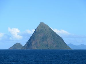
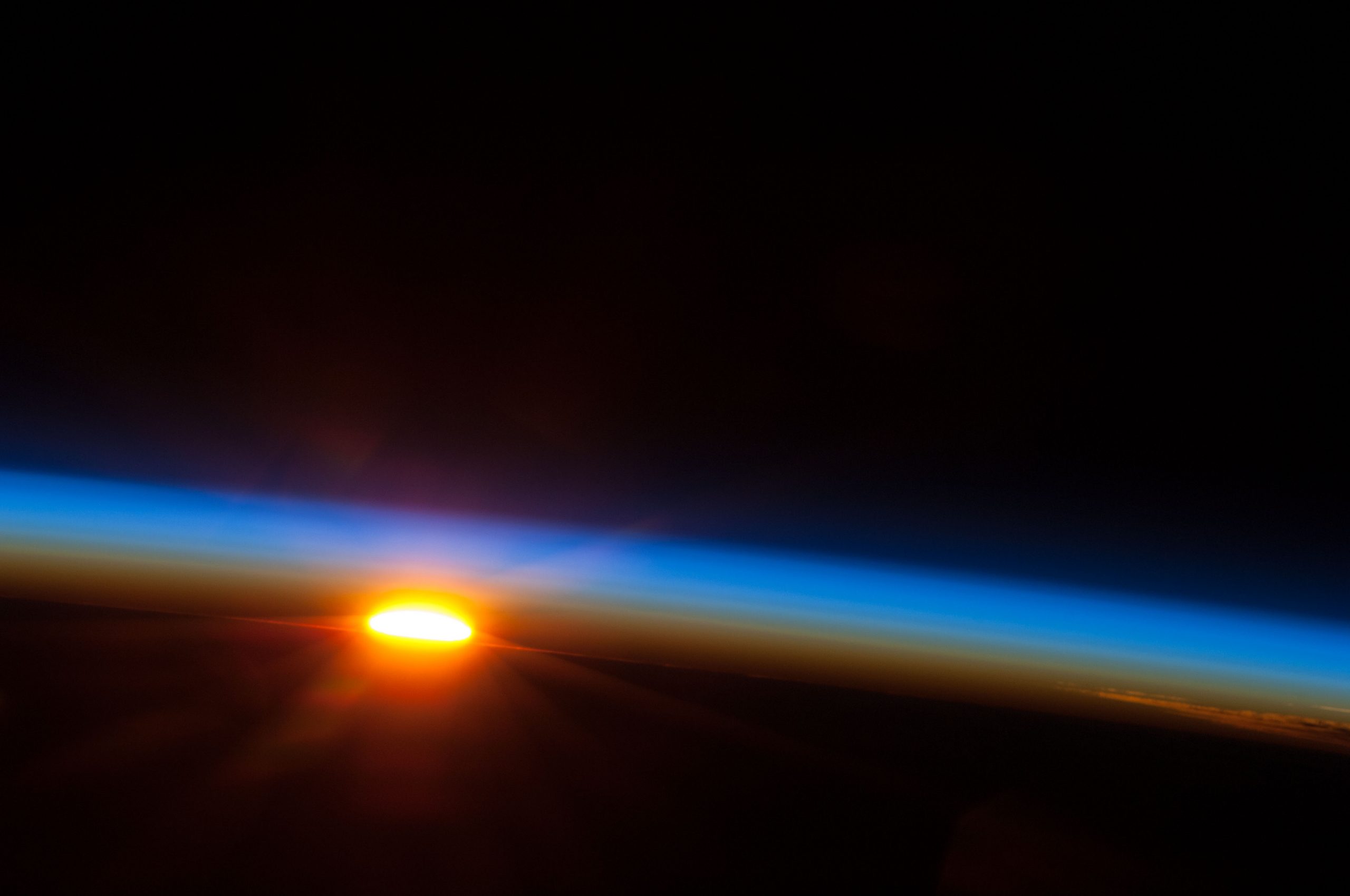
Photo by David Stanley on Flickr.
Population growth rates are moderate in the Pacific Realm. Three countries have TFRs that are above the world average: the Solomon Islands (3.0), Tuvalu (2.9), and Tonga (2.9). Five countries have TFRs at or below the world average, but above replacement rate: Vanuatu (2.8), Nauru (2.7), Fiji (2.3), the Federated States of Micronesia (2.3), and Kiribati (2.3). Only one country is below replacement rate, and that’s Palau (1.7).
Political and Economic Geography: Australia and New Zealand
The official head of state of both Australia and New Zealand is Queen Elizabeth II of Britain, although that relationship is largely symbolic. Both countries have been full democracies since their independence from Britain in the early 1900s, and their governments rate as some of the least corrupt in the world.
Both countries enjoy high standards of living. According to the Human Development Index, Australia is tied for the sixth best level of development (or generally, standard of living or quality of life), while New Zealand ranks fourteenth. This might be surprising, given the historic nature of the region’s economies.
For years, the economies of Australia and New Zealand were based on the export of raw materials. New Zealand has abundant pasture land, and Australia has the greatest non-oil mineral wealth per capita of any country on earth. As is discussed in Chapter 4, countries with economies that depend on raw materials are usually poor. In Australia and New Zealand, however, the resources were so vast, and the populations so small, that there was plenty of wealth to go around.
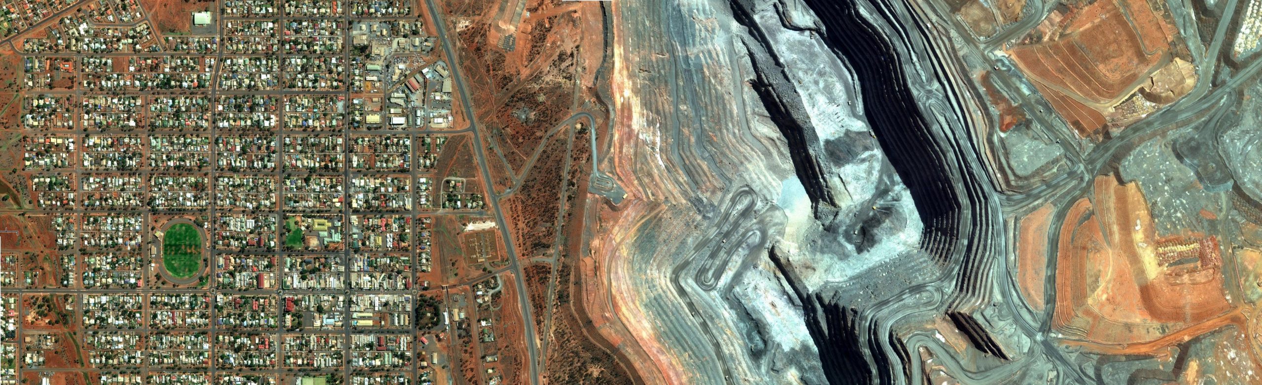
Again given the larger landmass, Australia dominates the region in terms of raw materials. As of 2012, Australia had:
- 51% of the world’s antimony
- 34% of the world’s bauxite
- 38% of the world’s black coal
- 51% of the world’s cobalt
- 28% of the world’s copper
- 55% of the world’s diamonds
- 42% of the world’s gold (see the so-called Super Pit, pictured above)
- 34% of the world’s iron ore
- 45% of the world’s lead
- 55% of the world’s lithium
- 72% of the world’s manganese
- 39% of the world’s molybdenum
- 90% of the world’s opals
- 67% of the world’s rare earths
- 36% of the world’s silver
- 48% of the world’s tantalum
- 61% of the world’s tin
- 51% of the world’s tungsten
- 34% of the world’s uranium
- 50% of the world’s zinc.
Now in 2020, Australia leads the world in exporting liquefied natural gas (LNG), a means of selling their natural gas output without using pipelines (under the ocean?).

The extensive land area also is heavily utilized in agriculture, sometimes for crops such as wheat and sugar cane, but significantly for ranching – cattle and sheep. Comparatively, New Zealand has significant dairy and sheep farming.
With this wealth, Australia and New Zealand invested heavily in infrastructure and education, which gave rise to thriving service and information sectors. What’s also unusual about this region’s economies is that they essentially skipped the industrial phase of economic development. Neither is a major manufacturer.
Finally, tourism has become a significant component of both countries’ economies. For years, they were too remote to attract many tourists, but as airplanes got bigger, faster, and more efficient in the 1980s, Australia and New Zealand were suddenly within reach of the rest of the world. The famously attractive scenery of both countries began to draw millions of tourists. The fact that Australia and New Zealand could serve up summer weather during the northern hemisphere’s winter was also a major boost, as was the fact that both countries served as the backdrop for some wildly popular movie franchises.
Political and Economic Geography: The Pacific Islands
Most of the Pacific Islands were colonized between 1840 and 1900. The major colonial powers were Britain, France, Germany, the United States, and Japan. Most of the countries achieved independence between 1960 and 1990. Today, most of the countries are democracies, with a few exceptions. The Solomon Islands and Fiji are partial democracies, with recent histories of instability and corruption. Tonga is a monarchy, with few democratic institutions.
There are few remaining colonies in the Pacific Realm. New Caledonia, French Polynesia, and the Wallis Islands are colonies of France. Guam, the Mariana Islands, and American Samoa are colonies of the United States. The Cook Islands are a colony of New Zealand.
The Pacific Realm is a relatively poor region. Palau and Tonga have standards of living that are close to the world average. Fiji, Nauru, Vanuatu, and the Federated States of Micronesia are below the world average. The poorest countries are Kiribati, the Solomon Islands, and Tuvalu, where standards of living are well below the world average. Much of the region’s population live in small villages, dependent upon root crops, tree crops, pig farming, and fishing.
For the small islands of the Pacific Realm, the random chance of having noteworthy raw materials is low. As described in Chapter 21, Nauru had the odd circumstance of huge phosphate deposits from bird droppings. New Caledonia does beat the odds with raw materials, especially in heavy deposits of nickel ore.
One reason that these countries are relatively poor is because they lack investment capital. It is difficult to fund economic development if you don’t have any funds. Many of the islands also lack valuable raw materials. But the greatest economic problem is distance. These are some of the most remote places on earth, and that is a huge economic liability that bogs down the potential of almost every economic activity in the region.
Tourism is an important industry, for obvious reasons. For many, the climate and landscapes of the Pacific islands are the stuff of dreams. But these islands are so far away from the major population centers of the world that tourism potential remains limited. Plantation farming and mining are also important activities, but again, distance limits their profitability, since producers in other parts of the world are closer to potential markets. About the only industries that benefits from the remoteness of the Pacific Realm are military and maritime services. Some islands are home to major naval bases and shipping terminals, since they are sometimes the only dry land around for hundreds of miles.

Overall: Isolation
A dominant element of the Pacific Realm is its relative isolation. Hawaii and Easter Island are some of the most remote places on the planet. Isolation makes the Austronesian Expansion even more impressive. When compared to other parts of the globe, Australia’s isolation led to its late European discovery and settlement. Nevertheless, this isolation meant that Australia was relatively empty, a feature that the British utilized in their colonization and eventually claim of all of the landmass. Strikingly, this settlement mainly began with the shipping of convicts to Australia to settle that new land. The original settlers of Australia brought with them the English language; however, the isolation of this place, both in distance and in separation from British civilization, endeavored the language to evolve, so that modern Australian English has a distinctive accent and numerous words that do not fit into British English nor into other regional variations of English (such as American English). Similar linguistic changes happened in New Zealand, as seen in “Zealand speak.”

In addition, isolation created a unique set of wildlife in Australia with some unusual animals and others that can be found only in Australia. This land down under is famous for the kangaroo and certainly known for the platypus and the koala. Wallace’s Line and Weber’s Line are two scholars’ works to delineate the separate Asian animal species (fauna) from Australian animal species.
Beautiful Pacific islands in tropical settings offer very appealing tourist destinations; however, the isolating distances to these islands is a deterrent to some potential tourists choose not to overcome. Similarly, Australia’s economy includes a major tourist sector, partly existent because of exotic elements present because of its isolation, while at the same time partly diminished because of the costs of distance as created by the same isolation.
Overall, the Pacific Realm is a fascinating region, largely dominated by Australia, and strongly influenced by its isolation.
Did You Know?
Hot Off the Press
For a spectacular map of the languages of New Guinea, go to: https://www.muturzikin.com/cartesoceanie/oceanie2.htm
Cited and additional bibliography:
Chen, Jackson. 2020. “Australia Takes Crown as World’s Top LNG Exporter | U.S. & International.” JWN Energy. January 8, 2020. https://www.jwnenergy.com/article/2020/1/australia-takes-crown-worlds-top-lng-exporter/.
Geoscience Australia. 2014. “Resources.” Www.Ga.Gov.Au. May 29, 2014. https://www.ga.gov.au/data-pubs/data-and-publications-search/publications/australian-minerals-resource-assessment/resources.
Lindstrand, Tor. 2012. Australian Mining. https://tinyurl.com/wamining. Attribution-ShareAlike 2.0 Generic (CC BY-SA 2.0).
NASA’s Marshall Space Flight Center. 2013. Sunrise Over the Pacific Ocean. https://tinyurl.com/sunrisepacific. Attribution-NonCommercial 2.0 Generic (CC BY-NC 2.0).
Pietrak, Przemek. 2015. Digital Rendering of the Satellite View of the Pacific Ocean. https://commons.wikimedia.org/wiki/File:Globe_-_Pacific_Ocean_space_view.png. Creative Commons Attribution 3.0 Unported.
Stanley, David. 2018. Mataso Island. https://tinyurl.com/vanmat. Attribution 2.0 Generic (CC BY 2.0).
Szekely, Pedro. 2017. Perth. https://tinyurl.com/perthwesta. Attribution-ShareAlike 2.0 Generic (CC BY-SA 2.0).
