47 North America: Overview
Physical Geography: The United States
Landform Regions

There are three major alpine regions in the United States, each of them running roughly north-to-south. One consists of a pair of ranges near the Pacific Ocean. The Coast Ranges are a relatively low mountain range that run the length of the Pacific Coast. A few hundred miles inland is a much more significant mountain range, known as the Cascades in central Oregon and Washington, and as the Sierra Nevada in eastern California. These are extremely rugged mountains with very high elevations, some of them rising above 14,000 feet. A few major valleys are interspersed between the Coast Ranges and the Sierra Nevada/Cascades, notably the Central Valley, a very flat, elongated plain occupying some 18,000 square miles of California.
A second major alpine region is the Rocky Mountains. The Rockies extend south out of Canada, occupying parts of Idaho, Montana, Wyoming, Colorado, Utah, and New Mexico. Like the Sierra Nevada/Cascades, elevations are high and the landscapes are dramatic.

Between the Sierra Nevada/Cascades and the Rockies, extending from eastern Washington to southern New Mexico, is a region known as the Intermountain West. It is an area of short, rugged mountain ranges separated by basins, plateaus, and plains. The southern part of this region is well known for the rugged beauty of its highly eroded landscapes, including the Grand Canyon of Arizona.
The United States’ third major alpine region is the Appalachians, a mountain range than runs from New England to northern Alabama. The Appalachians are much older than the mountains of the west, and have been weathered to significantly lower elevations, with the highest peaks topping out just above 6,600 feet. Although low, the Appalachians are steep and thickly forested. Much of the region possesses a remarkably orderly sequence of ridges and valleys. Extending east from the Appalachians is a rolling plateau known as the Piedmont, which runs from southeastern Pennsylvania to northern Georgia.
The flattest region of the country is the Gulf-Atlantic Coastal Plain. It begins as a very narrow strip along the coast of New England. The plain then broadens in southern New Jersey, sweeping across the eastern thirds of Virginia, the Carolinas, and Georgia. All of Florida is on the Coastal Plain, as is southern Alabama and Arkansas, eastern Texas, and all of Louisiana and Mississippi. The coastal plain slopes very gradually toward the sea, sometimes at a rate of only a few feet, or even a few inches, per mile. Because of this, the region has historically been very swampy, since flat landscapes do not shed water very quickly. Many of those swamps have been drained by vast networks of ditches and canals. Unlike the West Coast, where mountains run right up to the ocean, the transition from land to sea along the Gulf-Atlantic Coast Plain is far more gradual, and the shoreline is dotted by bays, bayous, and flat islands.
Dominating the heart of the country is another flat region known as the Interior Plains. This vast region is bordered on the east by the Appalachians, on the south by Ohio River, on the north by the Great Lakes, and on the west by the Rockies. The dry, grassy western section of the Interior Plains is sometimes called the Great Plains.
Some parts of the Interior Plains are remarkably flat, but much it has a gently rolling surface. There are a few areas of low hills scattered about the region, such as the Flint Hills of Kansas, or the Sand Hills of Nebraska. The northern sections of the Interior Plains were scoured during the last ice age, the most notable result being the presence of numerous lakes, including the Great Lakes, and the thousands of smaller lakes that dot Wisconsin and Minnesota.

There are a few highland regions in the central part of the country, including some hilly, deeply eroded plateaus in central Kentucky and Tennessee. The Superior Uplands, located in northern Minnesota and Wisconsin, are a hilly extension of the Canadian Shield. The most rugged landscapes in the central United States are found in the Ozark Highlands of southern Missouri, northern Arkansas, and eastern Oklahoma. This ancient, highly eroded landscape features a maze of ridges and valleys, with the highest peaks reaching just above 2,500 feet.
Climates
Wichita, Kansas, is a handy reference point for American climates. Areas south and east of Wichita possess a humid subtropical climate. This climate features a very long warm season. Summers are quite hot, and extraordinarily muggy. The cold season is comparatively short. Winters are generally mild, although the region does experience brief spells of cold weather. Precipitation is heaviest in summer, since warmer air typically contains more water vapor than cooler air, although this region is generally wet year-round.

Areas north and east of Wichita possess a humid continental climate. As a continental climate, its temperatures are defined by seasonal extremes. Summers tend to be quite hot, and winters tend to be quite cold. Precipitation levels are relatively high in summer. Winter precipitation rates are lower, although this area regularly receives significant snowfalls.
Much of the American West is dominated by a steppe climate. Steppe climates are characterized by hot summers and cold winters, but the most dominant trait is aridity. Although not quite a desert, steppe climates are significantly drier than the humid climates found in the eastern half of the United States. The transition is clearly manifested on the landscape as you head west—trees give way to grasslands, corn gives way to wheat, and the towns become fewer and far between. This climate is found in many of the lowland areas between Wichita and the Sierra Nevada, and also in California’s Central Valley. These relatively arid climates are the result of rain shadows cast by the Coast Ranges, the Sierra Nevada/Cascades, and the Rockies.

Deserts can be found in the southwestern United States, from southeastern California to southwestern Texas, including much of Arizona, New Mexico, Nevada, and southern Utah. In lowland areas, this climate generally features extremely hot summers and very mild winters. At higher elevations, temperatures can get quite cold, particularly in winter. Precipitation rates are low year-round, a result of the almost constant presence of high air pressure.
Alpine climates can be found throughout the Rockies, Sierra Nevada, and Cascades. This is not a climate in and of itself, but a complex region of thousands of microclimates. Generally speaking, though, these mountains tend to be colder and wetter in the north, and drier and hotter in the south.
Coastal California is home to a Mediterranean climate. It is a maritime climate, so temperatures are generally mild year-round. The spring and fall tend to be dry, and the summers can be virtually rainless, due to the presence of high air pressure. Winters can be relatively rainy, as the high pressure shifts south, and the westerlies carry moisture in off the Pacific. Coastal Oregon and Washington are home to a marine west coast climate. This is another maritime climate, so temperatures tend to be relatively mild year-round. Since the westerlies are constantly pushing moisture in off the Pacific, this region is wet throughout the year, with maximum precipitation occurring in winter.
Physical Geography: Canada

Many of Canada’s landform regions are extensions of those found in the United States. The high elevations of the Pacific and Rocky Mountain systems extend northward into British Columbia and the Yukon. The flat, fertile Interior Plains extend northward into southern Ontario, Quebec, Manitoba, Saskatchewan, and Alberta. The low Appalachian Mountains extend northward into New Brunswick, eastern Quebec, and Newfoundland. Much of the rest of Canada is dominated by the Canadian Shield (see Chapter 33).
The humid continental climate dominates much of Canada, featuring moderate precipitation, warm to hot summers and cold winters, with temperatures in both summer and winter declining as latitude increases. The rainy, mild marine west coast climate is found along the coast of British Columbia. Canada’s far north is characterized by arctic climates, which are generally cold year-round.
Historical Geography: The United States
The Northeast

The Northeast consists of two sub-regions—New England, which includes Connecticut, Maine, Massachusetts, New Hampshire, Rhode Island, and Vermont; and the Mid-Atlantic, which includes Delaware, Maryland, New Jersey, New York, Pennsylvania, and the District of Columbia. Although it is a relatively small region, the Northeast is densely populated, containing 20% of the country’s population.
One of the most prominent features of the Northeast is the Bos-Wash Megalopolis, a string of nearly continuous metropolitan development along the Atlantic Coast from Boston to Washington. This is the most densely populated region of the United States. It is home to one-sixth of the U.S. population, and includes four of the country’s ten largest metropolitan areas: New York, Philadelphia, Washington, and Boston. It also includes the mid-sized metropolitan areas of Baltimore, Providence, and Hartford. It is the second most heavily industrialized corridor in the U.S., and contains the country’s political capital, Washington, and its unofficial economic capital, New York. As is discussed in Chapter 32, most of these cities evolved around excellent natural harbors. For years, nearly all of the country’s imports, exports, and immigrants passed through these ports. They were a natural location for factories, banks, and corporations.

Because New York had the easiest connection to the interior of the country (also discussed in Chapter 32), it became the most prominent city in the Northeast, and in the country. It was already the United States’ largest city in 1790, and today, with 19 million people, it remains the most populous metro area in the country by a fairly wide margin. It is the world’s largest financial center, contains more corporate headquarters than any other city on earth, and is home to one of the world’s busiest ports.
The Midwest
The Midwest includes Ohio, Michigan, Illinois, Indiana, Wisconsin, Minnesota, Iowa, Missouri, Kansas, Nebraska, North Dakota, and South Dakota. It is a large region, and has a large population—it is home to 22% of the American population. See Chapter 29.
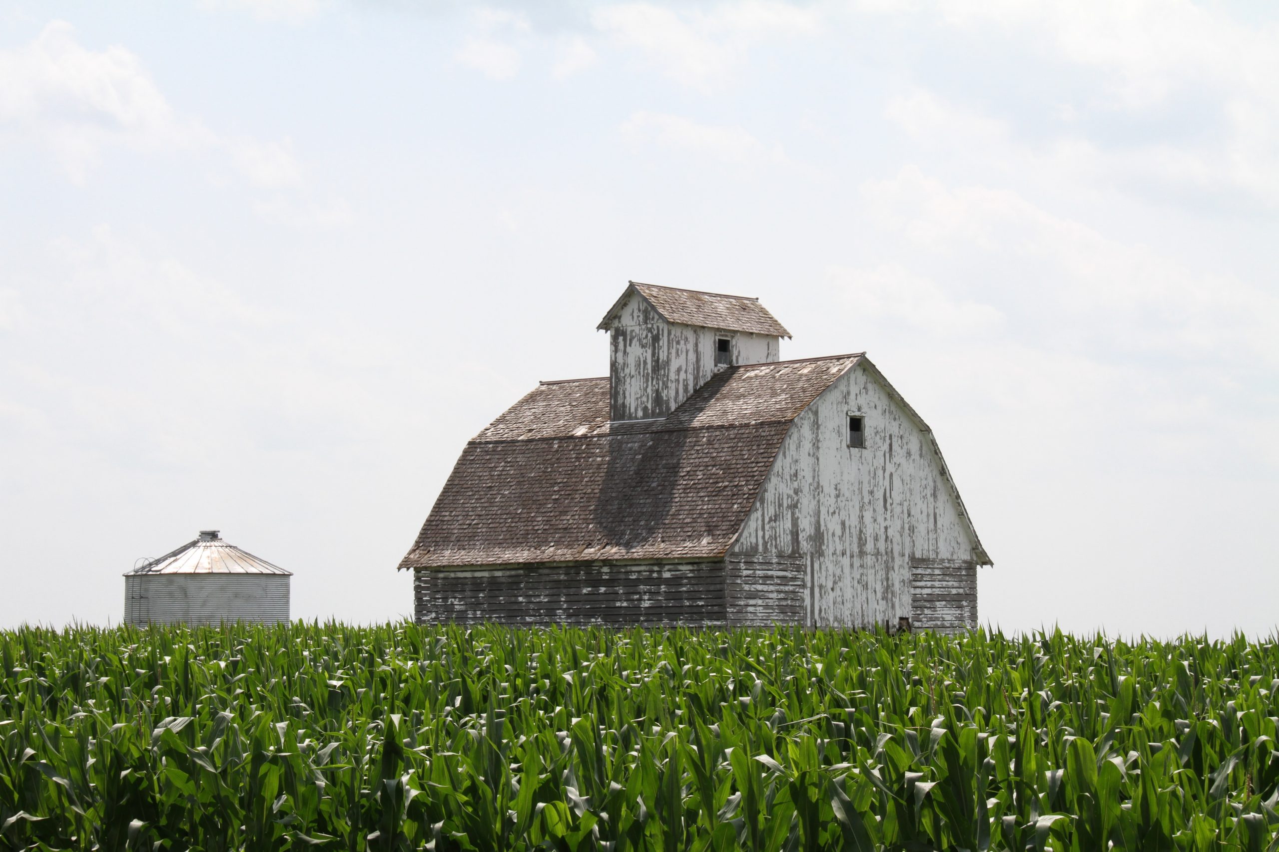
The Midwest is one of the world’s most productive agricultural regions. In the early 1800s, thousands of small-scale family farms were established from Ohio to Nebraska, in a region known as the Corn Belt. The dominant agricultural practice there has long been livestock fattening. Corn, and later soybeans, were grown as a feed crop for animals, which were exported to the cities of the Mississippi valley. Although this region is still carpeted with corn each summer, its rural population has declined significantly as a result of farm mechanization. During the 20th century, the Corn Belt’s rural population declined by more than 80%.
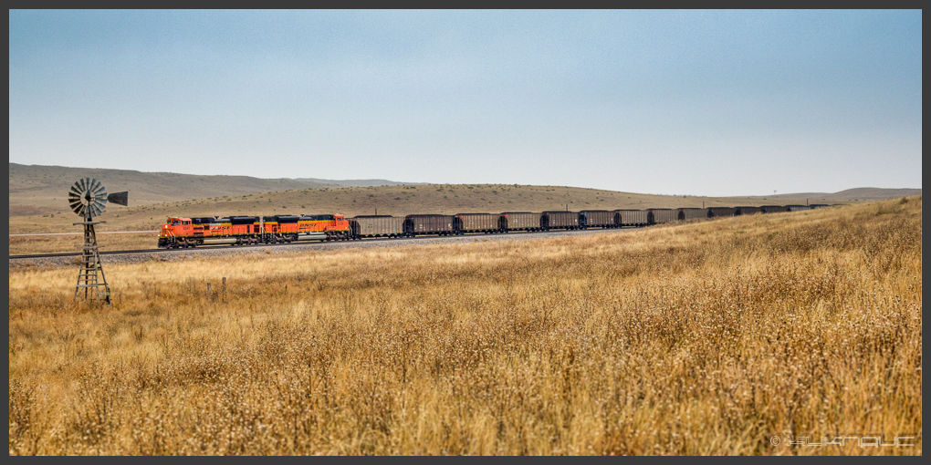
Further west is the Wheat Belt of the Great Plains, where conditions are too dry for corn production. It is a very productive region—the yield of the annual wheat crop is more than twice the domestic demand. The rest is exported to the global market. Production is also highly mechanized, with much of the work done by migratory crews. As a result, population densities in the Wheat Belt are extremely low. The combined population of North and South Dakota is just 1.4 million—smaller than that of metropolitan Milwaukee.
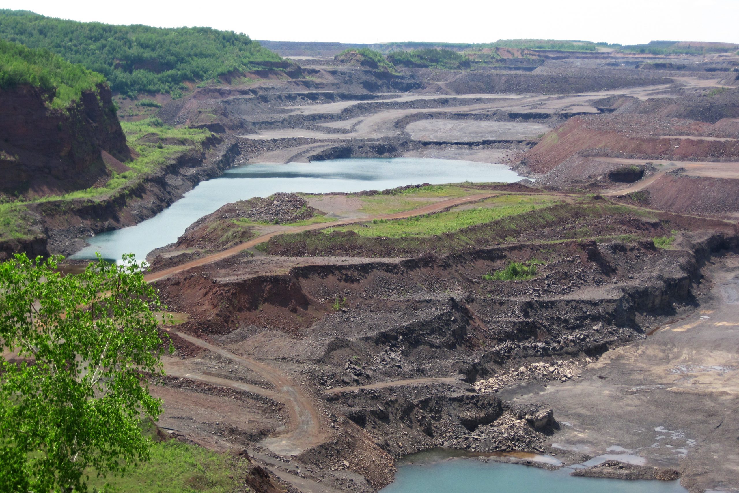
The Midwest is also synonymous with manufacturing, particularly in the large cities along the Great Lakes. Between the 1870s and the 1970s, the Great Lakes Steel Belt emerged as one of the world’s most productive manufacturing regions. The lakes provided an avenue for the cheap transport of bulky raw materials. Iron ore was mined on northwestern end of the Great Lakes, while coal was mined near the southeastern end. Coal and iron ore are the two fundamental ingredients of steel, and this made the Great Lakes an ideal setting for steel production. Steel was integral to the Industrial Revolution, used in the production of rails, industrial and agricultural machinery, buildings, transportation equipment, and much more. Steel is expensive to ship, so it made sense to manufacture things made out of steel right next to the steel mills. As a result, the Steel Belt became synonymous with American industrial might.

Although it contains numerous mid-sized metro areas, including Detroit, Minneapolis, Cleveland, St. Louis, Indianapolis, Columbus, Kansas City, Milwaukee, and Cincinnati, only one Midwestern metro area ranks in the country’s top ten. Chicago is the country’s third-largest metropolitan area. Located in an advantageous position in the center of the Midwest, and on the most direct route between the Mississippi Valley and the Great Lakes, Chicago emerged in the late 1800s as the Midwest’s undisputed economic capital. It became a trade and marketing center for the Corn Belt. By 1900, about half of all the animals slaughtered in the United States met their demise in the Union Stockyards on Chicago’s South Side. Chicago became a distribution point for the timber of the Great Lakes, and a major steel producer. Its economy was red hot at about the same time that immigration to the United States was peaking, and as a result Chicago became the most ethnically diverse city in the country. Today, Chicago remains the most important city in the U.S. interior. It is a major manufacturer, and an international center of trade, marketing, banking, and finance.
The South

The South consists of Virginia, North Carolina (seen in the icon to the left), South Carolina, Georgia, Alabama, Mississippi, Louisiana, West Virginia, Kentucky, Tennessee, and Arkansas. It is another large region, and contains a large population. About 19% of Americans live in the South. The South consists of two distinct sub-regions—the Lowland South (or Deep South), which occupies the Piedmont and the Gulf-Atlantic Coastal Plain, and the Upland South, which occupies the Appalachians and Ozarks.
Some of the first white settlers in the Lowland South were wealthy British immigrants who acquired enormous farms known as plantations. Plantations featured the intensive production of a single luxury crop, usually tobacco or cotton. These farms were infamously associated with slavery, utilizing the forced labor of African Americans.
The slave plantation culture established three enduring traits in the Lowland South: a lack of ethnic diversity, a lack of major urban areas, and a lack of a significant middle class. As we’ll discuss below, these traits have faded in recent decades, but have not disappeared altogether.
For years, most inhabitants of the Lowland South were descendants of British settlers, or of African slaves. Until recently, the region attracted very few immigrants from other places. The lack of available farmland, the lack of manufacturing jobs, and the lack of major ports and railroads made the region unattractive to immigrants, as did the social climate.
The wealthy land-owning classes of the region simply imported their manufactured goods from elsewhere, and had little incentive to invest in new economic enterprises like factories. The rest of the region’s population was relatively poor, so they had no money to invest or spend. This lack of manufacturing and commercial activity stunted the growth of Southern cities.
Perhaps the most distinctive trait of the Lowland South was its lack of a significant middle class, an unusual trait in the United States. The plantation economy produced a small, extraordinarily wealthy white ruling class, but most of the region’s white residents were poor subsistence framers eking out a living on marginal, unproductive land that had been passed over by the plantation owners. And, of course, most Black slaves were essentially moneyless. After the Civil War, the poor white subsistence farmers remained poor. The wealthy landowners remained wealthy. Emancipated slaves, lacking other economic opportunities, became sharecroppers, and largely remained poor.

The first white settlers to the Upland South arrived from Pennsylvania, flowing down the grain of the Appalachian valleys, then on to the hills of Kentucky and Tennessee, and eventually to the Ozarks. In this hilly country, these settlers developed an economy and culture very different from that of the Lowland South. Most of them did not own slaves, not because they were necessarily opposed to slavery, but because the poor soils and steep slopes made the land unsuitable for large-scale commercial agriculture. The topography also made transportation difficult, further limiting economic opportunities. The Upland South became, and remains, a region of low population density, high rates of poverty, and few large cities.
One economic bright spot for the Upland South has been tourism. It is a poor region, but a beautiful one. In the 1880s, with the Industrial Revolution in full roar, many wealthy city dwellers of the Midwest and Northeast were seeking refuge in nature, particularly in the summertime. Tourism accelerated in the 1900s as a number of rivers in the Upland South were dammed to create enormous artificial lakes. Vacation homes, retirement communities, marinas, and theme parks are now some of the most significant industries in the Upland South.
In the second half of the 20th century, many Southerners, anxious to leave the haunting legacies of slavery, poverty, segregation, and cultural isolation behind, began to speak of the evolution of a New South. The region has, indeed, undergone many changes over the past several decades. In the 1960s, the region began to develop a more diverse economy. Low wages and taxes made it an inviting place for businesses.

The region’s warm climate attracted Sunbelt migrants. Some of the most important changes resulted from the Civil Rights movement, which led to an improved social climate. In the 1980s, for the first time since Emancipation, more African-Americans were moving to the South than were leaving it. Compared to the Northeast and Midwest, it is still a region of relatively few large metropolitan areas, although Charlotte, Raleigh-Durham, Nashville and, in particular, Atlanta, have experienced explosive growth in recent years.
The Interior West
The Interior West includes Arizona, Colorado, Idaho, Montana, Nevada, New Mexico, Utah, and Wyoming. Outside of Alaska, it is the most sparsely populated area of the United States. Despite its enormous size, this region contains just 7% of the U.S. population. Wyoming, which sprawls across 98,000 square miles, contains just 580,000 people. By comparison, suburban Chicago’s DuPage County, which covers just 336 square miles, contains 923,000 people. Because of its relative emptiness, much of the land in the Interior West is still owned by the federal government, and the region contains numerous military bases, national parks, and national forests.

Photo by Matt Addington.
From the 1840s to the 1940s, the Interior West’s economy was based almost exclusively on primary sector activities, such as ranching, mining, and forestry, and there were few substantial cities. Beginning in the 1940s, the population of the region began to grow, and the economy expanded. The region has a large military presence, and as the military expanded exponentially during World War II and the Cold War, the economy of the Interior West expanded with it. Tourism also boomed in the second half of the 20th century, with scores of tourists attracted to the region’s national parks and ski resorts, and to the desert playgrounds of Reno and Las Vegas, Nevada.
The Interior West’s population has been growing steadily since the 1960s as the result of Sunbelt migration. It is still a relatively empty region, but some of the country’s fastest-growing metropolitan areas are found there, including Phoenix, Denver, Salt Lake City, and Las Vegas.
Texas and Oklahoma
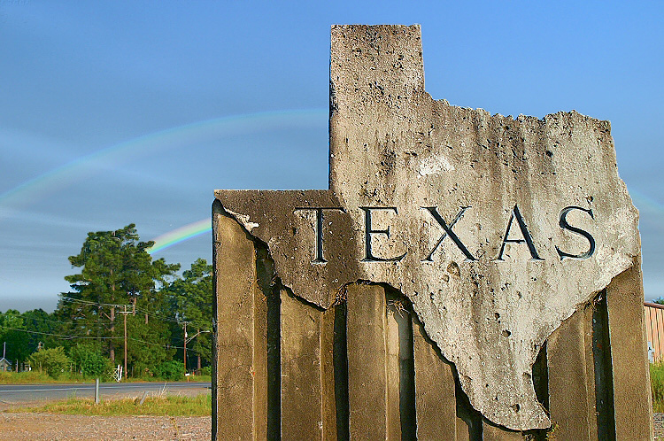
Texas and Oklahoma collectively account for about 9% of the country’s population, with the lion’s share of those people in Texas, which is the second most populous state. Both of these states were settled by non-Native Americans relatively late. Texas was originally part of Mexico, and its distance from Mexico’s population and economic cores limited economic opportunity there. Throughout much of the 1800s, Oklahoma was reserved for Native Americans.
In the 1820s, a newly independent Mexico opened Texas to settlement from the United States. In 1836, Texas achieved independence from Mexico. It would join the U.S. in 1845. Oklahoma was opened to white settlement in 1889, and became a state in 1907.
Through the first half of the 20th century, the economies of both states were based primarily on raw materials, particularly agriculture and the oil and gas industries, and their cities were relatively small. Beginning in the 1960s, Texas began to boom. The Dallas and Houston metro areas now rank among the United States’ ten largest. San Antonio and Austin are smaller, but their populations have also expanded rapidly. Texas’s economic boom resulted from a dramatic increase in trade with Mexico, a growing energy industry, the rapid expansion of high-tech industries, and Sunbelt migration. Oklahoma’s growth has been more modest. Its largest metropolitan area is Oklahoma City, which ranks 41st nationally.
The West Coast

California, Oregon (seen in the icon to the left), and Washington make up the West Coast states, which contain 15% of the country’s population. White settlement in Oregon and Washington, an area often referred to as the “Pacific Northwest,” began relatively early, in the 1840s with the Oregon Rush. Farmers from the east were attracted to the region’s climate, which features mild winters and plentiful rainfall. Eventually, the timber industry came to dominate the rural economy of the Pacific Northwest.
California began to grow rapidly at about the same time. In 1848, control of California was transferred from Mexico to the United States, just as gold was discovered in the foothills of the Sierra Nevada. The following year, thousands of ‘49ers—Americans hoping to make their fortune in the gold rush—poured into California. Some made the trek overland, but most arrived by sea, and San Francisco’s Golden Gate became the major point of entry.
California’s economy subsequently focused on agriculture in the Central Valley. Farming there was initially limited by physical geography. As snow in the Sierras melted each spring, vast sections of the valley would flood. Then, in the summer, when the flood waters receded, there would be no rain for weeks at a time. Beginning in the 1900s, massive private, local, state, and federal water projects transformed the landscape. Dams were built to trap spring snowmelt, and the water was doled out via thousands of miles of canals during the dry summers. Agriculture rapidly expanded throughout the valley and, by the 1930s, California was the country’s leading agricultural producer.
The West Coast is now home to numerous large cities, including the huge metropolitan areas of Los Angeles, San Francisco, and Seattle, and the mid-sized metros of Sacramento, Portland, and San Diego. As discussed in Chapter 32, the region’s three largest cities benefited from the arrival of railroads which linked the Pacific to the eastern United States.
Another transformative event was World War II. After Japan attacked the U.S. fleet at Pearl Harbor in 1941, the ensuing war increased the flow of materials through West Coast ports, and the federal government rushed to establish a military and industrial presence along the Pacific. The West Coast’s naval bases were expanded, and the aircraft and defense industries thrived. After the war, increased trade with Asia further expanded the West Coast’s industrial base.
But perhaps the most important factor in the West Coast’s population boom was Sunbelt migration. For a century, people have been attracted to the mild climates along the Pacific, particularly those of southern California. In the 1960s, California became the most populous state. In the 1980s, Los Angeles passed Chicago to become the country’s second largest metro area. Today, nearly one in eight Americans lives in California.
Florida

Over the course of the last century, Florida has transformed from an isolated, sparsely-populated backwater into the country’s third most populous state. Today, 6% of the Americans live there. The United States purchased Florida from Spain in 1819. When it became a state in 1845, it had a population of just 70,000. Northern Florida became an extension of the Lowland South’s slave plantation culture, and northern Florida remains the most “Southern” part of Florida. Swampy peninsular Florida would remain sparsely populated for decades.
In the 1920s, Florida’s economy began to boom with the emergence of the tourism industry. It also became a retirement haven for Americans. Today, nearly 20% of the state’s population is over sixty-five. Overall, few states exemplify Sunbelt migration quite like Florida. From 1920 to 2000, the state’s population doubled every twenty years. Three of its metropolitan areas—Tampa, Miami, and Orlando—now rank among the country’s twenty largest.
Alaska and Hawaii

Photo by Amanda Phung.
Hawaii is small, and thus has a relatively small population. Alaska is enormous, by far the largest state in the country, but it is very sparsely populated. Collectively, the two states account for less than 1% of the country’s population. Both achieved statehood in 1959. Hawaii’s economy largely revolves around the military, tourism, and agriculture. Alaska’s economy is dominated by raw materials extraction, such as oil and gas, mining, fishing, and timber.
Historical Geography: Canada
 Canada’s indigenous population, the First Nations, arrived on the continent about 15,000 years ago. In the 1500s, the first English colonies were established in Atlantic Canada. In the 1600s, French settlers moved into the St. Lawrence valley, and more English settlements were established north of Lake Erie and Lake Ontario. In the 1700s, France ceded control of its Canadian territories to the British. In the 1840s, all of the European settlements of Canada were unified into a single British colony. At about the same time, the Oregon Treaty with the United States established Canada’s southwestern border, increasing white settlement in the Prairie Provinces and British Columbia. Canada was granted home rule in 1867, and officially gained full independence in 1931, although the British monarch remains the symbolic head of state. Newfoundland would remain a British colony until joining Canada in 1949.
Atlantic Canada

Atlantic Canada consists of the provinces of Prince Edward Island, Nova Scotia, New Brunswick, and Newfoundland & Labrador. It is one of the poorest and most rural part of Canada. It has long been dominated by the logging and fishing industries, although the latter was decimated in the late 20th century by overfishing. A bright spot for Atlantic Canada is tourism, which has boomed in recent years due to the region’s attractive scenery, recreational opportunities, and unique culture.
Ontario
Ontario is the most populous, urbanized, and industrialized province in Canada. The majority of its population lives in the southeast, near Lake Erie and Lake Ontario. Ontario contains the country’s political capital, Ottawa, and his home to its largest metropolitan area, Toronto, which commands a huge share of the Canadian economy. Ontario is, without question, Canada’s economic and demographic core.
Quebec
 Quebec is more rural and less industrialized than Ontario, and has long been defined by its French identity. 85% of Canada’s French speakers live in Quebec, and 80% of the province’s population speak French as their first language. The secessionist Quebecois movement, which grew rapidly in the second half of the 20th century, sought independence for Quebec. A 1995 independence referendum was narrowly defeated, 51% to 49%, and the movement has since lost momentum. The province’s economic prospects are looking up, largely driven by the growth of high-tech industries in Montreal.
The Prairie Provinces
The Prairie Provinces include Alberta, Saskatchewan, and Manitoba. Historically, it has been a sparsely populated region, with an economy primarily based on mining, oil and gas, and wheat farming. It has recently experienced a high-tech boom in some of its cities, especially Calgary.

British Columbia
British Columbia was long an isolated outpost of Canada, but its economy has boomed in recent years, particularly in Vancouver, as mild climates have attracted numerous migrants. British Columbia has benefited immensely from Canada’s increased trade with Asia, since Vancouver is closer to Japan, Korea, and China than any other major North American city. Its Asian connection was further enhanced when a number of wealthy migrants arrived in Vancouver from Hong Kong in 1997 after China’s political takeover there. Vancouver’s population is now 20% Chinese-Canadian.
Cultural Geography: The United States
Language
A person’s “first” language is their household language—the language they speak with their parents, children, or spouse. English has long been the majority language of the United States, and 82% of Americans speak it as their first language. Spanish is the second most prominent language in the U.S., with 11% of Americans speaking it as their first language. All other languages account for 7% of Americans’ first languages, with Chinese languages, Tagalog, Vietnamese, Arabic, French, and Korean being particularly prominent among them.
Ethnicity
The original inhabitants of what is now the United States were a diverse group of peoples commonly referred to as Native Americans. After the 1600s, this indigenous population was decimated by warfare, displacement, and disease, and they were overwhelmed by immigrants from the Old World. From the 1600s through the mid-1800s, these immigrants largely came from northern and central Europe, and also from Africa—involuntary migrants who arrived in North America via the slave trade. From the late 1800s through the mid-1900s, the largest stream of immigrants was still from Europe, although now primarily from Europe’s east and south. Since the mid-1900s, immigrants have primarily arrived from Latin America and Asia.
Every ten years, the United States Census Bureau collects racial data on American citizens, and the four most prominent racial groups are white/Caucasian, Black/African-American, Asian, and Native American. Additionally, the census asks respondents of all races if they identify as Hispanic (or Latino/Latina). As of the 2010 census, 66% of Americans identify as white and Non-Hispanic. The largest minority populations are Hispanic (15%), Black (12%), Asian (4%), and Native American (1%). About 2% of Americans identify as multi-racial. To see how these numbers have changed since 2010, go to https://www.visualcapitalist.com/visualizing-u-s-population-by-race/ where you will see these data charted by state and for the whole United States.
The ten most common places of ancestral origin for Americans are Germany (15%), Africa (12%), Ireland (11%), England (9%), Scotland (8%), Mexico (7%), Italy (6%), Poland (3%), France (3%), and Scandinavia (3%).
Religion
For a detailed discussion of religion in the United States, see Chapters 30 and 38.
Cultural Geography: Canada
Like the United States, Canada was long inhabited by diverse groups of indigenous peoples, known as the First Nations in Canada. Eventually these groups were displaced by immigrants from Europe, mainly from the British Isles and France. Today, about two-thirds of Canadians trace their ancestry to those two places. Most of the remaining third of Canada’s population trace their ancestry to other European countries, to the First Nations or, increasingly, to Asia and Africa.
The language patterns of Canada reflect its ethnic patterns. About 57% of Canadians speak English as their first language, while 21% speak French as their first language. A myriad of other languages—prominently Punjabi, Spanish, Tagalog, Arabic, German, Italian, Hindi, Urdu, and the languages of China—account for the first languages of 22% of Canadians.
Christians account for 67% of Canada’s population, with the most prominent groups being Roman Catholic (39%), Protestant (24%), and Eastern Orthodox (2%). Other prominent religious groups include Muslims (3%), Hindus (2%), Sikhs (1%), Buddhists (1%), and Jews (1%).
Population Geography: The United States
Six major trends have defined the population geography of the United States over the course of its history: westward migration, rural-to-urban migration, declining population growth, an aging population, Sunbelt migration, and immigration.
The westward drift of American population can be seen in the movement of the country’s mean center of population. If a meridian of longitude is drawn through the population center, about half of the country lives east of that line, and about half west of it. (Likewise, if a parallel of latitude is drawn through this point, about half of the country lives north of it, and half south of it.) In 1790, the population center was in Maryland, near Chesapeake Bay, a strong indicator of how close to the Atlantic most Americans lived. Over the course of the 19th century, the population center would drift west into Virginia, then on to Ohio, Kentucky, and Indiana. By 1950, the population center was in Illinois. In 1980, the population center crossed the Mississippi River for the first time. It is currently located near Plato, Missouri, a small town in the south-central part of the state.
Another great historic shift in American demographics has been rural-to-urban migration. In 1800, just 6% of Americans lived in cities. By 1850, that number had inched up to 15%. In 1900, it was 40%. It wasn’t until 1920 that the U.S. census revealed, for the first time, that a majority of Americans, 51%, lived in cities. That number has climbed steadily over the last century. As of 2010, the United States was 81% urban. This rural-to-urban shift was caused by the Industrial Revolution, when machinery replaced much of the human labor on farms, and when more factory workers were needed in cities. The United States has become not only more urban, but also more metropolitan, with large metro areas accounting for an increasing share of the country’s population. As of 2010, there were twenty-nine American metropolitan areas with at least 2 million people, and they collectively accounted for 44% of the country’s population.
The United States’ population is about 328 million, making it the third most populous country on earth, albeit a distant third to China and India. The population continues to grow, but at a decreasing rate. Between 1800 and 1810, the country’s population grew by a remarkable 38%. Between 1900 and 1910, it grew by 21%. Between 2000 and 2010, the growth rate was just 10%. Much of this has to do with a decline in birth rates. The United States’ total fertility rate (TFR) is 1.9, below the replacement rate of 2.1. As a result, the United States increasingly relies on immigration to sustain population growth.
Americans are having fewer children, and they are also living longer. This has led to an aging population. In 1900, just one in twenty-five Americans were at least sixty-five years old. By 2000, one in eight were. By 2050, it’s estimated that one in five Americans will be senior citizens.
Two other major population trends include Sunbelt migration, which is discussed as part of Chapter 31, and immigration, which is discussed in Chapter 35.
Population Geography: Canada
Canada’s population is about 38 million, which is slightly smaller than California, and about one-ninth that of the United States. Like the U.S., Canada is experiencing declining birth rates and an aging population. Canada’s TFR is just 1.6, but population stagnation has been offset by high rates of immigration. Canada is highly urbanized, with 80% of its population living in cities. It is also highly metropolitanized. Canada’s six largest metro areas account for more than 43% of the country’s population, including Toronto (5.9 million), Montreal (4.1 million), Vancouver (2.5 million), Calgary (1.4), Ottawa (1.3 million), and Edmonton (1.3 million).

Canada’s population distribution has been compared to that of an island nation, with densely settled regions interrupted by vast areas that are sparsely populated. The highest population densities are found in a corridor that stretches along the northern shores of Lake Erie, Lake Ontario, and the St. Lawrence River. Much of the population lives within 200 miles of the U.S. border. Ontario is the most populous province, accounting for 38% of Canada’s population, followed by Quebec, at 24%. The Prairie Provinces collectively contain 18% of Canadians, while British Columbia is home to 13%. Atlantic Canada accounts for less than 7%.
Political Geography: The United States
The United States employs a federal political system, in which the fifty states enjoy a good deal of autonomy—they each have their own governments and constitutions, and are essentially free to do whatever they please, provided they do not violate the U.S. constitution. Theoretically, the federal government in Washington, D.C., only holds authority over the states in matters granted to it by the constitution. Exactly how far that authority extends has long been a point of contention in the U.S.
The federal government is made up of three branches: the judicial branch, the legislative branch, and the executive branch. The judicial branch is charged with interpreting laws and hearing legal cases, with the highest court being the Supreme Court. There are ninety-four federal court districts, which are organized into twelve regional circuits. Beyond that, there is little geography to the judicial branch. Theoretically, all nine Supreme Court justices could be from the same state.
There is, on the other hand, a good deal of geography associated with the legislative branch, which is charged with making laws and shaping federal policy. The United States Congress is divided into two houses – the Senate and the House of Representatives. The Senate has a relatively simple configuration. There are 100 senators. Each of the fifty states is represented by two senators, regardless of its population size. This means that sparsely populated states wield outsized influence in the Senate.
The House of Representatives is made up of 435 members, representing 435 separate districts. The makeup in the House is based on population size, with larger states having the most representatives, such as California (53), Texas (36), Florida (27), and New York (27). Every state is guaranteed at least one representative, and seven states—Alaska, Montana, Wyoming, North Dakota, South Dakota, Vermont, and Delaware—have the minimum of one representative. Every ten years the United States conducts a census, and congressional seats are reapportioned based on relative population growth. States experiencing slow population growth often lose seats in the House. States experiencing rapid population growth are likely to gain seats.
Each House district is a single-representative, equal-population district. That means that each state is carved up into districts of equal population, and that residents of each district elect one representative. Illinois, for example, has eighteen representatives in the House, so Illinois is divided into eighteen districts, each electing one representative, and each containing roughly one eighteenth of the state’s population.
Because some parts of a state may grow faster than others, each state (except those with only one district) must engage in redistricting after each census, to be sure that each district contains a relatively equal share of the state’s population. The process is made more complicated when a state gains or loses a seat as a result of reapportionment.

The boundaries of the House districts often follow unusual, serpentine lines. This is because the boundaries are determined by the state governments, and the majority parties in those states often engage in a controversial practice known as gerrymandering. Gerrymandering is the practice of drawing House boundaries so that the majority party has an advantage over the minority party. The two primary methods of gerrymandering are known as “packing” and “cracking.” Packing involves cramming most of the voters from the minority party into one or two districts, conceding those districts to the minority party, but guaranteeing wins for the majority party in all the other districts. Cracking involves running as many districts as possible into minority party strongholds, thus cracking up those strongholds, and denying the minority party any representation in the House.
The executive branch is charged with enforcing laws and carrying out the policies of the federal government. The head of the executive branch is the president, who largely shapes the make-up of the branch. For a discussion of presidential elections, see Chapter 42.
Political Geography: Canada
Canada is a constitutional monarchy. Its official head of state is the British monarch, currently Queen Elizabeth II. Legislative power rests with the parliament, which is made up of two bodies—the Senate and the House of Commons. The monarchy and the Senate are largely symbolic. Real constitutional power resides with the House of Commons, which is made up of 338 members. They are elected in single-representative, equal-population districts, commonly referred to as “ridings.” Any party, or coalition of parties, that forms a majority in the House of Commons then selects the executive officers of the federal government in Ottawa, including the prime minister, who is the chief executive. Like the United States, Canada employs a federal system, in which Canada’s ten provinces enjoy considerable autonomy.
Economic Geography: The United States
The United States possesses the world’s largest economy. It is home to 4.5% of the world’s population, but controls 23% of its wealth. It has a high overall standard of living, ranking fifteenth among the world’s countries, according to the Human Development Index.
The U.S. economy has moved through three historic phases. In the first phase, which lasted from the 1600s to the late 1800s, the economy was largely focused on the primary sector, mainly agriculture. During the second phase, which lasted from the late 1800s to around the 1970s, the American economy was largely focused on the secondary sector, manufacturing. Since the 1970s, the economy has increasingly focused on the tertiary and quaternary sectors, services and information. Here, we’ll take a brief look at American agriculture and manufacturing. The tertiary and quaternary sectors are covered in Chapter 31.
Agriculture
Agriculture was once the dominant force in American economics and society. Outside of the plantation south, most agricultural production took place on small family farms, and farming was by far the most common occupation in the country. Today, American agriculture remains very productive, and important to the domestic economy. The U.S. is world’s leading agricultural exporter by a wide margin, and the tremendous level of agricultural production keeps food exceptionally cheap for Americans, allowing them to spend money on other things, which aids other sectors of the economy. But agriculture’s labor base has been shrinking for years. In 1900, 40% of the American workforce were farmers. Today, fewer than 2% are.
For years, outside of the plantation South, most American agriculture was dominated by small-scale family farms. Profits for small family farms peaked from the 1940s through the 1960s. Rural-to-urban migration had decreased the number of farmers, but mechanization had enabled farmers to produce more with less labor. At the same time, the worldwide demand for American agricultural products skyrocketed as a result of global conflicts and the population explosion. Things could not have gone much better for America’s small family farms during those three decades. Unfortunately, in the following three decades, things couldn’t have gone much worse.
In the 1970s, the global market began to shrink as the Green Revolution reached the developing world— a lot of countries that had been very reliant on America’s farmers were becoming more agriculturally self-sufficient. At the same time, American farmers were overproducing, and prices for their products began to collapse. Finally, the cost of farming—that of modern machinery, chemicals, and fuel—began to surge. By the 1980s, millions of small family farms had become unprofitable. Many farm families defaulted on their loans and lost their land. Many of the small-scale farmers who survived were forced to engage in off-farm work to stay afloat financially. Over the last four decades, American agriculture has seen a good deal of consolidation and corporatization. Increasingly, American farmland is owned by corporations or wealthy individuals, and much of the work is done by migratory crews. Still, some small farms have hung on—there are still more than 2 million family farms in the United States.
 Manufacturing

In the late 1800s, the United States emerged as the world’s leading manufacturer. Manufacturing output peaked in the middle of the 20th century. The United States remains one of the world’s leading manufacturers, second only to China in total industrial output. Since the 1970s, however, the percentage of Americans working in manufacturing has declined significantly. In 1959, 28% of the American labor force worked in factories. Fifty years later, that number had dropped to 8%. The decline in American manufacturing employment was driven partly by the resurgence of major industrial competitors, like Germany and Japan, but primarily by the oil crisis of the early 1970s. As the cost of energy spiked and world markets slid into recession, American manufacturers searched for ways to cut expenditures, and one of the easiest ways to do that was to reduce labor costs. Manufacturers found ways to automate jobs that had previously been performed by humans. Other jobs were outsourced to countries in the developing world. The jobs most likely to be outsourced were those in “low-tech” industries, such as textiles, toys, and the final assembly of cars and appliances.
Today, American manufacturing jobs are increasingly focused on “high-tech” industries, such as heavy equipment, aircraft, chemicals, and pharmaceuticals. American manufacturing is also increasingly focused on the production of components (auto parts, computer chips, circuits, etc.), rather than on the final assembly of products, which tends to be more labor intensive.
Economic Geography: Canada
Canada possesses the world’s fifteenth largest economy, and boasts one of the world’s highest standards of living, ranking thirteenth globally according to the Human Development Index, just ahead of the United States.
Canada has an economic history similar to that of the U.S. Its economy initially focused on primary sector activities, like farming, fishing, timber, and mining. Like the U.S., employment in these activities has declined over time, although the export of raw materials remains vital to Canada’s economy. Canada is a significant manufacturer, with much of the production taking place in southern Ontario, which is an extension of the Midwest’s Steel Belt. Also like the U.S., Canada’s job market is increasingly focused on the tertiary and quaternary sectors.
Cited and additional bibliography:
a.canvas.of.light. 2017. Vancouver. https://tinyurl.com/vbccanada. Attribution 2.0 Generic (CC BY 2.0).
Addington, Matt. 2019. Bison in Big Sky. https://www.mattaddington.com.
Clker-Free-Vector-Images. n.d. Manufacturing. Accessed October 17, 2020. https://pixabay.com/vectors/manufacturing-production-factory-35083/.
Fairchild, Mary. 2013. Arizona. https://tinyurl.com/ArizonaDesert. Attribution-ShareAlike 2.0 Generic (CC BY-SA 2.0).
Quam, Joel. 2019. Nova Scotia.
Schnitzel_bank. 2017. Great Plains. https://tinyurl.com/GrPlains. Attribution-NoDerivs 2.0 Generic (CC BY-ND 2.0).
Sharp, Jeff. 2015. Ozark Mountains and White River. https://tinyurl.com/ozarkwhite. Attribution 2.0 Generic (CC BY 2.0).
skeeze. 2017. Great Smoky Mountains, Tennessee. https://pixabay.com/photos/landscape-sunset-cloudscape-2242864/. Image by skeeze from Pixabay .
Spragg, Bernard. 2016. Zion National Park. https://tinyurl.com/ZionNatP. Public Domain on Flickr.
St. John, James. 2015. Hull-Rust-Mahoning Mine, Hibbing, Minnesota. https://tinyurl.com/hibbingmine. Attribution 2.0 Generic (CC BY 2.0).
StockSnap. n.d. Toronto. Accessed October 17, 2020. https://pixabay.com/photos/toronto-city-cn-tower-skydome-1298016/.
