6 Physical Geography –
Concepts and Terminology
 Physical geography is the study of the spatial distribution of environmental features, like landforms, climate, soils, and organisms, and the processes that shape them. Each place on earth possesses its own unique physical characteristics. Here we will look at some basic facts about the earth, and some fundamental concepts of physical geography.
Latitude and Longitude
As anyone who has taken a basic geometry class knows, the location of a point is defined by the intersection of two lines. What is true in geometry is also true in geography. The location of any place on earth can be defined by the intersection of two lines—a parallel of latitude and a meridian of longitude.
The earth is rotating around an imaginary line called the rotation axis. The northern end of that axis is called the north pole, and the southern end of the axis is called the south pole. The halfway point between the north and south poles is known as the equator.
 A place’s latitude describes its location relative to the equator, and is an angle defined by two lines—one running from that particular place to the center of the earth, and the other running from the center of the earth to the equator. If you trace a line from Chicago straight down to the center of the earth, and another line from the center of the earth to the equator, the angle created by those two lines is about 42˚. Because Chicago is north of the equator, its latitude is 42˚N, the “N” standing for “north.”
The equator is at 0˚. Everything north of the equator is in the northern hemisphere. As locations get farther away from the equator, their latitude increases. New Orleans, for example, is closer to the equator than Chicago, and is at 30˚N latitude. Minneapolis is farther from the equator than Chicago, at 45˚N latitude, halfway to the north pole.
It works the same way in the southern hemisphere, which consists of all areas south of the equator. Quito, Ecuador, just south of the equator, is located at 2˚S (south) latitude. A little bit farther away from the equator is Lima, Peru, at 12˚S latitude. Even farther away from the equator is Buenos Aires, Argentina, at 34˚S latitude.
As you move toward the equator, you are moving to a lower latitude. As you move away from the equator, you are moving to a higher latitude. The north and south poles are the highest possible latitudes, at 90˚N and 90˚S. The equator is at the lowest possible latitude. Chicago (42˚N) is at a higher latitude than New Orleans (30˚N), but at a lower latitude than Minneapolis (45˚N). Lima (12˚S) is at a higher latitude than Quito (2˚S), but at a lower latitude than Buenos Aires (34˚S).
Keep in mind, the terms “higher” and “lower” latitude don’t always mean “up” and “down” on a map. New Orleans is at 30˚N. Buenos Aires is 34˚S. New Orleans is above Buenos Aires on a map, but Buenos Aires is at higher latitude, because it is farther from the equator.
Parallels of latitude are lines that run east and west on a map, and that connect all places that are at the same latitude. Parallels, as their name implies, are always the same distance from one another, and parallels decrease in length as latitude increases. The equator is the longest parallel of latitude. 1˚N and 1˚S are slightly shorter than the equator. 2˚N and 2˚S are slightly shorter than that, and so on up to 89˚N and 89˚S, which are very short. The poles, at 90˚N and 90˚S, have no length—they are points.
In addition to the equator and the poles, there are four other important parallels of latitude. The Tropic of Cancer is located at 23.5˚N latitude. The Tropic of Capricorn is located at 23.5˚S latitude. These two parallels are the northern and southern boundaries of a region known as the tropics. The Arctic Circle is located at 66.5˚N latitude. The Antarctic Circle is located at 66.5˚S latitude. These two parallels are the boundaries of the polar regions, which extend from these two parallels up to the poles. All places that are not in the tropics or polar regions are known as the midlatitudes.
Visualize latitude and longitude on this spinning globe. Video by Tomislav Jakupec from Pixabay.
Latitude’s counterpart is longitude. While latitude has a naturally occurring reference point—the equator—the reference point for longitude is arbitrary. The internationally agreed-upon reference point for longitude is based on Greenwich, England, home to Britain’s Royal Observatory. An imaginary line running from the north pole to the south pole, and passing through Greenwich, was established as the prime meridian in 1884.
A location’s longitude is determined by its position relative to Greenwich. If you were to start in Greenwich (or any other location on the prime meridian), and head due west, longitude would increase. When you got a quarter of the way around the world, you’d be at 90˚W (west) longitude. When you got exactly halfway around the world from Greenwich, out in the middle of the Pacific Ocean, you’d arrive at 180˚W longitude. The same is true if you head east from the prime meridian. If you left Greenwich heading due east, longitude would increase. When you got a quarter of the way around the world, you’d be at 90˚E (east) longitude. Once again, when you were halfway around the world from Greenwich, you’d be at 180˚E longitude (which is the same as 180˚W).
Chicago is located at about 88˚W longitude, not quite a quarter of the way around the world from the prime meridian. Honolulu located at 158˚W longitude, nearly halfway around the world from Greenwich. Heading the other way from the prime meridian, Baghdad is located at 42˚E longitude, while Tokyo is located at 139˚E longitude.
Meridians of longitude are lines that run north and south on a map. They connect all points at the same longitude. All meridians run from pole to pole. Meridians are not parallel to one another. They are farthest apart at the equator, and get closer and closer to one another as they move into the higher latitudes. Meridians and parallels always interest one another at right (90˚) angles.
 If you look at world map, you might discover that a several of the “rules” of latitude and longitude don’t always hold true. The parallels and meridians don’t always intersect at right angles, the equator is not always longer than the other parallels, and the meridians might not converge at the poles. This is because the earth is a sphere. A globe will accurately reflect the rules of latitude and longitude, but a flat world map cannot. Whenever you look at a world map, something is, by necessity,
 distorted. Direction, distance, shape, area, or sometimes a combination of all four, will always be distorted to some degree, since its impossible to accurately display the whole of the spherical earth on a two-dimensional surface. For instance, compare and contrast the world maps pinning this paragraph.
Earth’s Movements
The earth is continually making two major movements—revolution and rotation. First, the earth is revolving around the sun, once every 365.25 days (that extra quarter of a day is cashed in every four years for February 29th). The major effect of revolution is seasonality, which will be discussed below.
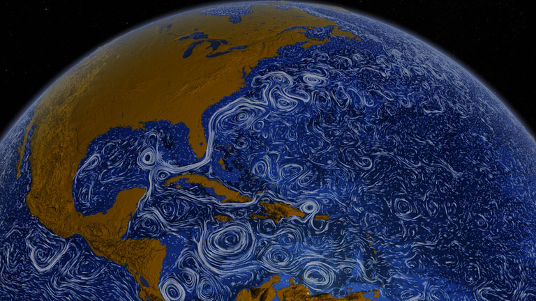
The earth is also rotating on axis, turning eastward, and making one rotation per day. This causes the daily alternation of day and night, and causes the sun, the moon, and the stars to appear to rise in the east and set in the west. Rotation, coupled with the gravitational pull of the moon, also creates the alternation of high tide and low tide along the world’s coastlines. The rotation of the earth also causes the Coriolis effect. As air masses travel through the atmosphere, they appear to change direction because they are passing over a spinning earth. In the northern hemisphere, the Coriolis effect causes air masses to deflect to the right. In the southern hemisphere, air masses deflect to the left. The effect increases with the latitude—the deflection is greatest at higher latitudes, and much less pronounced at lower latitudes. The Coriolis effect is negated if an air mass is travelling straight down the equator.
Elements of Climate
Weather is the state of atmospheric conditions, such as temperature and precipitation, in a given place at a given time. Climate refers to the usual patterns of weather in a given place. Put another way, climate is the long-term average of weather. Most climates can be reduced to three basic elements. The first element is temperature—whether a location is relatively hot, mild, or cold. The second element is precipitation—whether a place is humid (receiving a lot of precipitation), arid (receiving little precipitation), or something in between. The third element of climate is seasonality—how the characteristics of temperature and precipitation typically vary over the course of a year.
Temperature
There are a number of factors that affect the temperature of a location, but the most important factor is sunlight, or more specifically, the angle at which the sun’s rays strike the earth. Imagine you’re standing in a dark room, a few feet from a wall, holding a flashlight. If you hold the flashlight perpendicular to the wall, so that the beam from the flashlight strikes the wall at a 90˚ angle, it will create a small, intense pool of light. Now, if you tilt the flashlight to a 45˚ angle, you’ll notice that the pool of light on the wall gets bigger and dimmer. The same amount of energy is coming out of the flashlight, and it’s the same distance from the wall, but the change in angle has caused the light to spread out over a larger area, and decrease in intensity.
Because the surface of earth is curved, the sun’s rays strike different parts of the earth at different angles. In the lower latitudes, closer to the equator, the sun’s rays strike the earth at, or something close to, a 90˚ angle. The solar energy is concentrated, like our flashlight pointed directly at the wall, so temperatures are hotter. At higher latitudes, closer to the poles, the sun’s rays strike the earth at a lesser angle, and the effect is like our tilted flashlight. The sun’s energy is spread out over a larger area, the solar energy is diluted, so temperatures are lower.
This is why Sweden is colder than Libya. Sweden is at a higher latitude, where light strikes the earth at a lesser angle. Libya is at a lower latitude, where the sunlight strikes the earth at a greater angle. This is also why Minnesota is colder than Illinois, why Illinois is colder than Tennessee, and why Tennessee is colder than Florida. The effect can be found at relatively small scales. On a typical day, Chicago’s northern suburbs will run a degree or two cooler than Chicago’s southern suburbs, all because of the angle of the sun’s incoming rays.
Seasons
 The major cause of seasonal changes is the inclination of the earth’s axis. The axis around which the earth rotates is not perpendicular to the plane in which it orbits the sun. The earth’s axis is tilted 23.5˚ off center, like a buoy listing in a lake. As the earth makes its way around the sun, the northern hemisphere leans toward the sun for part of the year, and the southern hemisphere leans toward the sun the other part of the year.
From March to September, the northern hemisphere is tilted toward the sun. As a result, the northern hemisphere stays illuminated for a longer period of each day, meaning that the days grow longer. The sun’s most direct rays also drift into the northern hemisphere, bringing greater heat. During these months, the northern hemisphere experiences spring and summer. At the same time, the southern hemisphere is leaning away from the sun. Days in the southern hemisphere get shorter, and temperatures decrease. From March through September, the southern hemisphere experiences fall and winter.
The situation reverses itself from September to March, as the southern hemisphere tilts into the sun. The southern hemisphere has its longest and hottest days of the year, experiencing spring and summer. The northern hemisphere is now leaning away from the sun, experiencing shorter days and colder temperatures, passing through fall and winter.
Seasonal variations tend to be the greatest at higher latitudes, while seasons don’t change much in the lower latitudes. Honolulu, for example, receives about thirteen hours of daylight in June, and about eleven hours in December, not a tremendous difference. Chicago, on the other hand, receives fifteen hours of daylight in June, and only nine hours of daylight in December, a much more noticeable difference. Anchorage, Alaska, receives nearly twenty hours of daylight in June, and only about five hours of daylight in December. Meanwhile, locations at the equator receive about twelve hours of daylight every single day of the year. Places in the Arctic and Antarctic circles receive twenty-four hours of daylight in summer, and twenty-four hours of darkness in winter.
Precipitation
Precipitation—rain, snow, sleet, etc.—is an intensely complicated process. Very smart people with very expensive equipment still have trouble accurately predicting it. That said, the fundamentals of precipitation are relatively simple. Almost all precipitation processes begin with an air mass being lifted. As air rises, it begins to cool down. As air cools down, it approaches its dew point. If it does reach its dew point, the moisture in the air condenses to a liquid state, and a cloud is formed. If enough condensation occurs, then the water falls to the earth as precipitation.
There are different mechanisms that cause the air to lift. Convectional precipitation occurs when the earth’s surface heats the air above it, causing that air to rise, and is most often associated with brief, isolated summer storms. Frontal precipitation (sometimes called cyclonic precipitation) occurs when air masses with different temperature characteristics collide with one another. A cold front is the leading edge of a cold air mass. If the dense cold air along this front collides with a warmer air mass, it forces the more buoyant warm air aloft. Cold fronts are often associated with violent storms. A warm front is the leading edge of a warm air mass. If the buoyant warm air collides with a cooler air mass, it will often rise up over the dense cold air.

Orographic precipitation is associated with highland areas. As air masses strike a topographic barrier, like a mountain range, the air rises, which can create precipitation. The side of the mountain range where orographic precipitation takes place is known as the “windward” side. On the mostly dry continent of Australia, the east coast gets rain largely due to orographic precipitation.
A side effect of orographic precipitation is the rain shadow effect. The leeward, or “downwind” side of the mountain range is often much drier than the windward side. This is because air masses often dump much of their available moisture on the windward side, but also because air masses are descending and warming on the leeward side, and therefore are less likely to produce precipitation.
The rain shadow effect can be found at relatively small scales, as is the case on many Caribbean islands, where the windward side of an island receives more precipitation than the leeward side. Or, it can exist on massive scales. In the American West, the Sierra Nevada, Cascade, and Rocky Mountains cast rain shadows that extend for hundreds of miles.
Global Pressure Systems
Variations in air pressure are the means by which air masses are moved about the earth. Air pressure is the amount of atmospheric mass exerted on the earth’s surface, and it varies from place to place. Put simply, if there is higher air pressure in Phoenix than in Des Moines, then there is literally more air in Phoenix than in Des Moines.
Air flows from areas of high pressure toward areas of low pressure, and is manifested as wind. If the difference in pressure between two places is great, then the air will move faster, as in a gusty wind. If the difference in air pressure between to places is slight, then the air will move slowly, as in a gentle breeze. Because air moves away from areas of high pressure, reducing the chances of collision and lifting, those places tend to be relatively dry. Because air is drawn toward areas of low pressure, increasing the chances of collision and lifting, those places tend to be relatively wet. In most places, air pressure shifts constantly, which is why meteorologists keep an eye on the barometer, which measures air pressure. A rising barometer decreases the likelihood or precipitation. A falling barometer increases the likelihood of precipitation.
On the global scale, there are a few major pressure systems that have a tremendous impact on the world’s weather. The first are subtropical highs. The subtropical highs are a series of high-pressure systems that are found at approximately 30˚N and 30˚S latitude. These massive ridges of high pressure cause dry conditions wherever they are found. A quick look at a map of the world’s most significant deserts reveals that many of them are located at about 30˚N latitude, such as the Mojave, Sahara, Arabian, and Great Indian Deserts, or at about 30˚S latitude, such as the Atacama, Kalahari, and Australian Deserts. Note that the subtropical highs are a periodic sequence of pressure systems, not a continuous belt of high pressure. Not all places at 30˚ latitude are under subtropical highs. New Orleans, for example, is at that latitude, and is rain-soaked much of the year.
The subtropical highs also generate enormous amount of wind. They push air off toward the higher latitudes, creating the westerlies. The westerlies are located between approximately 30˚ and 60˚ north and south latitude. As the subtropical highs push air poleward, the Coriolis effect causes them to bend to the right in the northern hemisphere, and to the left in the southern hemisphere. The result is a circulation of air in both the northern and southern midlatitudes from west to east. Much of the continental United States, southern Canada, Europe, and the Russian Domain receive their weather from the west, which has a significant impact on climate patterns there.
 The subtropical highs also push air to the lower latitudes. In the northern hemisphere, these winds bend slightly to the right because of the Coriolis effect, creating the northeast trade winds. In the southern hemisphere, these winds bend slightly to the left, creating the southeast trade winds. So, in the southern tropics, air tends to flow equatorward from the southeast. In the northern tropics, air tends to flow equatorward from the northeast. The trade winds collide near the equator, in a region known as the intertropical convergence zone, or ITCZ. The collision of these warm, often very moist tropical air masses creates extremely wet conditions. Just as some of the world’s great deserts are associated with the subtropical highs, many of the world’s great rainforests are found near the equator, such as the Amazon rainforest, and the rainforests of central Africa and southeast Asia.
Two more high-pressure systems, the polar highs, are located in the Arctic and Antarctic regions, creating very dry conditions. Antarctica, although covered in snow and ice, is technically a desert, receiving very little annual precipitation. The polar highs push air off toward the lower latitudes, and the Coriolis effect deflects them to the right in the northern hemisphere, and to the left in the southern hemisphere. In the polar easterlies, air circulates from east to west, usually above 60˚ north and south latitude.
All of these pressure features shift seasonally. When it is summer in the northern hemisphere, they slide north. When it is summer in southern hemisphere, they slide south. For some places, this can cause significant changes in the weather. Los Angeles, for example, spends much of the year under a subtropical high, and receives very little precipitation. In the wintertime, though, that subtropical high shifts south. The westerlies also shift south, and carry a significant amount of moisture off the Pacific Ocean, bringing rainy winters to Los Angeles.
Other Climate Factors
Elevation has a significant impact on temperature. That is discussed in Chapter 68. The presence of absence or large bodies of water can also have a tremendous impact on temperature. The difference between maritime and continental climates is discussed in Chapter 41.
Climate Change
The earth’s climate has been changing for millions of years, with temperature periodically increasing or decreasing. Fifteen thousand years ago, much of the earth was covered in massive sheets of ice, so it is obviously much warmer now than it was then. Climate change is a natural process. That said, when people use the term climate change today, they are usually referring to anthropogenic climate change, or climate change caused by human activity. The earth is currently in a warming phase, but a preponderance of evidence suggests that humans are accelerating that warming at an alarming rate.
 Increased planetary temperatures are associated with the greenhouse effect. That term takes its name from greenhouses—buildings constructed primarily of glass that are utilized to grow and sustain plants in cold climates. The glass in a greenhouse allows vital sunlight to reach plants, but prevents heat from escaping the building.
If you don’t own a greenhouse, but do own a car, you have probably experienced the greenhouse effect. If you park your car in a lot on a sunny summer day, and return to it an hour or two later, you will likely find that the interior of your car is extremely hot. This is because sunlight, with its relatively short wavelength, has easily passed through the glass in your car. As your car absorbs that energy, it begins to radiate it back off as thermal radiation, or heat. Because thermal radiation has a longer wavelength, it has more trouble passing back through the glass of your car. So, light continues to pour in, but relatively little heat escapes, and the inside of your car gets hotter and hotter.
The same thing happens in the atmosphere. Instead of glass, there are greenhouse gasses, like carbon dioxide and methane. These gasses allow sunlight to pass through the atmosphere with relative ease. When the earth radiates heat, it has trouble escaping through the greenhouse gasses. So, the earth’s atmosphere stays relatively warm.
Like climate change, the greenhouse effect is a natural phenomenon, and is, in fact, vital for life on earth. Without the greenhouse effect, the earth would quickly shed its heat, and would be a very cold place. Humans did not create the greenhouse effect, but we are enhancing it. By various means, but primarily through the production and consumption of fossil fuels, humans are pumping large volumes of greenhouse gasses into the atmosphere. In doing so, we are amplifying the greenhouse effect. The more greenhouse gasses we put in the atmosphere, the more heat is trapped, and the warmer the earth gets.
Climate change has varied spatially and seasonally. Some places are warming faster than others, and some years are hotter than others, but the earth’s overall temperatures are certainly increasing. Of the ten hottest years on record, nine have occurred within the last decade, and all of them have occurred within the last fifteen years. Polar regions are being dramatically altered, since ecosystems based on ice and snow are going to be deeply impacted by even the slightest temperature increase. Precipitation patterns are being amplified. Wet areas are getting wetter, while dry areas are getting drier, wreaking havoc on agriculture in many parts of the world. Sea levels are rising. While it is unlikely that West Virginia will be oceanfront property anytime soon, coastal areas are experiencing increased erosion and dramatic flooding. Plant and animal extinctions are on the rise, as many species have trouble adjusting to the new normal. Climate scientists vary in their predictions for the future, but they generally range from deeply concerned to extremely gloomy. The vast majority of scientists agree that humans must find a way to curb greenhouse gas emissions to prevent a global environmental catastrophe.
Plate Tectonics
The outer crust of the earth is not one solid piece, but rather a collection of interlocking tectonic plates—a sort of three-dimensional jigsaw puzzle. These tectonic plates can and do move independently of one another, albeit at a very slow pace. Tectonic plates generally move about as fast as your fingernails grow. Given millions of years, though, the movement of these plates can dramatically rearrange the world map. Brazil used to border Nigeria, Portugal used to border Greenland, India used to border Australia, and the United States used to border Morocco (their territories, that is—this was, of course, millions of years before these countries actually existed).
Plate tectonics play a major role in global landforms and natural hazards. There are a few different types of tectonic boundaries, such as transform boundaries, where one plate is sliding alongside another one, and divergent boundaries, where one plate is moving away from another one. Of greatest interest to world regional geography is the convergent boundary, where one plate is colliding with another.
The most important result of a convergent boundary is folding. Imagine a throw rug on a floor. If you took a push broom and shoved it against the edge of that rug, the rug would wrinkle up, folding into ridges and valleys. The same thing can happen to the surface of the earth. About 80 million years ago, India began to collide with Asia. Using our metaphor, India would be the push broom, and Asia would be the rug. As a result of this collision, the Himalayas and many other mountain ranges folded upward, while valleys and basins sank downward. This “wrinkling” of the fabric of Asia is ongoing, and its effects have been far flung. India’s collision with Asia has caused the upward folding of mountain ranges as far away as Siberia.

For a visualization of this imaginative metaphor, look here.
For an excellent illustration of tectonic plates, go to: https://www.visualcapitalist.com/cp/explainer-earths-tectonic-plates/.
Convergent boundaries are also associated with major natural hazards. All around the Pacific Ocean is a zone known as the Ring of Fire. The tectonic plates beneath the eastern Pacific are moving east, colliding with the plates that make up the Americas. The tectonic plates beneath the western Pacific are moving west, colliding with the plates that make up East Asia. This collision has not only created numerous mountain ranges along the Pacific Rim, such as the Andes of South America, but also volcanoes and earthquakes.
As one tectonic plate slips below another one—a process known as “subduction”—the tremendous pressure involved melts the rock of the subducting plate. Some of the lava, ash, and gasses released by the melting plate find their way to the surface in volcanic eruptions. The Ring of Fire includes scores of volcanoes, such as Mt. Fuji in Japan, Mt. Pinatubo in the Philippines, and Mt. St. Helens in the United States. And every time these tectonic plates slip, the surface shudders. If they make a significant movement, the tremors can amplify into massive earthquakes. The entire Ring of Fire is highly susceptible to this hazard. Japan, Mexico, Peru, Ecuador, the United States, and the Philippines are some of the most earthquake-prone countries on the planet.
Erosion and Deposition
Tectonic plates are not the only forces that shape the world’s landscapes. Two other important forces—erosion and deposition—are constantly reshaping the face of the earth. Erosion refers to forces that remove material from a landscape. Deposition refers to those same forces depositing that material elsewhere. Running water, freezing and thawing, gravity, coastal waves, wind, and glaciers all pick up bits of earth, both large and small, and deposit them someplace else. A river erodes its banks, ice crystals and plant roots break up rocks, gravity carries material downslope, waves beat at seaside cliffs, wind carries away soil, and glaciers scour out lakes and valleys. And then rivers deposit sediment in deltas and floodplains, rocks come to rest in a valley floor, cliffs crash into the sea, wind-blown sediment settles onto the ground, and glaciers melt, leaving their eroded material behind.
Another name for this process is weathering, and different landscapes are at different stages of weathering. Some landscapes are at early stages of weathering, meaning that they are relatively new, and that erosion and deposition haven’t had much time to alter them. Other landscapes are at very advanced stages of weathering, meaning that they are quite old, and have been deeply altered by erosion and deposition. For example, the Great Lakes, and much of landscape of the upper Midwest, were formed by glacial erosion and deposition about 14,000 years ago. That’s relatively new. A few hundred miles away are the Ozark Highlands of Missouri and Arkansas, deeply eroded hills that are more than 200 million years old.
Did You Know?
Many people know that the Coriolis effect causes toilets flush clockwise in the northern hemisphere, and counterclockwise in the southern hemisphere. Unfortunately, many people are wrong. Toilets do not flush different ways in the two hemispheres, and whichever direction they flush, it has nothing to do with the Coriolis effect. So, if you’re planning to fly to Australia just to watch the toilets flush the other way, save your money.
A fascinating book about the importance of longitude in the Age of Exploration is Longitude by Dava Sobel.
Cited and additional bibliography:
alan, thomas. 2014. Eastern Washington. https://tinyurl.com/easternwa. Attribution-NonCommercial-NoDerivs 2.0 Generic (CC BY-NC-ND 2.0).
Armas, Lucinda. 2021. Photo. Morton Arboretum.
Jakupec, Tomislav. 2016. “Spinning Globe.” Pixabay. https://pixabay.com/videos/blue-earth-world-globe-global-map-5194/.
Nomad Tales. 2010. Caught in the Rain. https://tinyurl.com/sydneyrain. Attribution-ShareAlike 2.0 Generic (CC BY-SA 2.0).
quapan. 2017. Coriolis Effect. https://tinyurl.com/coriolis190. Attribution 2.0 Generic (CC BY 2.0).
